This item has been sold, but you can get on the Waitlist to be notified if another example becomes available, or purchase a digital scan.
1879 Warren Map of Africa
Africa-warren-1879$35.00

Title
Map of Africa.
1879 (undated) 9.5 x 11.5 in (24.13 x 29.21 cm)
1879 (undated) 9.5 x 11.5 in (24.13 x 29.21 cm)
Description
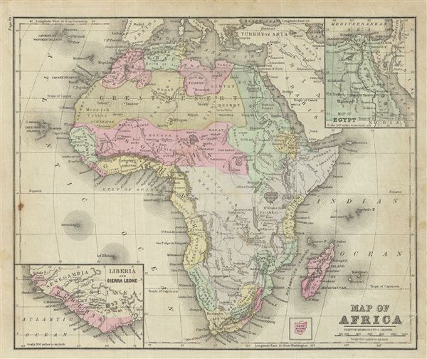
This is an example of David M. Warren's 1879 map of Africa. It covers the entire continent from the Mediterranean Sea to the Cape of Good Hope, including the island of Madagascar. Part of adjacent Arabia and Turkey are also featured. An inset map in the top right quadrant details egypt and another inset in the bottom left quadrant details Liberia and Sierra Leone. Lake Victoria (Lake Nyanza), Lake Albert, Lake Tanganyika, Lake Rukwa and Lake Malawi (Lake Nyassa) are marked. Also identifies the semi-apocryphal Mountains of the Moon, running in an unusual speculative north-south configuration between Mount Kenya and Abyssinia. Numerous African tribes and nations are named throughout. A large part of central Africa is marked 'Unexplored Region.' Throughout, the map identifies various cities, towns, rivers, deserts, islands, mountain passes and an assortment of additional topographical details. The map is color coded according to regional and political boundaries with elevation rendered by hachure. Issued as page 89 in the 1879 edition of Warren's Common-School Geography.
Source
Warren, D. M., Common School Geography, 1879.
Condition
Very good. Even overall toning. Text on verso. Verso repair near right margins. Some foxing.