
This item below is out of stock, but another example (left) is available. To view the available item, click "Details."
Details
1939 Sears and Roebuck Map of the Predicted Theatre of World War II
1939 (dated) $175.00
1879 Warren Map of Europe
Europe-warren-1879$35.00

Title
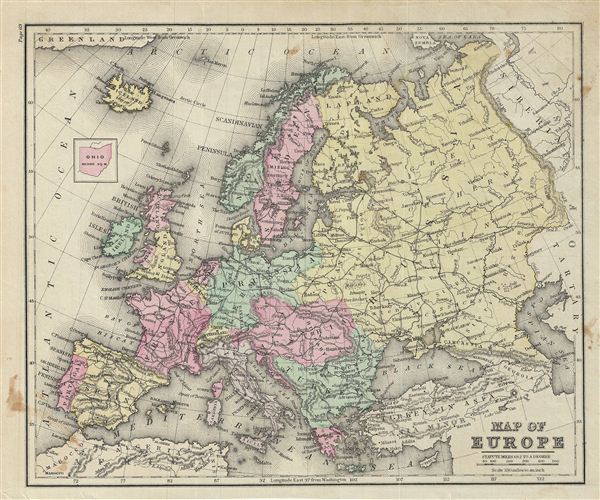
Map of Europe.
1879 (undated) 9.5 x 11.5 in (24.13 x 29.21 cm)
1879 (undated) 9.5 x 11.5 in (24.13 x 29.21 cm)
Description
This is an example of David M. Warren's 1879 map of europe. The map covers the continent in its entirety from the Atlantic to the Caspian Sea and from the Arctic Ocean to the Mediterranean Sea. It also details Iceland and parts of Turkey in Asia. Shows Italy as one unified nation. Notes the legendary and semi-mythical whirlpool known as the Maelstrom (Maelstrom) in northwestern Norway.
This map depicts a period shortly following the unification of Italy and the rise of the British empire apex of power and influence. It was also a time of decline for the Ottoman empire. This map follows the period immediately after the Franco-Prussian War and the unification of Germany.
Throughout, the map identifies various railroads, cities, towns, rivers, islands, mountain passes and an assortment of additional topographical details. The map is color coded according to regional and political boundaries with elevation rendered by hachure. Issued as page 69 in the 1879 edition of Warren's Common-School Geography.
Source
Warren, D. M., Common School Geography, 1879.
Condition
Very good. Even overall toning. Text on verso. Some foxing.