This copy is copyright protected.
Copyright © 2025 Geographicus Rare Antique Maps
Digital Image: 1815 Blankensteiner Blueback Nautical Chart or Map: Helsinki to St. Petersburg
HelsinkiStPetersburg-blankensteiner-1815_d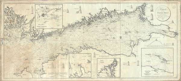

FOR THE ORIGINAL ANTIQUE MAP, WITH HISTORICAL ANALYSIS, CLICK HERE.
Digital Map Information
Geographicus maintains an archive of high-resolution rare map scans. We scan our maps at 300 DPI or higher, with newer images being 600 DPI, (either TIFF or JPEG, depending on when the scan was done) which is most cases in suitable for enlargement and printing.
Delivery
Once you purchase our digital scan service, you will receive a download link via email - usually within seconds. Digital orders are delivered as ZIP files, an industry standard file compression protocol that any computer should be able to unpack. Some of our files are very large, and can take some time to download. Most files are saved into your computer's 'Downloads' folder. All delivery is electronic. No physical product is shipped.
Credit and Scope of Use
You can use your digial image any way you want! Our digital images are unrestricted by copyright and can be used, modified, and published freely. The textual description that accompanies the original antique map is not included in the sale of digital images and remains protected by copyright. That said, we put significant care and effort into scanning and editing these maps, and we’d appreciate a credit when possible. Should you wish to credit us, please use the following credit line:
Courtesy of Geographicus Rare Antique Maps (http://www.geographicus.com).
How Large Can I Print?
In general, at 300 DPI, you should at least be able to double the size of the actual image, more so with our 600 DPI images. So, if the original was 10 x 12 inches, you can print at 20 x 24 inches, without quality loss. If your display requirements can accommodate some loss in image quality, you can make it even larger. That being said, no quality of scan will allow you to blow up at 10 x 12 inch map to wall size without significant quality loss. For more information, it is best consult a printer or reprographics specialist.
Refunds
If the high resolution image you ordered is unavailable, we will fully refund your purchase. Otherwise, digital images scans are a service, not a tangible product, and cannot be returned or refunded once the download link is used.
Johan Georg Blankensteiner (February 22, 1753 – May 8, 1835) was a German-Danish publisher of nautical charts, instrument maker, and nautical supplier based in Copenhagen, Denmark. Blankensteiner was born in Oberammergau, Bavaria. He moved to Copenhagen sometime around 1780. Ion 1791 he established a corner toy shop specializing in German toys at 69 Købmagergade. It seems that, from the beginning, the firm also sold nautical charts and navigation instruments. In 1792 he published a catalog of various maps and atlases. By 1803 they were a well-established nautical warehouse both producing their own charts and offering foreign charts. Sometime in the 1830s Carl August Blankensteiner (1809 - 1870), Johan Georg's son, joins the business and the firm is renamed Blankensteiner and Sons. After his death the firm continued to trade under Carl August. In 1844 the firm received a royal privilege, a kind of early copyright, by the Danish King Christian VIII, as chart sellers and instrument makers. At this time, they also relocated Toldbodvejen 48 (currently Esplanade) at the corner of Amaliegade. In 1860, the firm was sold to T. Baagøe, who traded as Blankensteiners Efterfølgers (Blankensteiner's Successors). Various owners followed, including August Busck, William Jensen, Cc. Peterson, and Christian Bønnelycke. The business continued to sell charts until about 2000, when it finally closed. As a side note, the toy side of the business was also quite successful and numbered the playwright and novelist Hans Christian Andersen among its clients. More by this mapmaker...
Copyright © 2025 Geographicus Rare Antique Maps | Geographicus Rare Antique Maps
This copy is copyright protected.
Copyright © 2025 Geographicus Rare Antique Maps