This copy is copyright protected.
Copyright © 2025 Geographicus Rare Antique Maps
Digital Image: 1859 Montgomerie Survey of India Wall Map of Kashmir
Kashmir-montgomerie-1859_d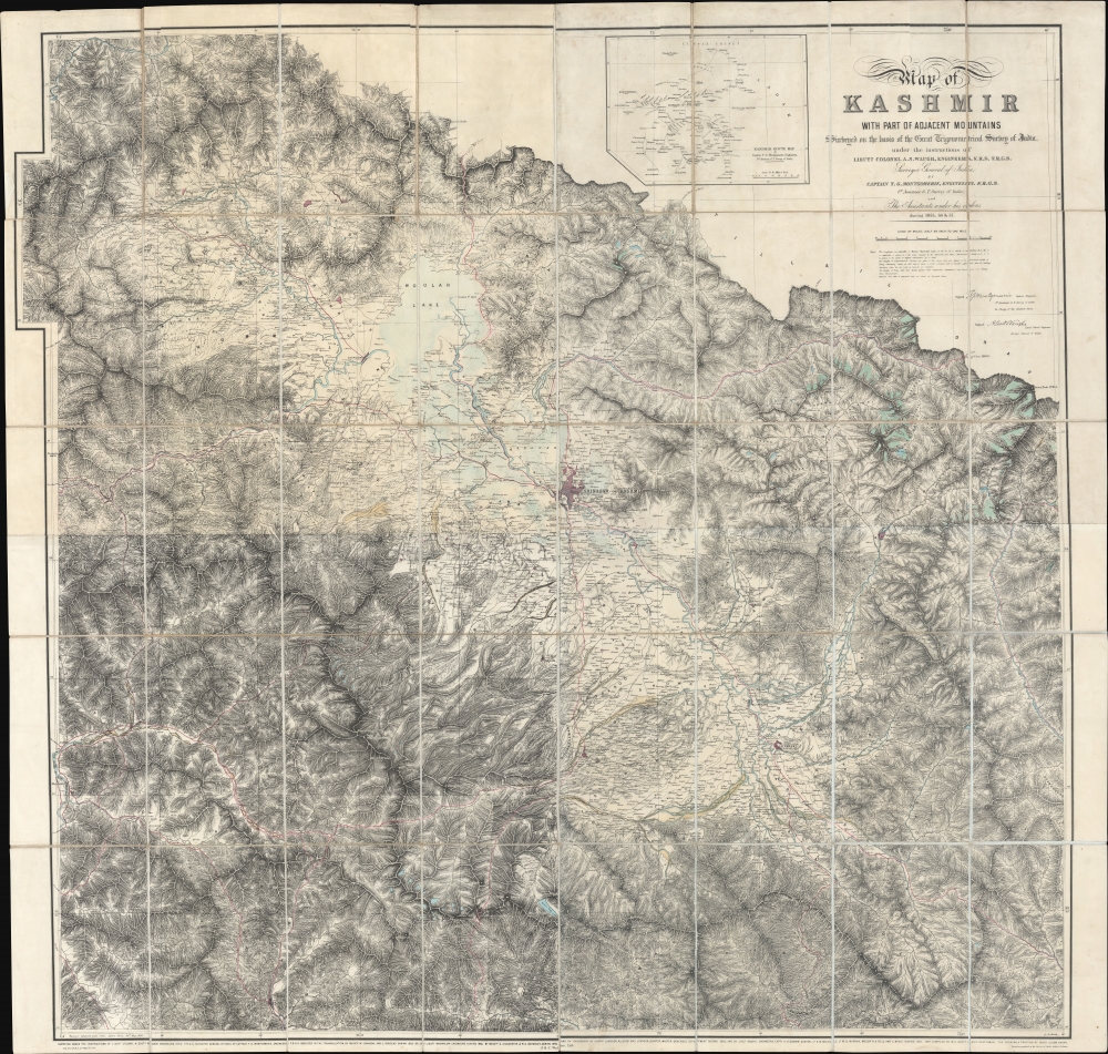


FOR THE ORIGINAL ANTIQUE MAP, WITH HISTORICAL ANALYSIS, CLICK HERE.
Digital Map Information
Geographicus maintains an archive of high-resolution rare map scans. We scan our maps at 300 DPI or higher, with newer images being 600 DPI, (either TIFF or JPEG, depending on when the scan was done) which is most cases in suitable for enlargement and printing.
Delivery
Once you purchase our digital scan service, you will receive a download link via email - usually within seconds. Digital orders are delivered as ZIP files, an industry standard file compression protocol that any computer should be able to unpack. Some of our files are very large, and can take some time to download. Most files are saved into your computer's 'Downloads' folder. All delivery is electronic. No physical product is shipped.
Credit and Scope of Use
You can use your digial image any way you want! Our digital images are unrestricted by copyright and can be used, modified, and published freely. The textual description that accompanies the original antique map is not included in the sale of digital images and remains protected by copyright. That said, we put significant care and effort into scanning and editing these maps, and we’d appreciate a credit when possible. Should you wish to credit us, please use the following credit line:
Courtesy of Geographicus Rare Antique Maps (http://www.geographicus.com).
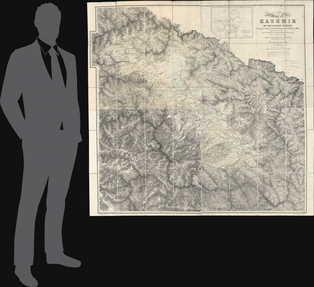
How Large Can I Print?
In general, at 300 DPI, you should at least be able to double the size of the actual image, more so with our 600 DPI images. So, if the original was 10 x 12 inches, you can print at 20 x 24 inches, without quality loss. If your display requirements can accommodate some loss in image quality, you can make it even larger. That being said, no quality of scan will allow you to blow up at 10 x 12 inch map to wall size without significant quality loss. For more information, it is best consult a printer or reprographics specialist.
Refunds
If the high resolution image you ordered is unavailable, we will fully refund your purchase. Otherwise, digital images scans are a service, not a tangible product, and cannot be returned or refunded once the download link is used.
Survey of India (1767 - Present) is India's central engineering agency in charge of mapping and surveying the country. It was founded in 1767 by Major James Rennell, who took the post of first Surveyor General, with the mission to map and consolidate the territories of the British East India Company. The Survey undertook the Great Trigonometrical Survey between 1802 and 1852 in an attempt to accurately measure the Indian Subcontinent - considered one of the greatest feats of mapping of all time. It also sponsored clandestine surveys, at times disguised as Buddhist pilgrims, to infiltrate and map Tibet, then a closed country. With India's independence in 1947, the Survey was folded into the new Indian government, which it remains part of to this day. More by this mapmaker...
Thomas George Montgomerie (April 23, 1830 - January 31, 1878) was a Scottish geodesist, military officer, and explorer active in India in the mid to late 19th century. Montgomerie was born in Ayrshire, Scotland. He studied first at the East Indian Company Military Seminary in Addiscombe, then at the Royal School of Military Engineering in Chatham. On graduating, he joined the Bengal Sappers, serving one year in Roorkee, India. On his own request, he was transferred to serve under Andrew Scott Waugh (1810 - 1878) on the Great Trigonometrical Survey of India (TSI), then underway. Under Scott, he ran baselines at Attock (Punjab) and Karachi. In 1855, Montgomerie was given leadership of the geodetic and trigonometric survey of Kashmir and Jammu, an area then largely unknown and unpenetrated by the British. The position was both politically sensitive and physically taxing. Montgomerie had to maintain positive relations with the Maharaja while tackling the world's most rigorous mountain terrain and avoiding confrontations associated with the 1857 Sepoy Rebellion. His large map of Kashmir, published in 1859, is a monument to diplomacy, meticulous trigonometry, mountaineering, and dogged tenacity. In 1860, Montgomerie pioneered the idea of using native Indian surveyors, the legendary Pundits, to map Tibet, a kingdom then forbidden to the British on pain of death. While leading this effort, he named the mountains of Karakorum with a novel numerical system, K1 (Masherbrum), K2, K3 (Gasherbrum IV), etc. In 1863, declining health forced him back to England. He returned to India in 1867, where he was assigned to the Himalayan Survey in Uttarakhand. There he headed Pundit efforts in the trans-Himalaya until 1873, when failing health once again forced him back to England. He formally retired from military service in 1876, having reached the rank of Colonel. He died two years later in Bath, England. Learn More...
Andrew Scott Waugh (February 3, 1810 - February 21, 1878) was a British geodesist and army officer active in India in the mid-19th century. Waugh was born in Madras, India, the son of Gilbert Waugh, a military auditor-general. He studied at the Addiscombe Military Seminary (Edinburgh) and the Royal School of Military Engineering (Chatham). He was sent to India in 1827 with the Bengal Engineers, serving at Kashipur and then with the Bengal Sappers through 1831. In 1832, having distinguished himself as a military engineer, he was posted to the Great Trigonometrical Survey under George Everest (1790 - 1866). Under Everest, he conducted surveys throughout India through 1843. When Everest retired, he recommended Waugh to succeed him in Dehra Dun as Surveyor General of India. In 1852, under Waugh, the Survey of India trigonometric team calculated the height of Mount Everest. Waugh named the mountain, discovered to be the highest in the world, after his predecessor. Waugh left India in 1861, returning to London where he was active in the Royal Geographical Society. He died there in 1878. Learn More...
Copyright © 2025 Geographicus Rare Antique Maps | Geographicus Rare Antique Maps
This copy is copyright protected.
Copyright © 2025 Geographicus Rare Antique Maps