This item has been sold, but you can get on the Waitlist to be notified if another example becomes available, or purchase a digital scan.
1886 Liebenow Folding Wall Map of Africa - Scramble for Africa
Afrika-liebenow-1886
Title
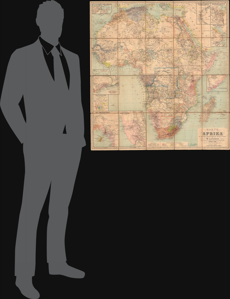
1886 (dated) 35.5 x 32.25 in (90.17 x 81.915 cm) 1 : 10000000
Description
A Closer Look
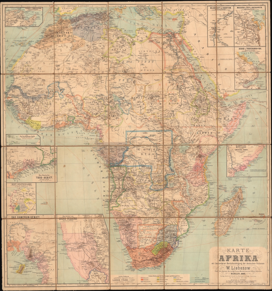
The African continent along with portions of Arabia, the Mediterranean, and southern Europe, is displayed with the still somewhat amorphous boundaries of Indigenous kingdoms and European colonies traced in outline color, explained in a legend at bottom. As promised in the title, special attention is paid to German colonies, shaded pink. Cities and settlements, peoples, tribes, railways (projected and completed), shipping lines, rivers, lakes, mountains, and other features are noted throughout.Ten insets surround the main map, focusing on (clockwise from top-left): Tunis, the Nile near Khartoum, Massawa (capital of Italian colony of Eritrea), Assab and Djibouti, 'Wituland' on the Kenyan coast (the northernmost extent of realistic German colonial ambitions in East Africa), the area around Angra Pequena and Lüderitz in Namibia (German South West Africa), the German colony of Kamerun and surroundings, a map of Germany at the same scale as the main map for size comparison, the German protectorate of Togoland, and the Cape Verde Islands.
Overall, the map reflects the improved European geographical knowledge of the interior of Africa which both permitted and was perfected by the Scramble for Africa. More particularly, it is a product of German interest in African colonization.
German Somalia
One of the most interesting features of this map is the German claim to much of today's Somalia, noted as 'Besitz der Deutsch-Ost-Afrikan. Ges.,' referring to the German East Africa Company. This claim was more an ambition than a reality, though agents of the company were indeed pursuing trade and protection agreements with the Sultanate of the Geledi and other local rulers along the Somali coast. The Germans were motivated by several factors, including the establishment of a British protectorate to the north in Somaliland and an attempt to hedge against the Sultan of Zanzibar, who was expanding his suzerainty over coastal ports to the annoyance and detriment of Somali sultans. More generally, Germany, Italy, Britain, and, to a lesser degree, France vied for influence in East Africa in the late 1880s, including the Horn of Africa, one of the clearest examples of the land grabs dubbed 'the Scramble for Africa' (discussed below). In the case of Somalia, there was skepticism about the viability of German designs in Somalia, given the competing and more ardent efforts of the British and Italians. Otto von Bismarck was generally wary of colonial adventurism and saw the maintenance of good relations with Britain and Italy (the former its ally in the Triple Alliance) as far more important. He worked to undermine signed agreements and statements by the Kaiser (who was far more enthusiastic about colonialism in Africa) and, by 1890, had worked with Britain and Italy to stabilize the situation in East Africa by surrendering any claims along the Somali coast.Scramble for Africa
The map is an artifact of the 'Scramble for Africa,' the series of late 19th and early 20th century protectorates, occupations, usurpations, annexations, divisions, and land seizures by European powers in Africa, including Britain, Germany, and France, among others. Rivalries and treaties led to several new African states, many of which remain, but few of which paid heed to traditional boundaries or cultural distinctions. The Scramble was punctuated by the Berlin Conference of 1884, wherein European colonization of Africa was regulated and made official, and the doctrine of Effective Occupation was introduced. According to this doctrine, colonial powers needed to prove 'effective occupation,' meaning the existence of treaties with local powers, their flags being flown, or having active forts in the region.The conference was meant to regulate European colonization of Africa to avoid conflicts, but in some ways facilitated an even more rapid divvying up of the continent. Rival powers raced to establish a presence in unclaimed territory, often building railways in their wake to strengthen their hold. Indigenous rulers aligned with one or another of the competing European powers to try to maintain a degree of independence, but these agreements were later used to reduce or eliminate their autonomy under colonial administrations.
The German Presence in Africa
Though itself only a unified country for less than twenty years, Prussian-led Germany carved out several colonies on the African continent in the wake of the Berlin Conference, including German East Africa, German Southwest Africa, Kamerun, and Togoland. Bismarck, who had engineered these acquisitions, quickly returned to his original view that they were a distraction from the more pressing matter of ensuring German unification and security in the face of hostile powers to its east and west. Within a few years of establishing the African colonies mentioned above, he considered abolishing them or giving them away to the British or Italians. Bismarck's successors as chancellor and foreign minister were not much more enthusiastic in acquiring or administering colonies, but Kaiser Wilhelm II aggressively pursued his vision of Weltpolitik, including an extensive colonial empire. 'Lobby groups' such as businessmen, scholars, Social Darwinists, and other colonial enthusiasts also pushed the government to grab as many colonies as possible.These contending forces resulted in German colonial policy being rather confused and driven primarily by private agents, some of whom were not even German. Once a territory was claimed, the Germans proved efficient yet brutal in crushing resistance, building railroads, and pursuing economic benefit. Aside from German Southwest Africa, few German colonists were attracted to Africa, and the white population was mostly limited to colonial officials, soldiers, and missionaries. Among a string of atrocities committed, the suppression of the Maji Maji Rebellion in East Africa and the concurrent Herero and Namaqua genocide in Southwest Africa stand out as especially appalling.
Publication History and Census
This map was prepared by Wilhelm Liebenow and printed by the Berliner Lithographisches Instituts in Berlin in 1886. The map is quite rare, being noted among the holdings of the University of Chicago, Bibliothèque nationale de France, British National Archives at Kew, Bibliothèques municipales de Chambéry, and the Map Collection of the Faculty of Sciences of the Univerzity Karlova in Prague. The present example is especially scarce for being dissected and laid on linen for folding.CartographerS
Johannes Wilhelm Liebenow (October 13, 1822 - July 21, 1897) was a German cartographer, topographer, and military officer. He was born and raised in the Neumark region. After attending school, he apprenticed as a merchant before joining the Prussian Army where he was assigned to the Garde-Artillerie. He became interested in geography and cartography, attending lectures at the University of Berlin and studying the topics on his own. As a result, he was transferred to the topographic department of the army's Große Generalstab, where he quickly caught the eye of higher ups. He continued to develop skills in surveying while also taking an interest in archeology and geology. He befriended and became a mentor of famed naturalist Alexander von Humboldt, who advised him to complete a map of the Hohenzollern lands, published in 1854 to great acclaim. In 1854, he took a position with the railway department of the Ministeriums für Handel, Gewerbe und öffentliche Arbeiten, while also maintaining various other cartographic projects. In the 1860s, he played a key role in the Prussian national survey, contributing significantly to some 350 maps. At the suggestion of Chief of the General Staff Helmut von Moltke he also undertook a years-long project resulting in a massive 164 sheet map of Central Europe, completed in 1884, though the initial portions relating to French-German borderlands were completed just in time to be used in the Franco-Prussian War. As a result, Liebenow was tapped by Otto von Bismarck to help draw a new Franco-German border at the end of the conflict. In the last years of his life, Liebenow took on several official positions related to public works and urban planning while also publishing map of his own and receiving many of the highest awards for science and military service in Germany. More by this mapmaker...
Berliner Lithographisches Institut (fl. c. 1850 - 1958), sometimes as 'Berliner Lithographisches Instituts,' was a lithographic printer and map publisher based in Berlin. Despite a long existence and prolific output, details of the company's history are limited. It was likely founded by one Julius Moser (not to be confused with the contemporary entomologist of the same name), whose name was sometimes added as a suffix to the company's name. It maintained a close relationship with the Prussian and then German military, producing topographical maps for its use. The company kept its location on the Potsdamer straße in western Berlin throughout its history. Learn More...


