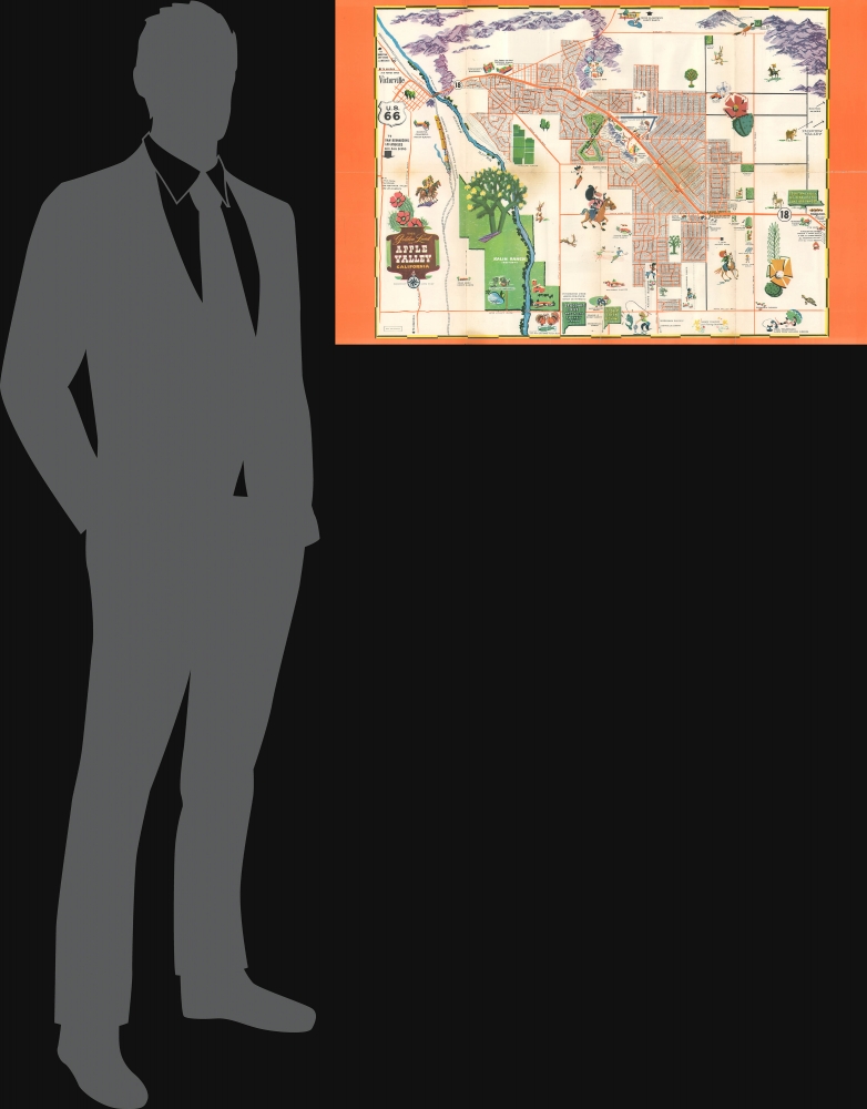
1956 Tomson Pictorial Map of Apple Valley, California
AppleValley-tomson-1956
Title
1956 (undated) 22 x 33.75 in (55.88 x 85.725 cm)
Description
A Closer Look
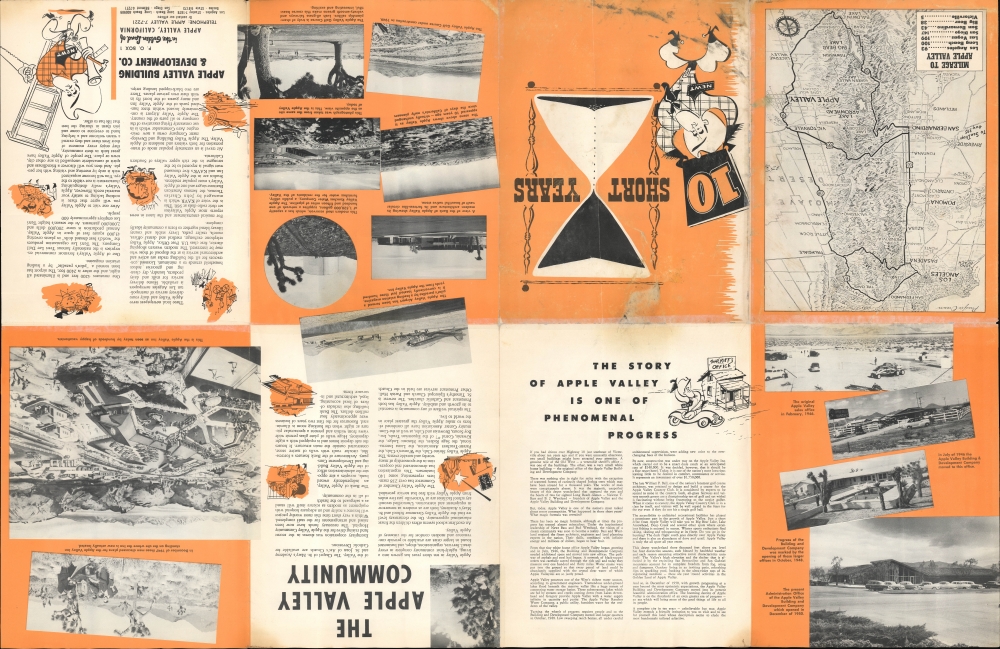
The community (it was not incorporated as a city until 1986) of Apple Valley is presented along with neighboring areas, including Victorville at left. Individual housing lots are numbered for ready reference to the real estate agent or prospective homebuyer. Illustrations highlight infrastructure draws, most notably the airport, country club, and Apple Valley Inn, all near center. Further afield, additional institutions and businesses are highlighted, including schools, trailer parks, ranches, farms, and motels. Roads are labeled, including U.S. Route 66, which travels through Victorville.The verso includes extensive promotional text discussing the brief history of the development and its attractions. An interesting map and view (signed by Howard Birke) on the verso is oriented towards the west over the San Gabriel Mountains, demonstrating the proximity of Apple Valley to Los Angeles and nearby attractions such as Big Bear Lake and Lake Arrowhead.
Building the Desert Wonderland
Apple Valley was the brainchild of Newton T. Bass (1903 - 1983) an oil executive and real estate developer, colorfully rendered here as a cowboy named 'Newt', and his partner Bernard 'Bud' Westlund. Bass, who was wealthy enough to retire from the oil industry at age 40, initially came to the area to look for a cattle ranch. But after he learned of the aquifers lying under the area (the Mojave River Basin), he began to envision a town developing on the site, and quickly worked with Westlund to acquire thousands of acres of ranchland. Ready access to water was essential not only for basic utilities but also for the town's image as a desert paradise, where water of 'infinite in quantity and purity' is accessed from 'one of the West's richest water sources,' as the verso describes it.Bass served as president, and Westlund as secretary, of the Apple Valley Building and Development Company (originally called the Apple Valley Ranchos Land Development Co.), which produced this map. The pair also started the Apple Valley Ranchos Water Company, the Apple Valley Country Club, and the radio station KAVR, referred to on the verso (no doubt they were also the driving force behind the Bank of Apple Valley). Perhaps most importantly, the pair set up the Apple Valley Inn, an oasis in the middle of the desert.
The Apple Valley Inn, a posh hotel and restaurant, was key to the town's growth. Investors and potential residents were flown in, then taken to the Building and Development Company offices to be given the sales pitch for Apple Valley, and then wined and dined at the nearby Apple Valley Inn. Early targets for investment included Western legend Roy Rogers, who later moved to Apple Valley and leased the Inn, as well as leading names in Hollywood from Bob Hope and Kirk Douglas to Marilyn Monroe and Jane Russell (John Wayne and Richard Nixon were also regular visitors to the Inn). These efforts paid off; although there were multiple such 'desert paradises' planned in Southern California in the early postwar period, not all were successful. But Apple Valley has grown considerably since this map's production, aided by its easy access to Los Angeles via the Cajon Pass (now traversed by Interstate 15).
Publication History and Census
This map was prepared by landscape architect Tommy Tomson, who was involved in the development of a similar desert community, Palm Desert, some 70 miles to the south of Apple Valley. Though not stated, it is likely that Tomson helped plan elements of the town's layout and greenery, such as the country club. The map is undated but refers to ten years since the founding of the company, which should date the map c. 1956. No examples are recorded in the OCLC, and the map has no known history on the market.Cartographer
Tommy Tomson (1900 - 1986), also known as Charles G. Tomson and Golden Sands Tomson, was a surveyor, landscape architect, and urban planner closely associated with the development and history of Palm Desert, in California's Coachella Valley. Born in Zanesville, Ohio, Tomson trained as a surveyor in Michigan before relocating to the American Southwest, working in Albuquerque, Texas, and Hollywood. After briefly considering a career as an actor, Tomson committed to surveying and urban planning. In Los Angeles, he met and married Dorris Henderson, a California native from the inland desert to the east and south of Los Angeles. After a stint in Portland, Oregon, Tomson returned to Los Angeles, where he was tasked with planning the landscaping for the infield at the Santa Anita Park horse racing track. This project gained him acclaim and many new clients, including celebrities (the likes of Henry Fonda, Frank Sinatra, and Red Skelton) looking for elaborate landscaping for their homes. He was also given additional projects for public institutions, including a patio at Union Station, laying out swimming pools for hotels in Beverley Hills, and designing the landscaping for the Park La Brea housing community. His designs are credited with helping create the postwar image of Southern California defined by swimming pools, palm trees, and an adaptation of California's romanticized, mythologized past to homes designed with outdoor leisure in mind. He became particularly well known for his 'kidney shaped' and figure 8 swimming pool designs, as well as the famous piano-shaped swimming pool in Frank Sinatra's Palm Springs home. After the Second World War, Tomson and his four brothers-in-law undertook a project to develop land in the inland deserts of Southern California. Government-owned land, which had been used by the military during the war, was being sold at a very favorable price on the condition that investments and improvements were made to the land. The land chosen by Tomson and the Hendersons in 1946 was just off Highway 74, not far from Palm Springs, and was dubbed by one of Tomson's brothers-in-law as Palm Desert. Tomson chose a plot and built a house for his family, though they initially only stayed for weekends given the lack of services and infrastructure. Later, Tomson retired to a grand, distinctive Spanish-style 'hacienda' that he designed and built in Palm Desert, complete with a chapel, blacksmith shop, and faux ruins of an aqueduct. More by this mapmaker...


