This item has been sold, but you can get on the Waitlist to be notified if another example becomes available, or purchase a digital scan.
1862 Johnston and Stanford Library Wall Map of Asia
AsiaLibraryMap-johnston-1862$950.00


Title
Stanford's Library Map of Asia.
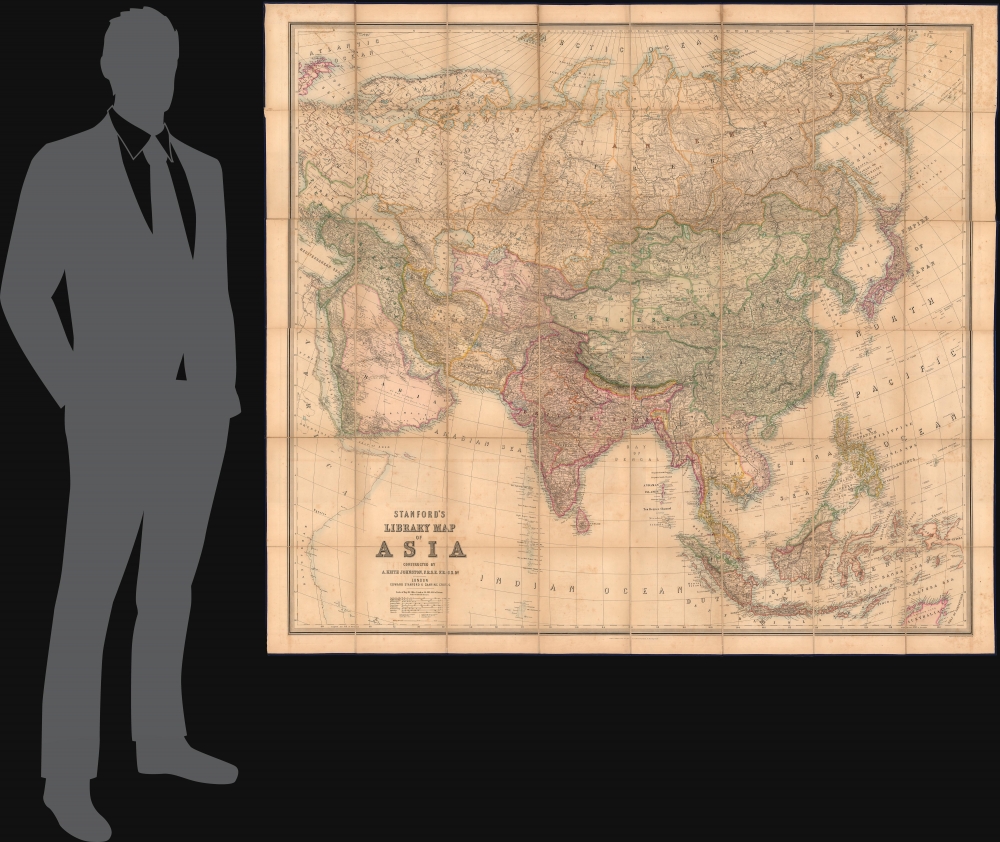
1862 (dated) 61 x 69 in (154.94 x 175.26 cm) 1 : 6969600
1862 (dated) 61 x 69 in (154.94 x 175.26 cm) 1 : 6969600
Description
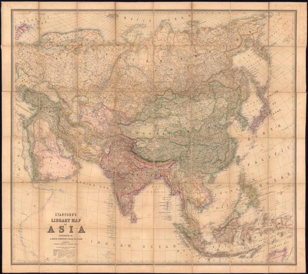
This is an 1863 Edward Stanford and A. K. Johnston wall map of Asia. The map is designed to underscore British power and influence, both highlighting its colonial jewels and emphasizing the theaters of the Great Game in Central Asia.
Other critical British colonies, including the Straits Settlements (Singapore, Malacca, Penang, Dindings) and Hong Kong, are underlined in red to indicate a British presence. Tibet is prominently labeled as part of the Chinese Empire.
Of significance, Standford and Johnston have lavished attention on the theater of the Great Game, illustrating British and Russian spheres of influence, as well as military and infrastructural development efforts on both sides, particularly in Turkestan and Afghanistan.
A Closer Look
Coverage embraces from western Europe to the Bering Strait and from the Arctic Ocean to northern Australia and the Chagos Archipelago. India, the 'Jewel in the Crown', takes center stage as Britian's largest and most important colony. Here, it is well-mapped, reflecting nearly a century of cartographic work and infrastructure development. Surrounding territories, by contrast, seem primitive, lacking roads, railroad development, or even dense cartographic detail. The map thus presents India as the key to Asia, around which the rest of the continent revolves.Other critical British colonies, including the Straits Settlements (Singapore, Malacca, Penang, Dindings) and Hong Kong, are underlined in red to indicate a British presence. Tibet is prominently labeled as part of the Chinese Empire.
Of significance, Standford and Johnston have lavished attention on the theater of the Great Game, illustrating British and Russian spheres of influence, as well as military and infrastructural development efforts on both sides, particularly in Turkestan and Afghanistan.
The Great Game
'The Great Game' was a diplomatic confrontation between the British and Russian Empires over Afghanistan and other territories in Central and Southern Asia. The conflict, rooted in long-standing animosity between Russia and Britain, revolved around Afghanistan, which, while lacking significant resources of its own, was strategically situated. For its part, Russia feared Britain was making commercial and military inroads into Central Asia, an area long within the sphere of influence of St. Petersburg. Britain, conversely, feared Russia making gains in India, 'the jewel in the crown' of British Asia. The escalating tensions led to several wars and proxy wars: The First Anglo-Afghan War (1839 - 1842), the First Anglo-Sikh War (1845 - 1846), the Second Anglo-Sikh War (1848 - 1849), and the Second Anglo-Afghan War (1878 - 1880), along with the Russian annexations of Khiva, Bukhara, and Kokand. Then, as now, Afghanistan proved a grinding stone upon which the world's great empires diminished themselves, none achieving a definitive victory despite committing staggering resources. The Great Game 'ended' on September 10, 1895, with the signing of the Pamir Boundary Commission Protocols, which stabilized the border between Afghanistan and the Russian Empire - but in truth, the conflict persisted well into the 20th century. Regarding the attitude of Afghans toward the British and Russians, the general assumption of the British was that 'Some will fight for us, some against us, but all will fight.Stanford's Library Maps
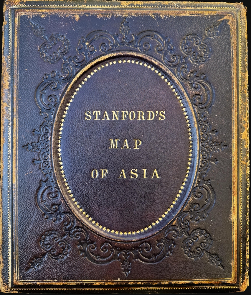
The Library Map series represented Stanford's top-tier cartographic work. They were lavish productions of enormous size, finely engraved, and often housed in elegant, elaborately tooled leather binders - as here. Library Maps were marketed to government institutions, businesses, and the wealthy, thus advertising Stanford's peerless cartographic and printing capacity. The series included a world map, maps of the continents, and a map of London, among others. The series was regularly updated to reflect political changes and expanding geographical knowledge. Due to their high price and enormous size, Library Maps had limited distribution and rarely appear on the market.Publication History and Census
This map was compiled by Alexander Keith Johnston and published by Edward Stanford on July 31, 1862. We note cataloged examples of the present 1862 edition in OCLC at: Harvard University, the Boston Athenaeum, the National Library of Scotland, the University of Oxford, the University of Reading, the British Library, the Bibliothèque nationale de France, the Universiteit Leiden, and the National Library of Australia.CartographerS
Edward Stanford (May 27, 1827 - November 3, 1904) was one of the most prolific map publishing firms of the late 19th century. The company began as a partnership in 1848 between the 21 year old Edward Stanford and the established map dealer Trelawney Saunders. By 1853 the partnership had dissolved and Edward Stanford took full control of the business. A subsequent series of expansions and exciting new map issues finally led to the production of Stanford's masterwork, "Stanford's Library Map of London". This map is still available and remains somewhat accurate. At the time of publishing it was hailed by the Royal Geographical Society as "the most perfect map of London that has ever been issued". In 1882 Edward Stanford Sr. passed the firm on to his son, Edward Stanford Jr. who continued in his father's proud tradition. Today the Stanford firm still publishes maps and remains one of the most important and prolific cartographic publishers in the world. More by this mapmaker...
Alexander Keith Johnston (December 28, 1804 - July 9, 1871) was a Scottish cartographer and map publisher active in the middle portion of the 19th century. Johnson was born at Kirkhill, near Edinburgh, Scotland. He studied at the University of Edinburgh where he apprenticed as an engraver. Around 1826, in partnership with his brother William, he founded a cartographic printing and engraving firm with the imprint "W. and A. K. Johnston." Johnston made a name for himself in educational geography, publishing numerous maps for use in schools. His brother, William Johnston, eventually left the firm to pursue a career in politics, eventually becoming the Lord Provost of Edinburgh. Alexander's son, who would bear the same name, became a geographer and explorer, suffering an untimely death on the Royal Geographical Society's 1879 expedition to Lake Nyasa. Learn More...
Condition
Good. Dissected and mounted on linen. Verso reinforcements to linen fold separations.
References
OCLC 864847260, 556416713.