This item has been sold, but you can get on the Waitlist to be notified if another example becomes available.
1973 Leigh Pictorial Map of Barbados
Barbados-leigh-1973$475.00

Title
Barbados.
1973 (undated) 33.75 x 23.25 in (85.725 x 59.055 cm) 1 : 55000
1973 (undated) 33.75 x 23.25 in (85.725 x 59.055 cm) 1 : 55000
Description
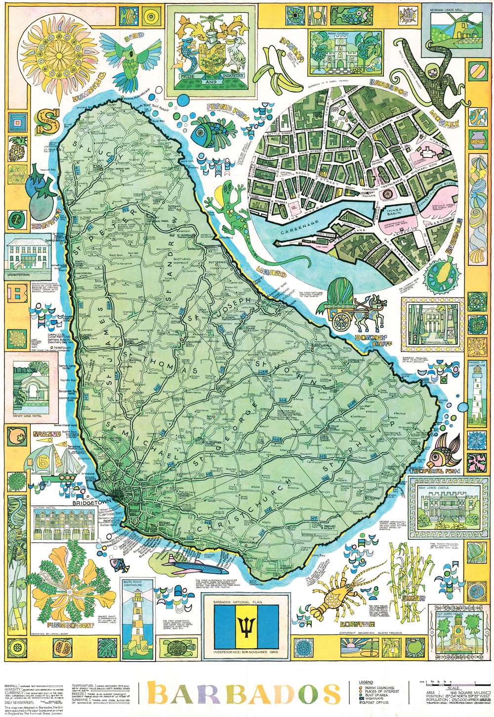
This is a 1973 John Leigh pictorial map of Barbados. Created and designed in Barbados, the map features a decidedly Caribbean flair and color scheme. Illustrations of local wildlife, including hummingbirds, monkeys, lizards, several species of fish, and various flora, are juxtaposed with views of landmarks. Cities and towns are labeled all across the island and its road network is illustrated in detail. A circular inset in the upper right focuses on Bridgetown and identifies streets and important buildings. A pictorial border that incorporates views of popular sites around the island alongside colorful tropical-themed 'tiles' surrounds the whole, with the island's coat of arms occupying the top center.
Publication History and Census
This map was designed by John Leigh in Barbados and. Printed by The Furnival Press in London, England in 1973. It appears that several different editions were published, dating from between 1966 and 1977. Each edition has a slightly different color scheme, which slightly alters the piece's aesthetics. We have located two examples of the present edition in the institutional collections at the Library of Congress and the University of Miami.Condition
Very good. Exhibits light wear along original fold lines. Attached to one partial cover of original binder.
References
Library of Congress G5140 1973 .L4.