This item has been sold, but you can get on the Waitlist to be notified if another example becomes available, or purchase a digital scan.
1920 Segui City Plan or Map of Barcelona, Spain
Barcelona-segui-1920$475.00

Title
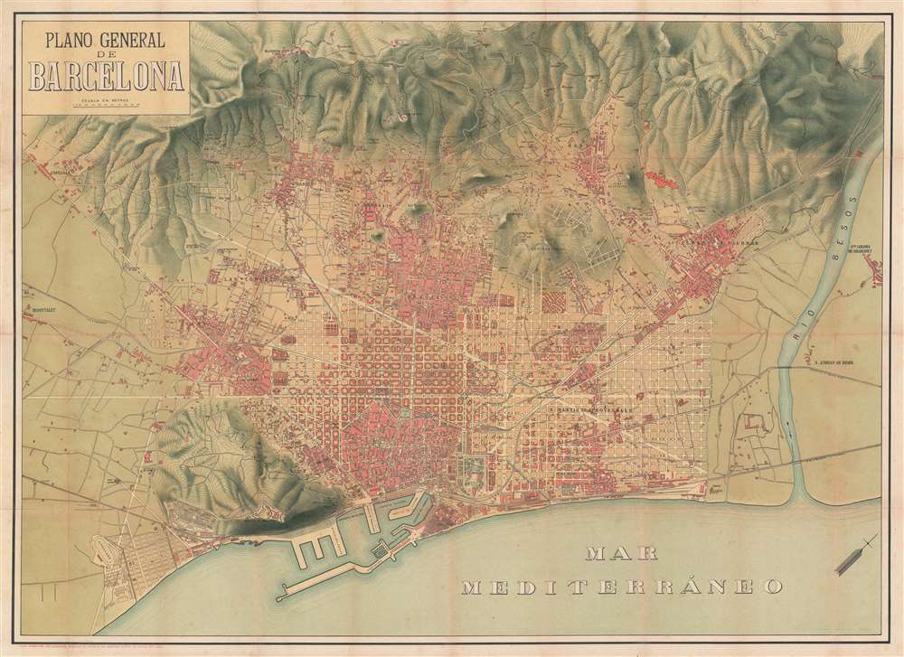
Plano General de Barcelona.
1920 (undated) 24.75 x 32.75 in (62.865 x 83.185 cm) 1 : 15750
1920 (undated) 24.75 x 32.75 in (62.865 x 83.185 cm) 1 : 15750
Description
This is a c. 1920 Segui city plan or map of Barcelona, Spain, and its environs. With the Mediterranean at the bottom of the sheet and part of the Catalan Pre-Coastal Range at the top, Barcelona fills the plain between the sea and the mountains. Central Barcelona is illustrated in detail, with streets (even minor ones) labeled. Hospitals, churches, and other sites are identified, including the Hospital Santa Cruz and the Mercado de San José. Outside Barcelona's old town center (and the centers of the older suburbs), a street grid dominates, contrasting the old, organic city building with modern urban planning. The Besos River cuts diagonally through the right side and separates Santa Coloma de Gramanet from the rest of the burgeoning metropolis.
Publication History and Census
This map was created and published by M. Segui c. 1920. This is the only known cataloged example.Condition
Good. Backed on archival tissue for stability. Exhibits wear along original fold lines. Exhibits areas of infill at fold intersections.