This item has been sold, but you can get on the Waitlist to be notified if another example becomes available, or purchase a digital scan.
1875 Sanford and Leggett Wall Map of Belfast, Waldo County, Maine
BelfastMaine-sanfordleggett-1875$1,250.00

Title
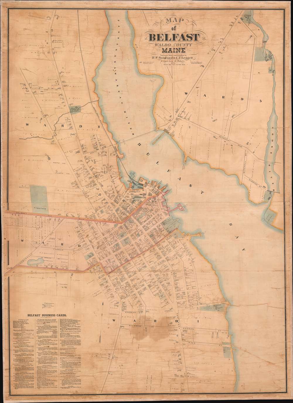
Map of Belfast Waldo County Maine.
1875 (dated) 55 x 40 in (139.7 x 101.6 cm) 1 : 2400
1875 (dated) 55 x 40 in (139.7 x 101.6 cm) 1 : 2400
Description
An extremely rare 1875 wall map of Belfast, Maine, issued by E. F. Sanford and C. T. Leggett. Centered on Belfast Bay and the Passagassawakeag River, the map covers the urban center of Belfast and surrounding areas. Throughout the 19th and into the 20th century, Belfast was a major center of shipbuilding. Numerous ship yards, lumber yards, Foundries, Wharves, and Chandlers are noted throughout the map. The map also names individual property owners and businesses.
Publication History and Census
Published by F. F. Sanford and C. T. Leggett in 1875. The map was engraved in Philadelphia by Worley and Bracher (31 South 6th Street) and printed, also in Philadelphia, by E. Bourquin (same address). Like most such maps, this map was produced in limited numbers on a subscription basis. Today it is exceedingly rare.Condition
Good. Full professional restoration.