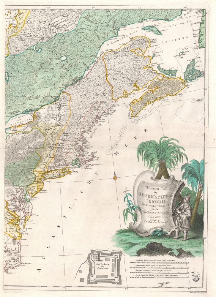
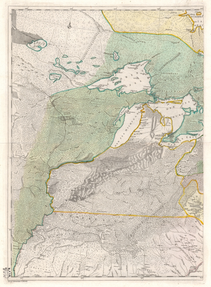
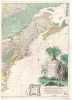
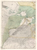
Digital Image: 1761 Rhode Map of North America, Theater of the French and Indian War
BelliinAmericaSeptentrionali-rhode-1761_d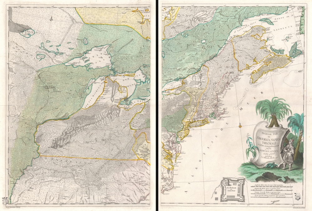

Title
Theatrum belli in America Septentrionali. II. foliis comprehensum jussu Acad. Reg. Scient. et Eleg. Litt. exhibet I. C. Rhode Ac: Geogr. Berger, sculpsit berol.
1761 (undated) 32 x 23 in (81.28 x 58.42 cm) 1 : 3800000
1761 (undated) 32 x 23 in (81.28 x 58.42 cm) 1 : 3800000
Description
FOR THE ORIGINAL ANTIQUE MAP, WITH HISTORICAL ANALYSIS, CLICK HERE.
Digital Map Information
Geographicus maintains an archive of high-resolution rare map scans. We scan our maps at 300 DPI or higher, with newer images being 600 DPI, (either TIFF or JPEG, depending on when the scan was done) which is most cases in suitable for enlargement and printing.
Delivery
Once you purchase our digital scan service, you will receive a download link via email - usually within seconds. Digital orders are delivered as ZIP files, an industry standard file compression protocol that any computer should be able to unpack. Some of our files are very large, and can take some time to download. Most files are saved into your computer's 'Downloads' folder. All delivery is electronic. No physical product is shipped.
Credit and Scope of Use
You can use your digial image any way you want! Our digital images are unrestricted by copyright and can be used, modified, and published freely. The textual description that accompanies the original antique map is not included in the sale of digital images and remains protected by copyright. That said, we put significant care and effort into scanning and editing these maps, and we’d appreciate a credit when possible. Should you wish to credit us, please use the following credit line:
Courtesy of Geographicus Rare Antique Maps (http://www.geographicus.com).
How Large Can I Print?
In general, at 300 DPI, you should at least be able to double the size of the actual image, more so with our 600 DPI images. So, if the original was 10 x 12 inches, you can print at 20 x 24 inches, without quality loss. If your display requirements can accommodate some loss in image quality, you can make it even larger. That being said, no quality of scan will allow you to blow up at 10 x 12 inch map to wall size without significant quality loss. For more information, it is best consult a printer or reprographics specialist.
Refunds
If the high resolution image you ordered is unavailable, we will fully refund your purchase. Otherwise, digital images scans are a service, not a tangible product, and cannot be returned or refunded once the download link is used.
Cartographer S
Johann Christoph Rhode (1713 - 1786) was a German cartographer active in the middle part of the 18th century. Rhode was a student of Leonhard Euler with whom he worked under the auspices of the Prussian Royal Academy of Sciences (Konigliche Akademie der Wissenschaften). There, in 1752, he was appointed resident geographer, where he was assigned to create a detailed German post-route map. He produced several other maps in conjunction with the Academy, most of which focused on Prussian Territories. The exceptions are a map of the North Pole (1753), this map of the Theater of the French and Indian War (1755), and Asia Minor in Antiquity (1780). Rhode's works were intended to be exemplars of Prussian cartography under the patronage of Frederick II (the Great) and were often lavishly engraved. His most important map is most likely Theatrum belli in America Septentrionali although his Neuer Geometrischer Plan der Gesammten Koniglich-Preussischen … Berlin is also similarly extravagant. More by this mapmaker...
Friedrich Gottlieb Berger (1713 - c. 1797), was a German engraver active in Berlin in the middle part of the 18th century. Little is known of his career, but his work in cartography seems limited to a few maps by Johann Chrisoph Rhode and the Prussian Royal Academy of Sciences. His non-cartographic corpus consists of numerous general engravings and bookplates. Berger was survived by his son, Gottfried Daniel Berger (October 25, 1744 - November 17, 1825), also an engraver. Learn More...
References
Library of Congress, G3300 1755 .R5 Vault, 73696824. OCLC 494053904.