This copy is copyright protected.
Copyright © 2025 Geographicus Rare Antique Maps
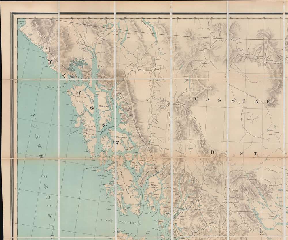
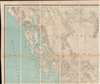
Digital Image: 1896 Jörgensen Map of British Columbia, Canada
BritishColumbia-jorgensen-1895_d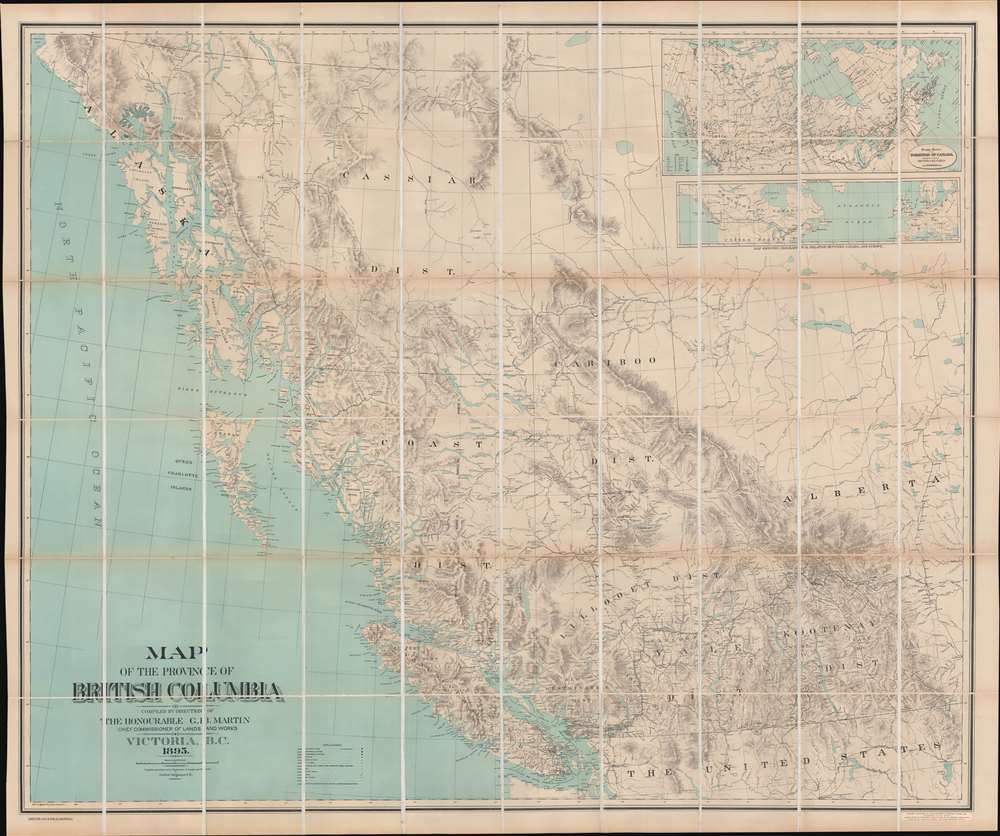


FOR THE ORIGINAL ANTIQUE MAP, WITH HISTORICAL ANALYSIS, CLICK HERE.
Digital Map Information
Geographicus maintains an archive of high-resolution rare map scans. We scan our maps at 300 DPI or higher, with newer images being 600 DPI, (either TIFF or JPEG, depending on when the scan was done) which is most cases in suitable for enlargement and printing.
Delivery
Once you purchase our digital scan service, you will receive a download link via email - usually within seconds. Digital orders are delivered as ZIP files, an industry standard file compression protocol that any computer should be able to unpack. Some of our files are very large, and can take some time to download. Most files are saved into your computer's 'Downloads' folder. All delivery is electronic. No physical product is shipped.
Credit and Scope of Use
You can use your digial image any way you want! Our digital images are unrestricted by copyright and can be used, modified, and published freely. The textual description that accompanies the original antique map is not included in the sale of digital images and remains protected by copyright. That said, we put significant care and effort into scanning and editing these maps, and we’d appreciate a credit when possible. Should you wish to credit us, please use the following credit line:
Courtesy of Geographicus Rare Antique Maps (http://www.geographicus.com).
How Large Can I Print?
In general, at 300 DPI, you should at least be able to double the size of the actual image, more so with our 600 DPI images. So, if the original was 10 x 12 inches, you can print at 20 x 24 inches, without quality loss. If your display requirements can accommodate some loss in image quality, you can make it even larger. That being said, no quality of scan will allow you to blow up at 10 x 12 inch map to wall size without significant quality loss. For more information, it is best consult a printer or reprographics specialist.
Refunds
If the high resolution image you ordered is unavailable, we will fully refund your purchase. Otherwise, digital images scans are a service, not a tangible product, and cannot be returned or refunded once the download link is used.
Gotfred Emil Jörgensen (fl. c. .1890 - 1910) was a Danish-American civil engineer active in British Columbia, Canada, and Washington State in the late 19th and early 20h centuries. Jörgensen is elusive, and there is no record of his birth in Denmark or his relocation to the Pacific Northwest. He lived for a time in Seattle, where he appears in the 1891 directory as a Civil Engineer, but most of his work was done for the British Columbia Department of Lands and Works. In his earliest maps, he appears as a 'draughtsman', by 1891 he is listed as a 'civil engineer', and by 1909 he is the 'Survey General of British Columbia'. It is possible he returned to Denmark in the early 20th century. He is most admired for his large-scale maps of Victoria City and British Columbia. More by this mapmaker...
Alexander Sabiston (April 1859 - May 5, 1900) was a Montreal based lithographer active in the late 19th century. Sabiston was born in Liverpool, England and spent his early years as a ship's carpenter.. His firm, the Sabistion Lithographic and Publishing Company, was incorporated on 1889. The firm remained active until April 13, 1896, when it went into insolvency. The firm's assets were sold at a public auction on April 28th, 1865, most of which were acquired by one 'George Hyde', who transferred the assets to the managers of the Toronto Lithographing Company. Those gentlemen registered an Appellant Company in Montreal as the 'Montreal Lithographic Company, Ltd'. Meanwhile, in May 1869, Alexander Sabiston and his brother, likely James McLeod Sabiston (1867 - 1948) founded a new firm, the Sabiston Lithographing and Publishing Company. This created a branding conflict with the 'Montreal Lithgoraphic Company', who claimed ownership of the Sabiston name, and filed proceedings against the brothers in December 1896. Learn More...
Edward Stanford (May 27, 1827 - November 3, 1904) was one of the most prolific map publishing firms of the late 19th century. The company began as a partnership in 1848 between the 21 year old Edward Stanford and the established map dealer Trelawney Saunders. By 1853 the partnership had dissolved and Edward Stanford took full control of the business. A subsequent series of expansions and exciting new map issues finally led to the production of Stanford's masterwork, "Stanford's Library Map of London". This map is still available and remains somewhat accurate. At the time of publishing it was hailed by the Royal Geographical Society as "the most perfect map of London that has ever been issued". In 1882 Edward Stanford Sr. passed the firm on to his son, Edward Stanford Jr. who continued in his father's proud tradition. Today the Stanford firm still publishes maps and remains one of the most important and prolific cartographic publishers in the world. Learn More...
Copyright © 2025 Geographicus Rare Antique Maps | Geographicus Rare Antique Maps
This copy is copyright protected.
Copyright © 2025 Geographicus Rare Antique Maps