This copy is copyright protected.
Copyright © 2024 Geographicus Rare Antique Maps
1951 Meyer / British Railways Pictorial Map of Britain
BritishIsles-meyer-1951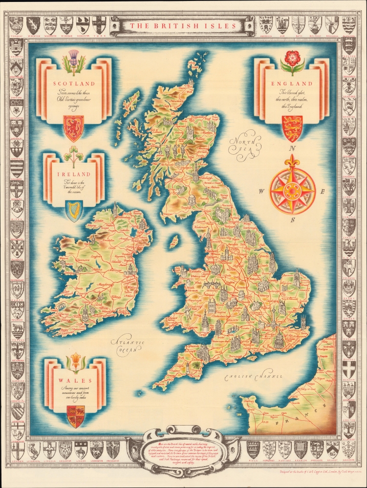


Copyright © 2024 Geographicus Rare Antique Maps | Geographicus Rare Antique Maps
This copy is copyright protected.
Copyright © 2024 Geographicus Rare Antique Maps