This item has been sold, but you can get on the Waitlist to be notified if another example becomes available, or purchase a digital scan.
1912 Escalante City Map or Plan of Buenos Aires, Argentina
BuenosAires-escalante-1912$750.00

Title
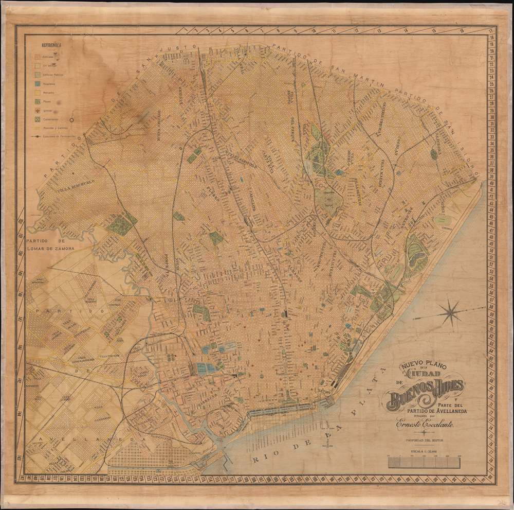
Nuevo Plano de la Ciudad de Buenos Aires. Parte del Partido de Avellaneda.
1912 (undated0 27 x 27 in (68.58 x 68.58 cm) 1 : 32000
1912 (undated0 27 x 27 in (68.58 x 68.58 cm) 1 : 32000
Description
This is a 1912 Ernesto Escalante city map or plan of Buenos Aires, Argentina. The map depicts the city from the Partido de Avellaneda and the Villa Riachuelo to the Rio de la Plata and from the Avenida General Paz to the Rio de la Plata. Highly detailed, myriad streets are illustrated and labeled throughout the city, along with hospitals, public buildings, parks, and cemeteries. A key situated in the upper left corner explains the various different colors used and what they denote. Names of neighborhoods are overprinted, giving some idea of how the city is organized.
Census and Publication History
This map was published by Ernesto Escalante in 1912. It is rare, with only three known examples in institutional collections at the University of Toronto, the Biblioteca Nacional de España, and the Cleveland Public Library.Condition
Very good. Full professional restoration including fresh linen backing. Even overall toning.
References
OCLC 977986858.