This copy is copyright protected.
Copyright © 2025 Geographicus Rare Antique Maps
Digital Image: 1850 Handtke / Flemming Map of the Western United States
CalifornienOregonUtah-flemming-1850-3_d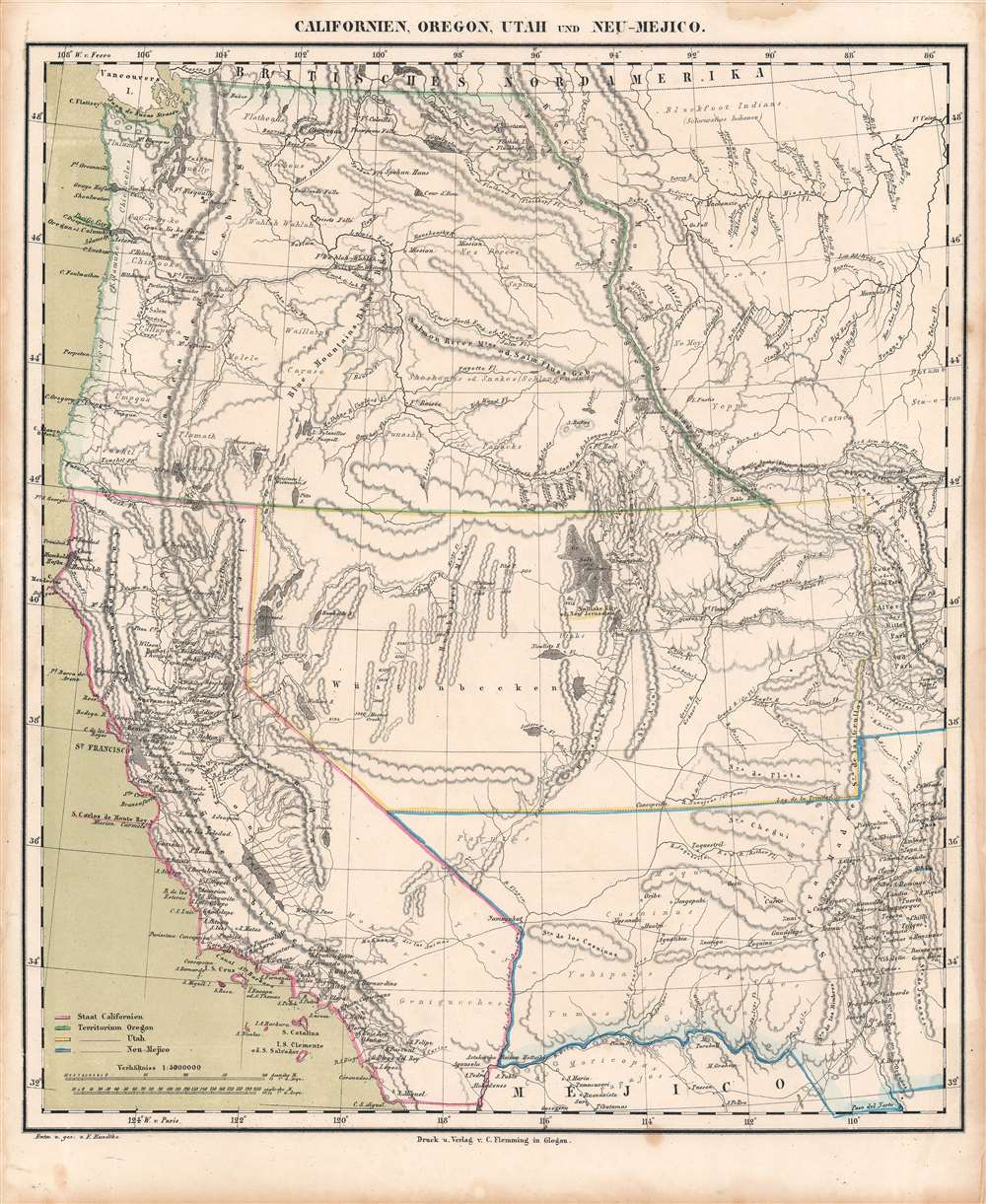

FOR THE ORIGINAL ANTIQUE MAP, WITH HISTORICAL ANALYSIS, CLICK HERE.
Digital Map Information
Geographicus maintains an archive of high-resolution rare map scans. We scan our maps at 300 DPI or higher, with newer images being 600 DPI, (either TIFF or JPEG, depending on when the scan was done) which is most cases in suitable for enlargement and printing.
Delivery
Once you purchase our digital scan service, you will receive a download link via email - usually within seconds. Digital orders are delivered as ZIP files, an industry standard file compression protocol that any computer should be able to unpack. Some of our files are very large, and can take some time to download. Most files are saved into your computer's 'Downloads' folder. All delivery is electronic. No physical product is shipped.
Credit and Scope of Use
You can use your digial image any way you want! Our digital images are unrestricted by copyright and can be used, modified, and published freely. The textual description that accompanies the original antique map is not included in the sale of digital images and remains protected by copyright. That said, we put significant care and effort into scanning and editing these maps, and we’d appreciate a credit when possible. Should you wish to credit us, please use the following credit line:
Courtesy of Geographicus Rare Antique Maps (http://www.geographicus.com).
How Large Can I Print?
In general, at 300 DPI, you should at least be able to double the size of the actual image, more so with our 600 DPI images. So, if the original was 10 x 12 inches, you can print at 20 x 24 inches, without quality loss. If your display requirements can accommodate some loss in image quality, you can make it even larger. That being said, no quality of scan will allow you to blow up at 10 x 12 inch map to wall size without significant quality loss. For more information, it is best consult a printer or reprographics specialist.
Refunds
If the high resolution image you ordered is unavailable, we will fully refund your purchase. Otherwise, digital images scans are a service, not a tangible product, and cannot be returned or refunded once the download link is used.
Carl Flemming (fl. c. 1840 - c. 1879) was a German cartographer and map publisher active in the late 19th and early 20th centuries. The firm was an early adopter of modern multicolor printing techniques, which it utilized to produce low cost attractive maps focused on the German market. The firm is also known for its children's books. Flemming died in 1878 or 1879, but his firm continued to publish well into the 20th century. Flemming was based in Glogow, a region that is currently part of modern day Poland's Lower Silesian Voivodeship. More by this mapmaker...
Friedrich Handtke (December 7, 1815 - January 25, 1879) was a German engraver and cartographer active in the second half of the 19th century. Handtke was formally trained as a surveyor in the Prussian army. Following his discharge in 1838 he took a position as the head of cartography at the Głogów, Poland, publishing house of Carl Flemming. Initially, Handtke, in an attempt to hide his youth, inscribed his map publications as "Dr. Karl Sohr". From 1838 to 1874, Handtke and Flemming issued some 260 maps, about 168 of which Handke drew himself. Both Flemming and Handke died in 1879 leaving the powerful Flemming publishing house without its heads. Nonetheless, the firm continued to publish, and republish, well into the 20th century. Głogów, where Handtke was based, is currently part of modern day Poland's Lower Silesian Voivodeship. Learn More...
Copyright © 2025 Geographicus Rare Antique Maps | Geographicus Rare Antique Maps
This copy is copyright protected.
Copyright © 2025 Geographicus Rare Antique Maps