1931 McCarty Pictorial View of Santa Catalina Island, California
CatalinaIsland-mccarty-1931$325.00


Title
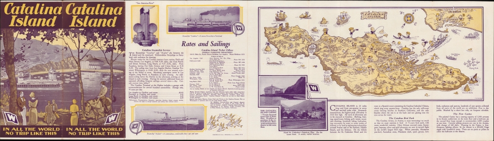
Catalina Island In All the World No Trip Like This.
1931 (dated) 6 x 14.5 in (15.24 x 36.83 cm)
1931 (dated) 6 x 14.5 in (15.24 x 36.83 cm)
Description
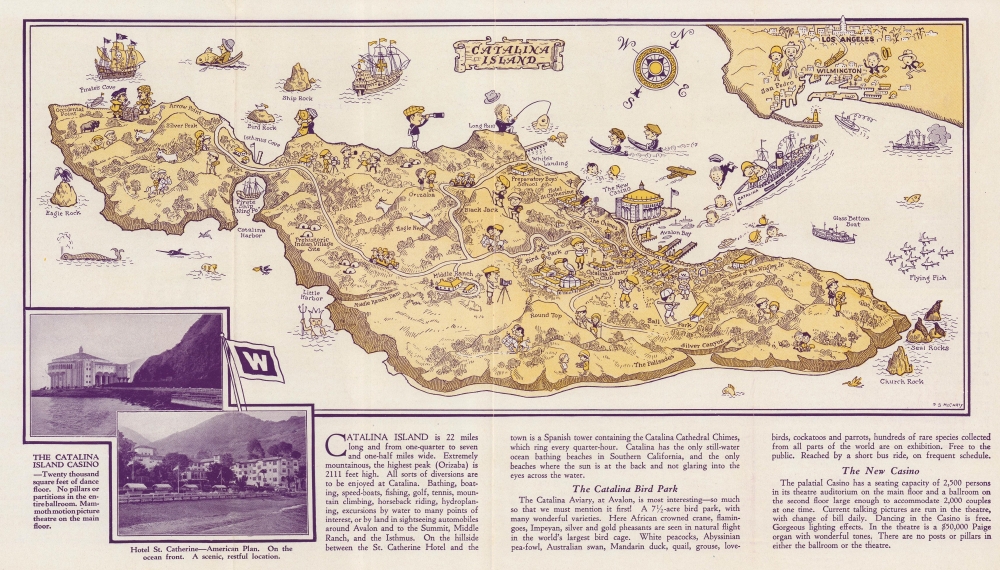
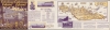
A lovely 1931 pictorial map of Santa Catalina Island drawn by Phil S. McCarty, part of a brochure published for the Wilmington Transportation Company, operator of the steamships connecting the island with Los Angeles.
Wrigley, whose home is labeled here, invested a fortune to bring Avalon and the rest of the island to fruition as a resort. He opened a casino (that is, a dance hall and theater, not a place of gambling) in the town, sponsored the bird park seen near center, and designated Catalina as the spring training home of the Chicago Cubs, which he also owned, explaining the baseball park on the outskirts of Avalon towards the right. William's son Philip inherited his control of the Santa Catalina Island Company when he died in 1932, and the island continued to develop, though most of the island outside of Avalon remained rural. The Catalina Island Conservancy, a private land trust, now manages this part of the island.
A Closer Look
Oriented towards the northwest, this pictorial map covers the entirety of Santa Catalina Island, with Wilmington, San Pedro, and Los Angeles in the background. Illustrated figures, drawn in the style characteristic of pictorial maps of the era, demonstrate the various activities available to tourists on the island, including golfing, hiking, horseback riding, driving (though nowadays, the use of motor vehicles on the island is strictly limited), admiring the scenery and wildlife, swimming, fishing, boating, or enjoying activities available in Avalon, including watching films and dancing at the town's magnificent new Catalina Casino. Several other features give a sense of the lively environment on the island, half-pastoral and half-Hollywood production. The accompanying brochure includes promotional text and images for the Wilmington Transportation Company and for various attractions around the island.The Wilmington Transportation Company
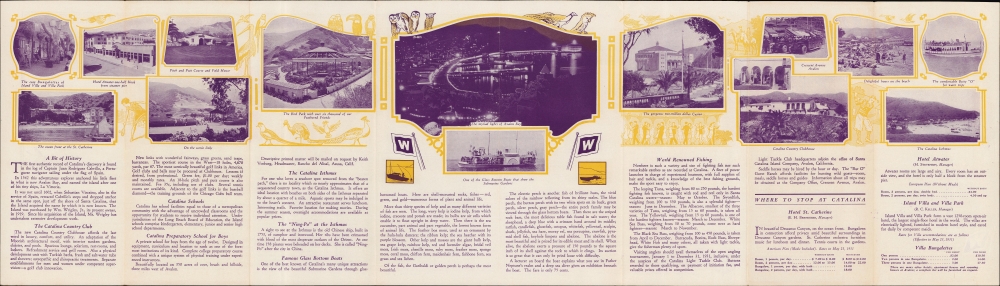
The ship carrying passengers to the island belongs to the Wilmington Transportation Company (whose logo was the large 'W' flags that appear throughout the brochure). The company was a primary means by which travelers shuttled between Los Angeles and Catalina Island. Passengers from throughout the Los Angeles region could reach the company's harbor facilities by the Pacific Electric interurban system, which is represented by the train at the top-right. Its ticket offices were integrated with those of Pacific Electric and Southern Pacific (which owned Pacific Electric at this time), explaining the joint ticket option advertised in the brochure. The company's history mirrored the ownership of the island since it was founded by the Banning brothers in conjunction with George Shatto before it was sold to William Wrigley Jr. (discussed below). However, unlike many other aspects of the island, passenger steamers were not controlled monopolistically, as the competing Meteor Boat Company won a lawsuit in 1907 that made Avalon an open port. However, in 1920, the Wilmington Transportation Company bought the Meteor Boat Company, granting it an effective monopoly. The same year this map was published, it began an 'amphibious' service in conjunction with Wilmington-Catalina Airlines, also owned by Wrigley. The company's reach can be attested to by its large number of ticket offices in southern California, listed on the recto of the brochure, along with its office in Pheonix, Arizona.The Pirate Ship 'Ning Po'
The Pirate Ship 'Ning Po' at left was a captured Chinese pirate junk with a storied history. Originally built in the 1750s, it smuggled opium, slaves, and prisoners during its career, preyed on civilian ships, and was captured multiple times by the British, the Qing, and Taiping rebels. In 1911, it was captured by another set of anti-Qing rebels during the Xinhai Revolution and sold to a group of Americans. The ship had a harrowing journey across the Pacific, which included getting caught in a typhoon off Japan, having its sails and rudder incapacitated, and undergoing a mutiny before a small group of loyal crewmembers rowed back to the Chinese coast, had the ship repaired, and sailed to California. After being displayed at several points in southern California, it was docked off Catalina Island in 1917 and was converted into a Chinese restaurant. It caught fire in 1938, perhaps deliberately burned for a scene in a film.Open Air Hollywood Set
Not only was Catalina Island a preferred getaway for Hollywood types, but it was also a setting for many films of the silent film era and afterward. Nearly all the major studios of the 1920s shot films there, and it was an ideal setting for films with biblical and maritime themes. Towards the left, there is a film crew and actors on a shoot, a location that was so popular that it became known as a 'movie colony'. The Lasky Film Corporation was especially fond of shooting on the island. It was the most likely source of a small herd of buffalo who were brought to Catalina for a film shoot but escaped captivity, alluded to here by the illustration of a buffalo on the island's western tip. To this day, the descendants of these buffalo roam freely on the island's western portion.Los Angeles' Leisureland
Santa Catalina Island emerged as a posh playground for Hollywood stars and other Los Angeles grandees in the decade or so before this map's production. Throughout its history, Santa Catalina Island had been inhabited by Tongva people, visited by Spanish explorers, Russian traders, pirates, and smugglers, and experienced a brief gold rush in the 1850s; the island maintained a small population of ranchers in the late 19th century when it was owned by James Lick (the richest man in California). In 1887, Lick sold the island to George Shatto, who sensed its possibilities as a resort for growing Los Angeles. Late in life, before his untimely death in a train crash, Shatto partnered with the Banning brothers, sons of Los Angeles magnate Phineas Banning, and began to develop Santa Catalina as a resort. However, after a fire destroyed most of Avalon in 1915, the island was effectively sold to William Wrigley Jr. (of chewing gum fame) when he bought a controlling interest in the Santa Catalina Island Company, which bought the island in 1919.Wrigley, whose home is labeled here, invested a fortune to bring Avalon and the rest of the island to fruition as a resort. He opened a casino (that is, a dance hall and theater, not a place of gambling) in the town, sponsored the bird park seen near center, and designated Catalina as the spring training home of the Chicago Cubs, which he also owned, explaining the baseball park on the outskirts of Avalon towards the right. William's son Philip inherited his control of the Santa Catalina Island Company when he died in 1932, and the island continued to develop, though most of the island outside of Avalon remained rural. The Catalina Island Conservancy, a private land trust, now manages this part of the island.
Publication History and Census
This pictorial map was drawn by artist Phil S. McCarty and is part of a brochure published by the Wilmington Transportation Company, with cover art by E. O. Withers. The limited publication information suggests that it was printed by a local outfit called Sterling in 1931. We are not aware of any examples of this map and brochure in institutional collections.Cartographer
Phil S. McCarty (fl. c. 1927 - 1950), often as P. S. McCarty, was an illustrator active in Los Angeles from the late 1920s through the 1940s. He may be the same P. S. McCarty who worked for the Menasha Printing and Cartoon Company in Wisconsin and the Direct Advertising Corporation in Indianapolis in the 1910s and 1920s, respectively. At any rate, Phil S. McCarty appears in city directories and government records from 1927 in Los Angeles and San Gabriel. In at least one instance, he is listed as an 'elevator operator' instead of an artist, suggesting he had trouble establishing himself, perhaps due to the Great Depression. McCarty's style fits well with pictorial maps of the era, and the limited amount of his known work appeared in brochures for attractions in the L.A. area, such as Catalina Island and the Mission San Gabriel. He does not appear to have any relation to contemporary California artist Lea McCarty, who also produced pictorial maps. More by this mapmaker...
Condition
Very good. Light wear along original folds. Text and images on verso.