Digital Image: 1871 'Prairie Farmer' First Broadside Map of the Chicago Fire - issued days after fir
ChicagoFire-prairiefarmer-1871_d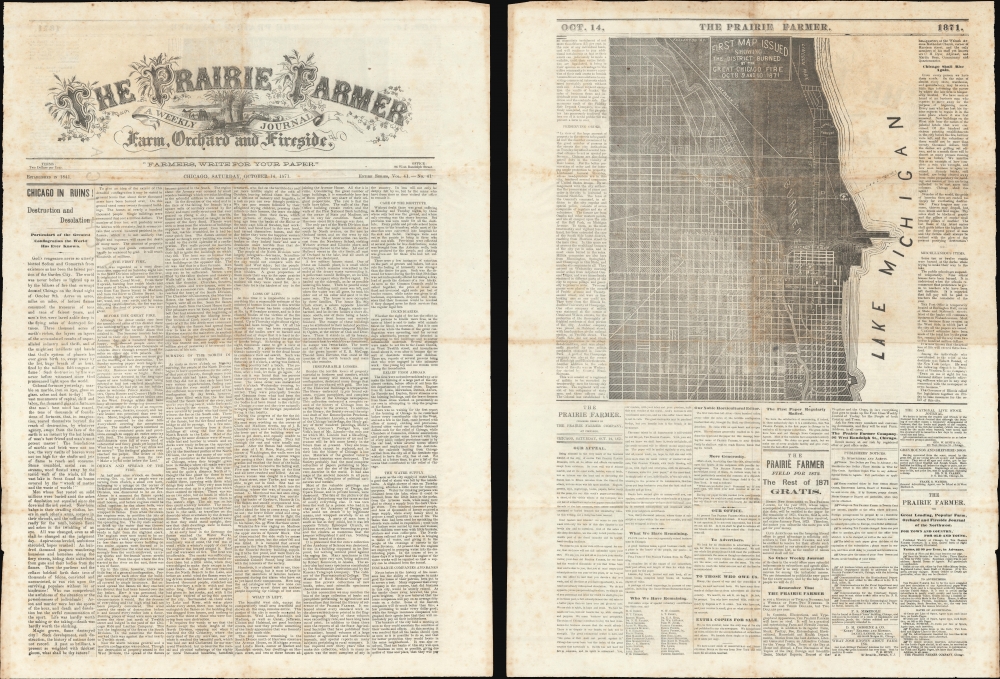


Title
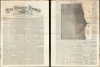
The Prairie Farmer / First Map Issued Showing the District Burned by the Great Chicago Fire Oct. 8 9 and 10, 1871.
1871 (dated) 22 x 16 in (55.88 x 40.64 cm)
1871 (dated) 22 x 16 in (55.88 x 40.64 cm)
Description
FOR THE ORIGINAL ANTIQUE MAP, WITH HISTORICAL ANALYSIS, CLICK HERE.
Digital Map Information
Geographicus maintains an archive of high-resolution rare map scans. We scan our maps at 300 DPI or higher, with newer images being 600 DPI, (either TIFF or JPEG, depending on when the scan was done) which is most cases in suitable for enlargement and printing.
Delivery
Once you purchase our digital scan service, you will receive a download link via email - usually within seconds. Digital orders are delivered as ZIP files, an industry standard file compression protocol that any computer should be able to unpack. Some of our files are very large, and can take some time to download. Most files are saved into your computer's 'Downloads' folder. All delivery is electronic. No physical product is shipped.
Credit and Scope of Use
You can use your digial image any way you want! Our digital images are unrestricted by copyright and can be used, modified, and published freely. The textual description that accompanies the original antique map is not included in the sale of digital images and remains protected by copyright. That said, we put significant care and effort into scanning and editing these maps, and we’d appreciate a credit when possible. Should you wish to credit us, please use the following credit line:
Courtesy of Geographicus Rare Antique Maps (http://www.geographicus.com).
How Large Can I Print?
In general, at 300 DPI, you should at least be able to double the size of the actual image, more so with our 600 DPI images. So, if the original was 10 x 12 inches, you can print at 20 x 24 inches, without quality loss. If your display requirements can accommodate some loss in image quality, you can make it even larger. That being said, no quality of scan will allow you to blow up at 10 x 12 inch map to wall size without significant quality loss. For more information, it is best consult a printer or reprographics specialist.
Refunds
If the high resolution image you ordered is unavailable, we will fully refund your purchase. Otherwise, digital images scans are a service, not a tangible product, and cannot be returned or refunded once the download link is used.
Cartographer
Prairie Farmer (1841 - Present), published in Chicago, Illinois, is one of the oldest agricultural publications in the United States. Initially launched as The Union Agriculturist and Western Prairie Farmer by John Stephen Wright (1815 - 1874), it aimed to provide practical information and advocacy for Midwestern farmers. Over the decades, it grew in influence, offering a mix of farming techniques, industry news, and rural lifestyle content, adapting to the changing needs of its readership. Wright actively managed the newspaper until 1856, when he hired an editor and turned his business interests elsewhere. During the Great Chicago Fire of 1871, Prairie Farmer's offices in central Chicago were destroyed, but some printing tools, a subscriber list, and back issues were saved, allowing the editors to continue their operations and even meet publication deadlines for their next issue, just days after the event. The Prairie Farmer played a crucial role in advancing agricultural education and innovation, supporting the development of modern farming practices. Today, it continues to serve as a vital resource for the agricultural community, maintaining its legacy of support and information for farmers. More by this mapmaker...
Source
The Prairie Farmer, (Chicago) October 14, 1871.