Digital Image: 1601 Herrera y Tordesillas Map of Chile
Chile-herrera-1601_d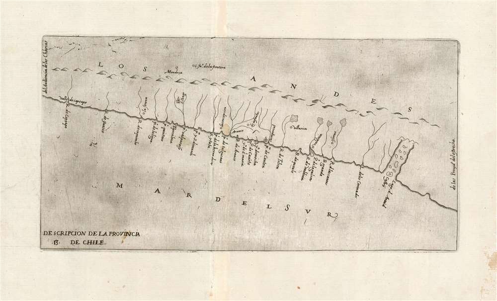

Title
Descripcion De La Provincia De Chile.
1601 (undated) 5.75 x 11.25 in (14.605 x 28.575 cm) 1 : 6000000
1601 (undated) 5.75 x 11.25 in (14.605 x 28.575 cm) 1 : 6000000
Description
FOR THE ORIGINAL ANTIQUE MAP, WITH HISTORICAL ANALYSIS, CLICK HERE.
Digital Map Information
Geographicus maintains an archive of high-resolution rare map scans. We scan our maps at 300 DPI or higher, with newer images being 600 DPI, (either TIFF or JPEG, depending on when the scan was done) which is most cases in suitable for enlargement and printing.
Delivery
Once you purchase our digital scan service, you will receive a download link via email - usually within seconds. Digital orders are delivered as ZIP files, an industry standard file compression protocol that any computer should be able to unpack. Some of our files are very large, and can take some time to download. Most files are saved into your computer's 'Downloads' folder. All delivery is electronic. No physical product is shipped.
Credit and Scope of Use
You can use your digial image any way you want! Our digital images are unrestricted by copyright and can be used, modified, and published freely. The textual description that accompanies the original antique map is not included in the sale of digital images and remains protected by copyright. That said, we put significant care and effort into scanning and editing these maps, and we’d appreciate a credit when possible. Should you wish to credit us, please use the following credit line:
Courtesy of Geographicus Rare Antique Maps (http://www.geographicus.com).
How Large Can I Print?
In general, at 300 DPI, you should at least be able to double the size of the actual image, more so with our 600 DPI images. So, if the original was 10 x 12 inches, you can print at 20 x 24 inches, without quality loss. If your display requirements can accommodate some loss in image quality, you can make it even larger. That being said, no quality of scan will allow you to blow up at 10 x 12 inch map to wall size without significant quality loss. For more information, it is best consult a printer or reprographics specialist.
Refunds
If the high resolution image you ordered is unavailable, we will fully refund your purchase. Otherwise, digital images scans are a service, not a tangible product, and cannot be returned or refunded once the download link is used.
Cartographer S
Antonio de Herrera y Tordesillas (1549 - March 28, 1626 or March 27, 1625) was a chronicler, historian, and writer of the Spanish Golden Age. He authored what is considered one of the best contemporaneous works written on the conquest of the Americas - despite never having lived or visited any part of them. As Chief Chronicler of Castile and the Americas during the reigns of Philip II and Philip III he would become one of the most prolific historians of his era. This is not to say that he was among the best. The Diccionario de historia de España, described him as an opportunistic, greedy, scheming plagiarist: not notably desirable qualities in a historian. For a courtier, these prove to be essential traits, and they served Herrera y Tordesillas well. His youthful connections would eventually bring him under the service of the Italian Prince Vespasiano I Gonzaga, to whom he became a most trusted aide. Herrera successfully leveraged this position to expand both his circle of friends and his personal wealth, and the relationship would lead to the introduction to King Philip II which made the rest of his career. His massive output ensured that he had constantly new opportunities to dedicate works to powerful potential patrons. Herrera y Tordesillas' cartographic contributions are largely contained in his 1601 Descripción de las Indias Occidentales, which is notable for containing some of the only maps produced during early colonization of the Americas that were derived from official Spanish sources, including the manuscript maps of Juan López de Velasco. More by this mapmaker...
Juan López de Velasco (c. 1530 - 1598) was a Spanish cosmographer and historian. He served as Spain's senior chronicler of the Indies in the second half of the century, during the reign of Philip II. He produced a number of charts of the Americas - of Guatemala, Panama, Chile and Mexico - which would provide the basis of the maps included in Herrera y Tordesillas' 1601 geography of the West Indies. He also created a 51-point rubric for the cataloguing of every town, village or city falling within Philip II's domains. Learn More...
Source
Herrera y Tordesillas, A. Descripcion de la islas y tierra firme del mar oceano que ilaman Indias Ocidentales / De Antonio de Herrera. (Madrid) 1601.
References
OCLC 218031052.