This item has been sold, but you can get on the Waitlist to be notified if another example becomes available, or purchase a digital scan.
1887 Mouchet Gastronomic Map of Cognac (Charente, France)
CognacLesCrus-mouchet-1887$175.00

Title
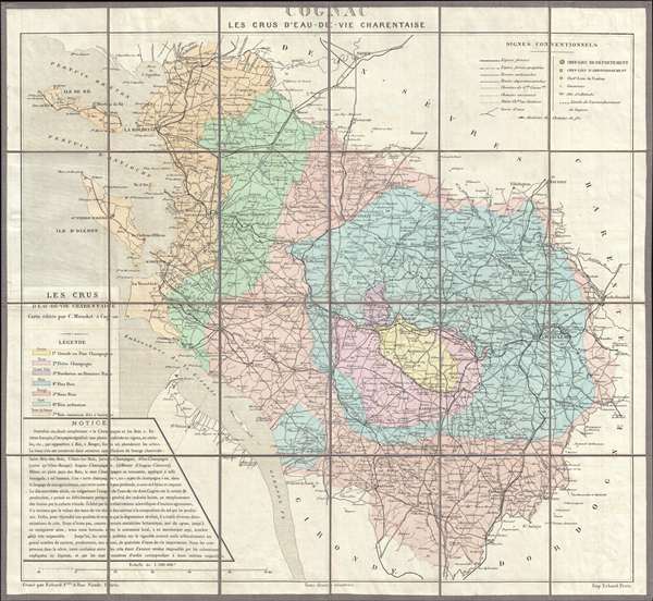
Cognac Les Crus D'Eau-de-vie Charentaise.
1887 (dated) 21 x 22.5 in (53.34 x 57.15 cm) 1 : 300000
1887 (dated) 21 x 22.5 in (53.34 x 57.15 cm) 1 : 300000
Description
An uncommon 1887 C. Mouchet gastronomic map of Charente or the Cognac producing region of France. Centered on the city of Cognac, the map extends from the Bay of Biscay and the Gironde Estuary eastward as far as Angouleme, northwards as far as Niort, and south as far as Montguyon. Color coding identifies the various grape growing regions of Cognac:
- Grand our Fine Champagne
- Petit Champagne
- Borderies ou Premiers Bois
- Fins Bois
- Bois Ordinaires
- Bois Communs did a Terroir
Condition
Very good condition. Dissected and mounted on linen on 24 panels. Original brown linen in good condition. Slight transference. Removed from but accompanied by original red linen binder with gilt stamping.
References
OCLC 556933552. Bibliotheque Nationale de France, GE C-798