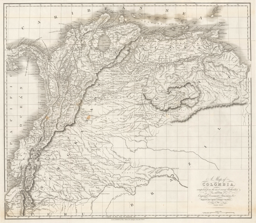
1825 Sidney Hall Map of Gran Colombia
Colombia-hall-1825
Title
1825 (dated) 21.75 x 25 in (55.245 x 63.5 cm) 1 : 4000000
Description
A Closer Look
The map illustrates Gran Colombia at its height, under the governance of Simón Bolívar, one year after the Constitution of Cúcuta and before infighting began to tear the vast territory apart. Coverage embraces from the Pacific to the Essequibo River and from the Caribbean Sea to the Amazon, thus incorporating a vast territory including modern-day Colombia, Ecuador, Venezuela, and Panama, as well as part of Peru and Brazil. It is meticulously detailed throughout, showing roads, river systems, topography, and political boundaries.The cartography closely follows the 1823 Zea Map of Colombia (cf. Colombia-baldwincradockjoy-1823), itself derivative of the northwestern portions of the 1814 John Arrowsmith's large-scale general map of South America.
Gran Colombia
Gran Colombia was a republic that encompassed much of northern South America, including present-day Colombia, Venezuela, Ecuador, and Panama. Established in 1819 after the successful liberation from Spanish rule, Gran Colombia was led by Simón Bolívar, a key figure in Latin America's independence movements. The Republic aimed to unite the diverse regions under a single federal government, promoting stability and prosperity. Despite initial enthusiasm, the vast territory and regional differences posed significant challenges to governance. Internal conflicts and differing visions for the Republic's future ultimately led to its dissolution in 1831. During its brief existence, Gran Colombia symbolized the dream of a unified and independent Latin America.Publication History and Census
This map was engraved and printed by Sydney Hall to illustrate Charles Stuart Cochrane's 1825 Journal of a Residence and Travels in Colombia, during the Years 1823 and 1824, published in London by Henry Colburn. Overpopulation of digital resources in OCLC makes an institutional census of the work impossible, but we note that it occasionally appears on the market.Cartographer
Sidney Hall (1788 - 1831) was an English engraver and map publisher active in London during the late 18th and early 19th centuries. His earliest imprints, dating to about 1814, suggest a partnership with Michael Thomson, another prominent English map engraver. Hall engraved for most of the prominent London map publishers of his day, including Aaron Arrowsmith, William Faden, William Harwood, and John Thomson, among others. Hall is credited as being one of the earliest adopters of steel plate engraving, a technique that allowed for finer detail and larger print runs due to the exceptional hardness of the medium. Upon his early death - he was only in his 40s - Hall's business was inherited by his wife, Selina Hall, who continued to publish under the imprint, "S. Hall", presumably for continuity. The business eventually passed to Sidney and Selina's nephew Edward Weller, who became extremely prominent in his own right. More by this mapmaker...

