This copy is copyright protected.
Copyright © 2025 Geographicus Rare Antique Maps
1905 Blanchard Map of New England Electric Railways, Roads, and Railroads
CommercialSurvey-blanchard-1905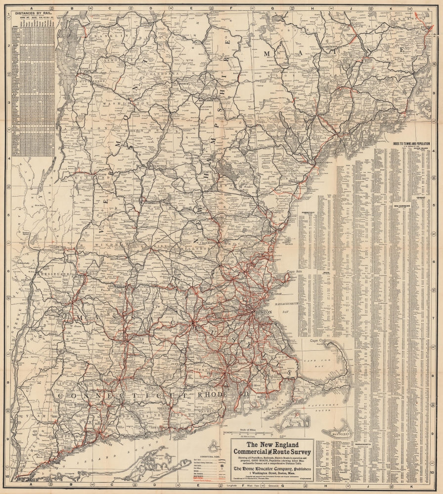


Copyright © 2025 Geographicus Rare Antique Maps | Geographicus Rare Antique Maps
This copy is copyright protected.
Copyright © 2025 Geographicus Rare Antique Maps