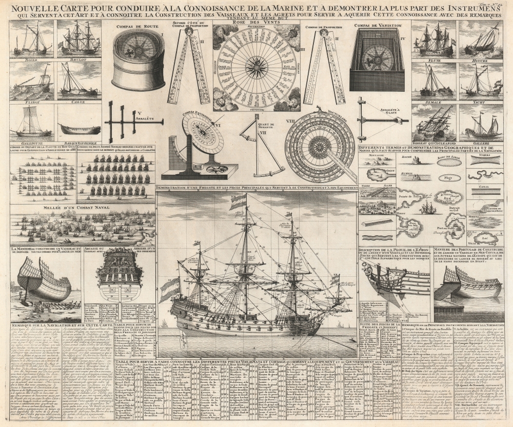
1720 Chatelain Chart of Ships, Ship Construction, and Naval Instruments
ConnoissancesMarine-chatelain-1720
Title
1720 (undated) 19.625 x 23.25 in (49.8475 x 59.055 cm)
Description
A Closer Look
A diagram of a frigate with all its constituent parts identified is the chart's centerpiece. Tables identifying over 100 ship components, including masts, sails, and rigging, occupy space to the left, right, and below the illustration. Diagrams of the bow and stern of the frigate appear to the right and left, respectively, with different parts of their construction identified alphabetically. Illustrations of naval fleets in combat or aligned in rows ready for combat appear above and to the left of the frigate, while tables illustrating hazards and havens of travel by sea occupy the right. Illustrations of 12 types of sailing vessels occupy the upper-left and upper-right corners. Eight navigational instruments, including several compasses, command attention at top center. Short descriptions of these eight devices are also included in the lower right corner. Text in the lower left corner summarizes the chart and provides some of Chatelain's rationale for including this chart in his Suplément a l'Atlas Historique contenant diverses pièces de Chronologie, de Genealogie, d'Historie, et d'autres Science qui avoient été omises dans les précédens Volumes.Publication History and Census
This chart was published by Henri Abraham Chatelain and François L'Honoré in 1720 in the 7th volume of their Atlas historique, ou Nouvelle introduction à l'histoire, à la chronologie et à la géographie ancienne et moderne... titled Suplément a l'Atlas Historique contenant diverses pièces de Chronologie, de Genealogie, d'Historie, et d'autres Science qui avoient été omises dans les précédens Volumes. The separate chart is not cataloged in OCLC. We note a single cataloged example of the separate chart, which is part of the collection at the Mariners' Museum and Park in Newport News, Virginia. The Suplément a l'Atlas Historique is well represented in institutional collections.Cartographer
Henri Abraham Chatelain (1684 - 1743) was a Huguenot pastor of Parisian origins. He lived consecutively in Paris, St. Martins, London (c. 1710), The Hague (c. 1721) and Amsterdam (c. 1728). He is best known as a Dutch cartographer and more specifically for his cartographic contribution in the seminal seven volume Atlas Historique, published in Amsterdam between 1705 and 1720. Innovative for its time, the Atlas Historique combined fine engraving and artwork with scholarly studies of geography, history, ethnology, heraldry, and cosmography. Some scholarship suggests that the Atlas Historique was not exclusively compiled by Henri Chatelain, as is commonly believed, but rather was a family enterprise involving Henri, his father Zacharie and his brother, also Zacharie. More by this mapmaker...

