This item has been sold, but you can get on the Waitlist to be notified if another example becomes available, or purchase a digital scan.
1570 Lafreri Map of Crete
Crete-lafreri-1570
Title
1570 (undated) 11 x 8.25 in (27.94 x 20.955 cm) 1 : 947000
Description
A Closer Look
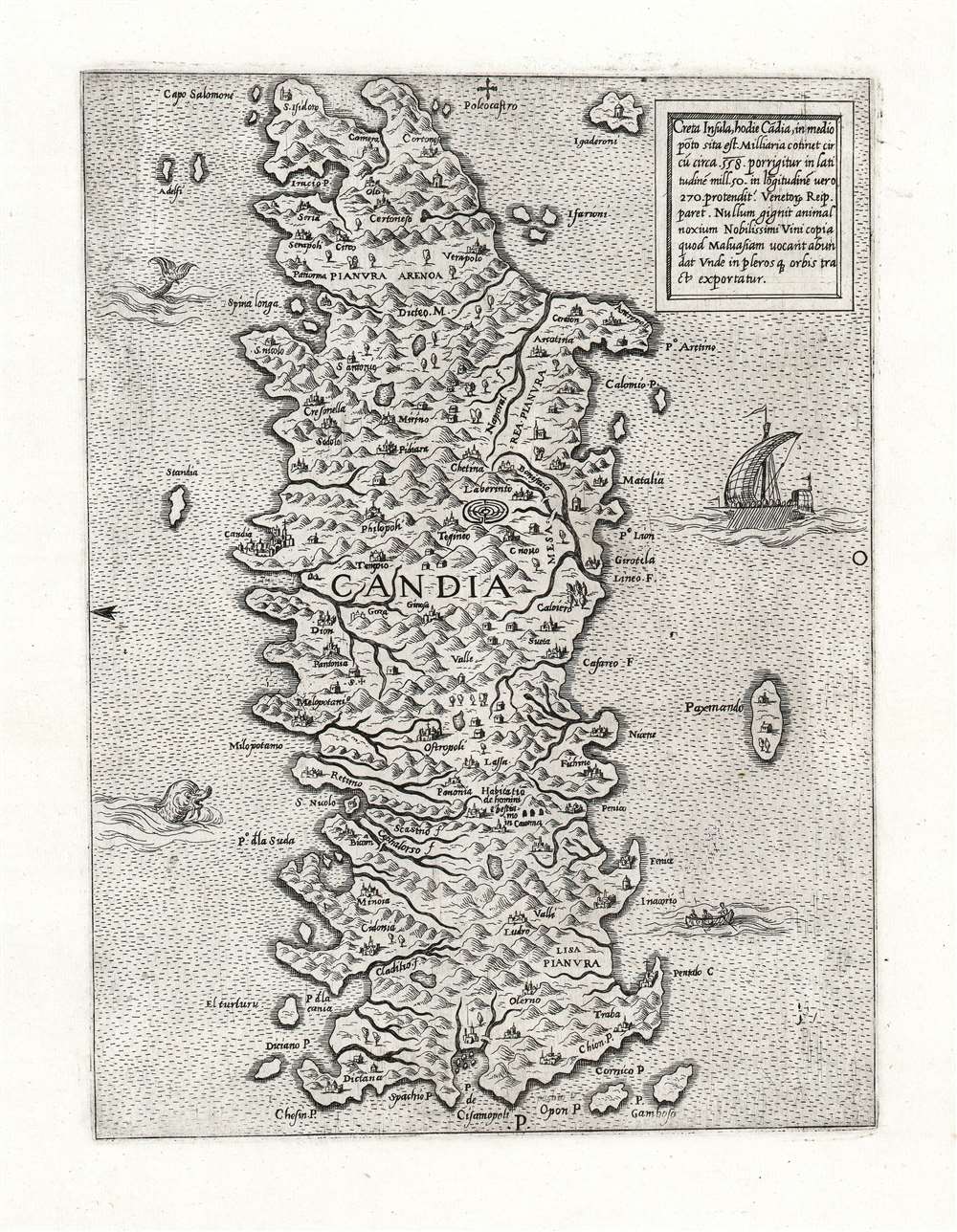
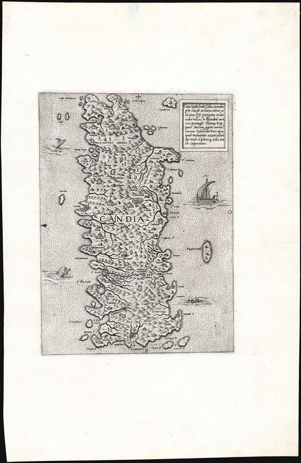
The map's engraving is characterized by its neat, pictorial mountains, boldly hachured coastlines, painstakingly spaced and legible lettering, and delicately engraved decorative elements: two sea monsters, a small fishing boat, and a war galley. As with the map's precursors, this one includes the Labyrinth of Daedalus: the legendary maze built for King Minos to contain the bull-headed Minotaur. While often considered to have been constructed at Knossos, recent archaeology suggests a series of tunnels at Gortyn, which is tantalizingly close to the location of the labyrinth symbol on these maps. This corresponds with Gortyna, the Cretan capital in the 1st century AD. Among other notable and tantalizing features are colonies of cave-dwellings, yet another sign that the map was at least in part the result of actual visitation: such dwellings remain extant.Attribution and Sequence
Dating the map is problematic, given its lack of imprint. Bifolco and Ronco credit the map to Antonio Lafreri, citing Destombes' attribution based on Lafreri's typography. A collection of maps of Greek islands by Lafreri were issued together, including this one, Rhodes, Cyprus, and others. All share the same format and exhibit many of the same stylistic elements. Bifolco and Ronco suppose this map to be a copy of the Forlani-Duchetti map published in Venice in 1570, which is certainly possible. The Venetian mapmakers regularly exchanged plates and maps with their Roman colleagues, such as Lafreri. Certainly, one of these two maps was copied from the other as their composition is virtually identical, down to the cartouche. The typography of the present map, in almost every respect, is better considered and more neatly spaced, and although the cartouche text is the same in both, Duchetti has compressed the text to fit imprint and the date on its last line. Such a compositional difference suggests the priority of the Lafreri before the Duchetti. Also, a corrected misplacement of the placename 'Spachio P.' can just be discerned above the placename 'Opon P.' on the Lafreri, an error that we suspect would be unlikely were the engraver following closely the model of the Duchetti, and not the other way around. We note the presence of this anonymous map listed among those in a Lafreri composite atlas which auctioned in 2014, which was dated circa 1565. While it is not at all impossible that later maps would be tipped in to that work, we cannot discount the possibility that the present map was executed prior to 1570, even substantially so.It is certain that this plate was among those inherited by Duchetti in 1577 at Lafreri's death, because it was among those that had passed via Duchetti ultimately to Giovanni Orlandi, who added to it his own imprint and dated it in 1602. It is interesting that Orlandi came by this plate, and not the one bearing Duchetti's imprint: a number of the Greek island maps attributed to Lafreri also appeared, reengraved, with Duchetti's imprint, and some of these appear in states also bearing Orlandi's 1602 imprint.
Publication History and Census
This map was engraved by Antonio Lafreri, who sold it separately and included it in his composite atlases. One example is separately cataloged in OCLC, appearing in the Bibliothèque Nationale de France. We are aware of several examples appearing in Atlases factice, including an example in the Library of Congress. The map is extremely rare on the market.Cartographer
Antonio Lafreri (1512–1577), born Antoine du Pérac Lafréry, was a Burgundian engraver, cartographer and publisher active in Rome in the 16th century. Apart from his birth in Orgelet in Burgundy, nothing is known about his early life, education or training. He is thought to have arrived in Rome by 1540 and was established as an engraver and printmaker in 1544. He became a business partner with Antonio Salamanca the Elder in 1553, until his partner's death in 1562. He would continue in the trade as a successful publisher of maps in the 1560s, and by 1570 he was selling made-to-order atlases both of his own maps and those of his collaborators. By the time of his death he was the leading dealer of engravings in Rome. His work was instrumental in disseminating the geographical ideas of Giacomo Gastaldi, but his battle scenes and maps focusing on the wars between Venice and the Ottoman Empire (particularly the famous Siege of Malta) are particularly prized. He is also noted for his 1758 Speculum Romanae Magnificentiae, a three volume collection of engravings of Rome.Other mapmakers in Rome and Venice sharing both Lafreri's aesthetic and geographical sources such as other Battista Agnese, Antonio Salamanca, Francesco Camocio the Younger, Donato Bertelli, Ferando Bertelli and Paolo Forlani are collectively generally referred to as belonging to the 'Lafreri' school of mapmakers, although this was not a formal organization. The terms 'Lafreri Atlases' and 'IATO (Italian, Assembled To Order) Atlases' are used to refer to the same class of works. He died at Rome in 1577. More by this mapmaker...


