This item has been sold, but you can get on the Waitlist to be notified if another example becomes available, or purchase a digital scan.
1745 Weigel Historical Chart of European Reigns with Volvelle
DiscusChronologicus-weigel-1745
Title
1745 (undated) 20.5 x 19.25 in (52.07 x 48.895 cm)
Description
Updated
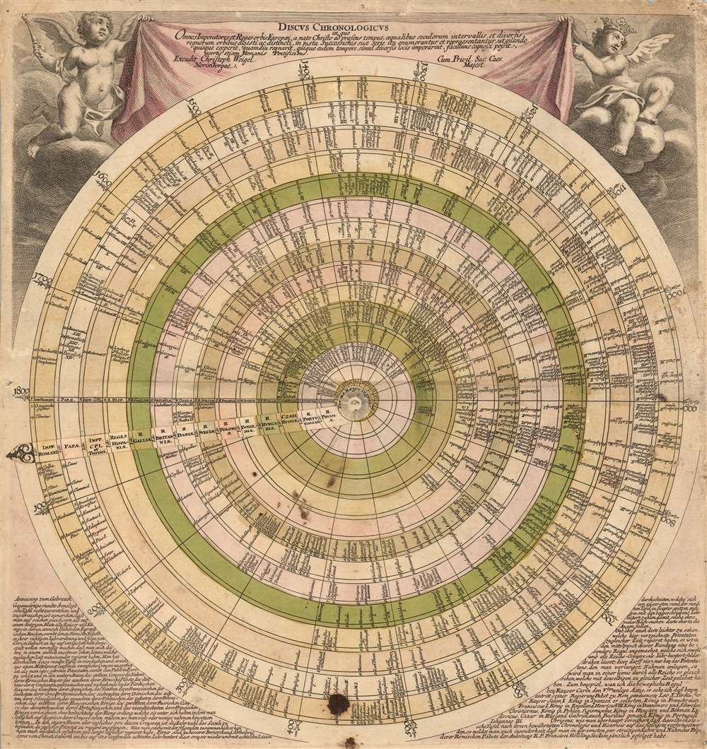
We are aware of several different states of this engraving, differing in the most recent reigns recorded in the 18th century; the earliest having a late date of 1719, the most recent coronation being that of Ulrika Eleonora of Sweden, but not that of her successor the next year. A further example has as its final entry the 1725 coronation of Catherine I of Russia. An example in the University of Bern has as its latest date the 1733 accession of Augustus II of Poland. The present example is later, with the most recent entry for Francis I (Franciscus Stephanus) of the Holy Roman Empire, who was crowned in 1745. The latest printing contains the 1775 coronation of Pope Pius VI.Unique and Attractive Presentation
The engraving's title cartouche is displayed atop the discus as a banner, suspended by two putti, one bearing a scepter and the other wearing a crown. The volvelle ends in an elegantly engraved finial. Where it is attached to the chart at its axis, it is engraved with a radiance meant to represent the deity. Around this reads the Latin motto, 'Per me Reges regnant' (Through Me, Kings Rule).The Text
In the bottom corners of the engraving is an extensive German text, providing instructions for the use of the discus in order to see 'at one glance those who ruled at the same time... For example, when we put on the movable ruler at Emperor Charles V in 1519, we see that when he began his reign, Pope Leo X was in Rome, and Selim I was the Emperor of the Turks...'Publication History and Census
This engraving was produced around 1720; the present example was amended no earlier than 1745. OCLC dates several examples as late as 1780, but lacking any evidence of the content we question such a late appearance. Some were separately issued; some appear to have been tipped into examples of Johann David Köhler’s school atlas, and may have been added to other composite atlases. We see eleven separate examples of varied dating appearing in institutional collections.Cartographer
Christoph Weigel (November 9, 1654 - February 5, 1725) was a German goldsmith, printer, and engraver based in Nuremburg. Weigel apprenticed in engraving in the publishing center of Augsburg after which he held various positions in Vienna and Frankfurt. Eventually Weigel worked his way to 18th century printing Mecca of Nuremburg where, in 1698, he became a citizen of the city and established his own firm. Weigel is known to have worked closely with the most prominent of the Nuremburg map publishers J. B. Homann as well as with with his brother Johann Christoph Weigel (1654 - 1726) and the printer, Kohler. Following Weigel's passing in 1725, control of the firm passed to his widow, who published a number of Weigel's maps and atlases posthumously. The widow Weigel eventually ceded control of the firm to her son, Johann Christoph Weigel the younger (?? - 1746) who partnered with Schneider to publish as Schneider-Weigel. The Schneider-Weigel firm continued to publish until the early 19th century. More by this mapmaker...

