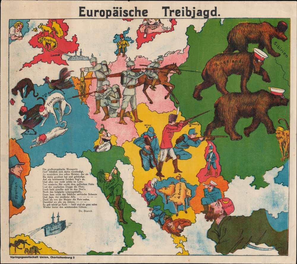
1914 Verlagsgesellschaft Union Serio-Comic Map, European 'Hunting Party'
EuropaischeTreibjagd-verlagsgesellschaftunion-1914$1,800.00

Title
Europäische Treibjagd.
1914 (undated) 15 x 16.5 in (38.1 x 41.91 cm) 1 : 10000000
1914 (undated) 15 x 16.5 in (38.1 x 41.91 cm) 1 : 10000000
Description
Condition
Very good. Several small tears along border professionally repaired. Light foxing. Some blue ink stains in the negative space on lower half and upper left quadrant.
References
OCLC 1183771291. Imperial War Museums Catalogue number: Art.IWM PST 6962.