This item has been sold, but you can get on the Waitlist to be notified if another example becomes available, or purchase a digital scan.
1951 East Coast Highways Association of Florida Pictorial Highway Map of Florida
FloridasHolidayHighways-eastcoast-1951$125.00


Title
Florida's Holiday Highways for all of Florida's Famous East Coast.
1951 (dated) 23.5 x 8.625 in (59.69 x 21.9075 cm) 1 : 1277000
1951 (dated) 23.5 x 8.625 in (59.69 x 21.9075 cm) 1 : 1277000
Description
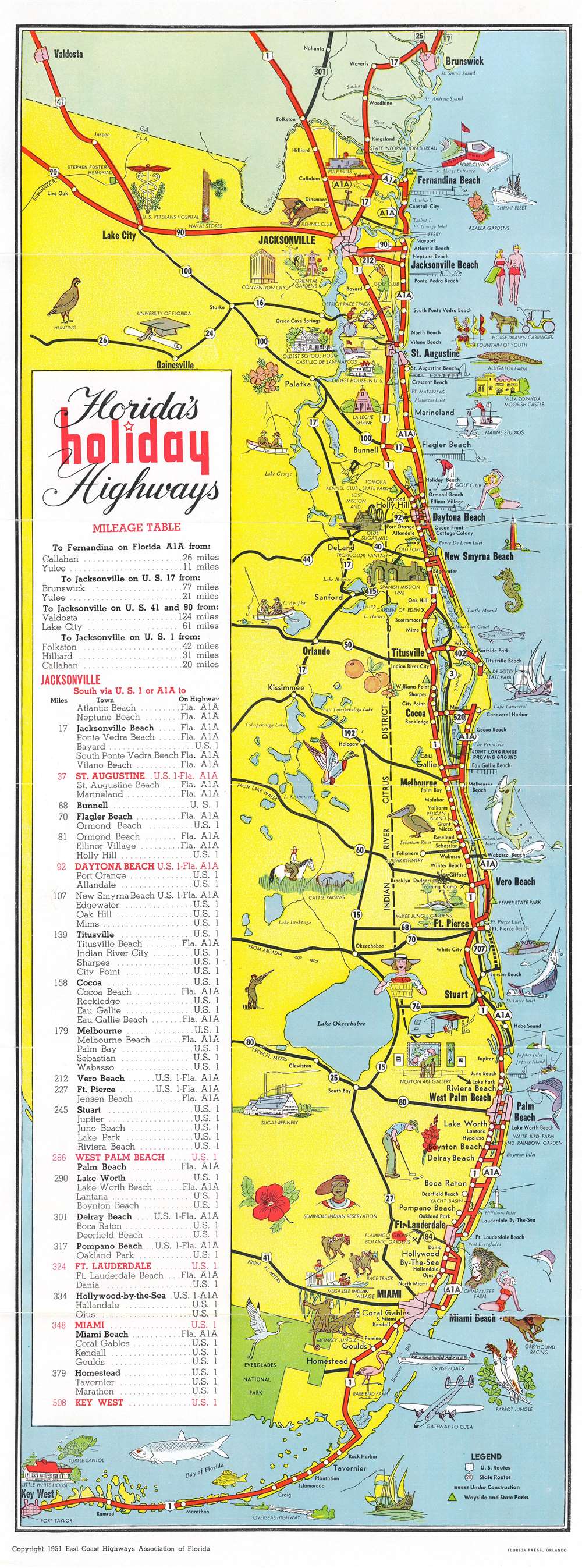
This is a 1951 East Coast Highways Association pictorial tourist highway map of Florida. Thick red lines highlight U.S. Highways 1 and 90 and Florida State Highway A1A from the Georgia-Florida border south to Key West. White dots mark cities and towns along the highways. Black lines trace connecting state and federal highways, allowing for a better understanding of the complete road network. Pictorial vignettes add charm and underscore popular tourist activities along Florida's coast, such as deep-sea fishing, sunbathing, and golfing. Popular tourist attractions, including Marine Studios, Parrot Jungle, and the Little White House, appear as vignettes. A heron underscores the natural beauty of the recently established Everglades National Park. A mileage table from Jacksonville south to Key West occupies the left.
Verso Content
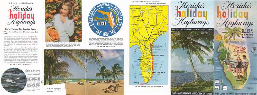
Appealing photographs of beautiful beaches and fresh oranges adorn the verso along with text lauding the 'glorious vacation opportunities' of Florida. A highway map of the southeastern United States shows best way to get to Miami Beach or Key West.Publication History and Census
This map was created for and published by the East Coast Highway Association of Florida in 1951. Scarce.Cartographer
The East Coast Highway Association of Florida (1940 - c. 1953) was an organization created to 'obtain federal military highway funds for establishing a four-lane road down the east coast' of Florida. The first meeting of the organization took place in Fort Lauderdale, Florida, on November 22, 1940. The group continued meeting through 1941, however newspaper accounts of their meetings end that year. Advertisements for the 1951 'Florida Holiday Highways' map appear in Florida newspapers in December of that year, and references to the group continue through 1953. More by this mapmaker...
Condition
Very good. Exhibits light wear along original fold lines. Text and printed images on verso.