This copy is copyright protected.
Copyright © 2025 Geographicus Rare Antique Maps
1962 Florida Agricultural Experiment Stations Soil Map of Florida
FloridaSoilMap-experiment-1962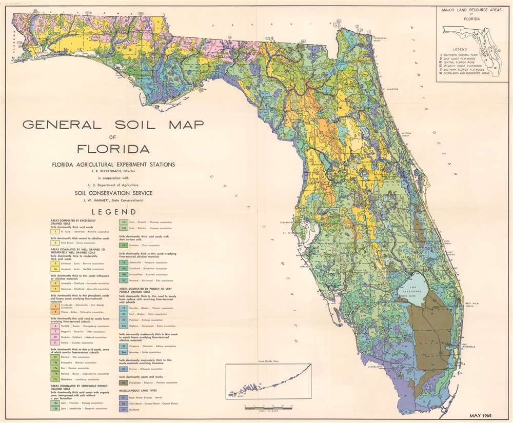

Copyright © 2025 Geographicus Rare Antique Maps | Geographicus Rare Antique Maps
This copy is copyright protected.
Copyright © 2025 Geographicus Rare Antique Maps