This copy is copyright protected.
Copyright © 2025 Geographicus Rare Antique Maps
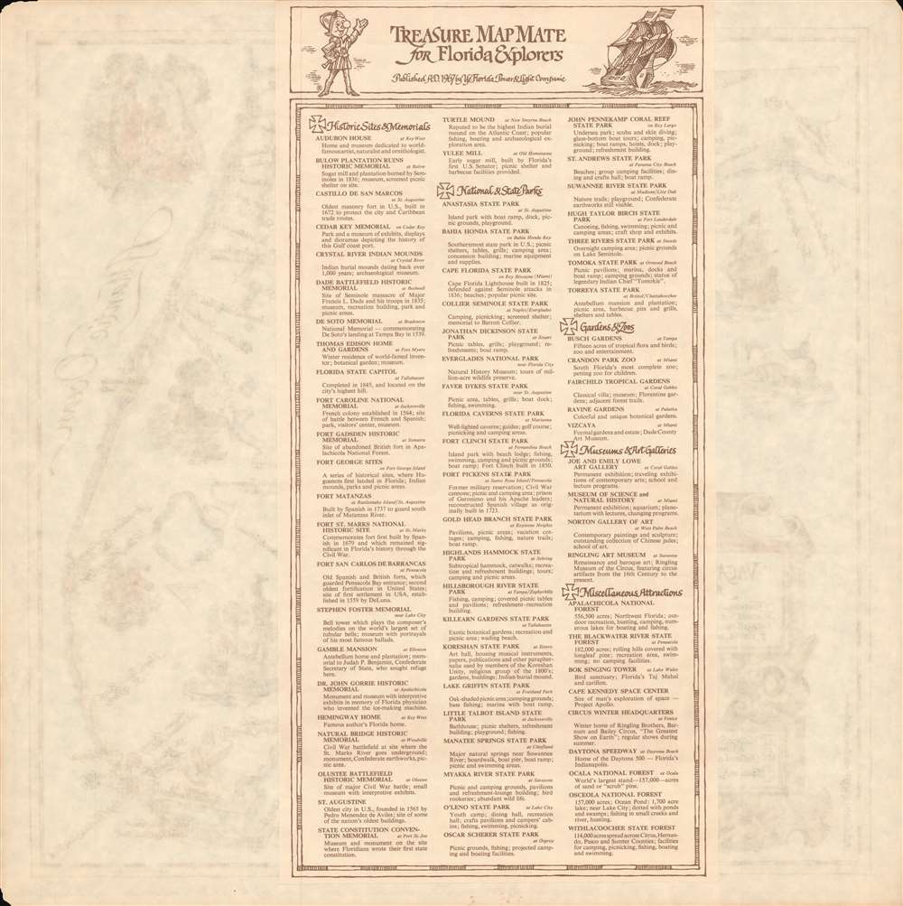
1968 Florida Power and Light Company Pictorial Tourist Map of Florida
FloridaTreasure-powerandlight-1968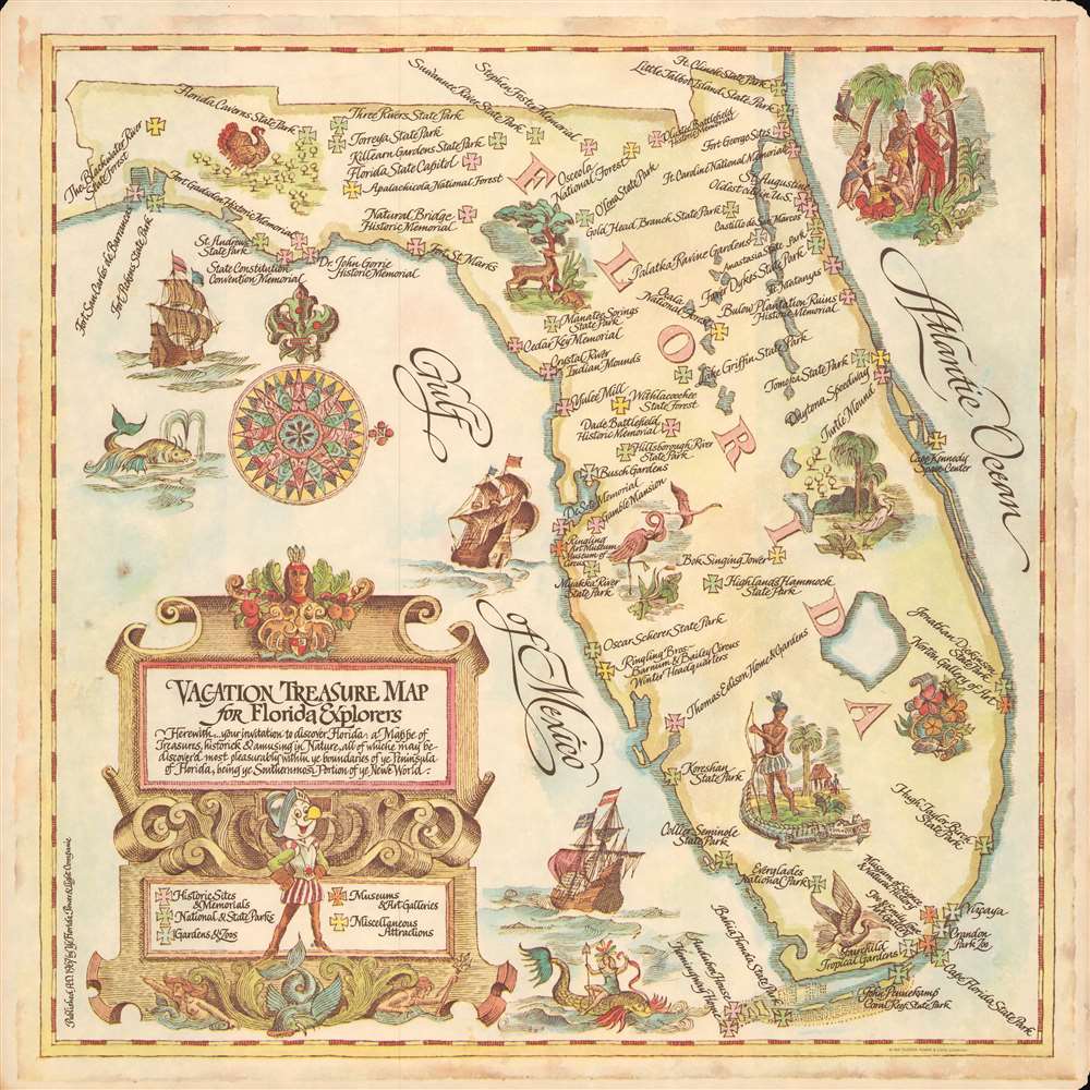

Copyright © 2025 Geographicus Rare Antique Maps | Geographicus Rare Antique Maps
This copy is copyright protected.
Copyright © 2025 Geographicus Rare Antique Maps