1946 Dix Lawrence Pictorial Folklore Music Map of the United States
FolkloreMusicMap-dixlawrence-1946
Title
1946 (undated) 22.25 x 29.5 in (56.515 x 74.93 cm) 1 : 7200000
Description
A Closer Look
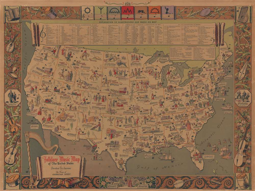
Over ninety songs are referenced, with pictorial vignettes, music staffs with notes, and oversized music notes labeling individual songs. Some vignettes illustrate specific scenes, while others present a song's overall aesthetic. A key near the top border identifies songs by their 'musical classification,' which includes French songs, miners' songs, fishermen's songs, ballads, and cowboy songs. The pictorial border contains musical instruments, a few more folk songs, and illustrations of Zuni symbols representing musical notes. The key also includes a detailed explanation of the border illustrations.Publication History and Census
This map was created by Dorothea Dix Lawrence and illustrated by Harry Cimino in 1946. It was printed and published by Hagstrom in New York. We note 19 examples cataloged in OCLC.CartographerS
Dorothea Dix Lawrence (September 22, 1899 - May 23, 1979) was an American soprano and folklorist. Born in New York City, she attended Barnard College for a while where she studied voice. Her operatic debut happened in 1929 in Montreal with the Quebec Opera Company, and her career blossomed during the 1930s and 1940s, performing regularly throughout the United States and Europe. She also performed on television and radio broadcasts. Lawrence's passion for American folklore and folk music developed during the 1930s and she began collecting songs, including those from the Zuni Indians in New Mexico and residents of the Pine Barrens on New Jersey. She created a radio program called Primer of American Music in 1939, which was sponsored by the Philadelphia Board of Education and consisted of twenty-seven weekly broadcasts. She also produced and starred in an eight-week program entitled Folk Musicians for WNYC. This interest led to the creation of the Folklore Music Map of the United States in 1945, which was widely distributed to American schools. The map became the basis for Lawrence's hundreds of recitals and lectures of American music across North America and Europe. She retired in 1970 and died in Plainfield, New Jersey on May 23, 1979. More by this mapmaker...
Harry Cimino (1898 - 1969) was an American woodcut artist, illustrator, and engraver. Cimino collaborated with Dorothea Dix Lawrence (1899 - 1979) on her Folklore Music Map of America. He was born in Marion, Indiana, and died in Sharon, Connecticut. Learn More...
Andrew Gunnar Hagstrom (1890 - September 24, 1977) was a map publisher based in Maspeth, Queens. Hagstrom was a Swedish immigrant who came to new York in 1909 where took work milking cows at a farm near Coney Island, Brooklyn. He then worked in the meat packing industry while taking a degree in commercial art at the New York Mechanics Institute. Afterwords he founded a drafting business in Manhattan, creating a map to illustrate his drafting skill help customers locate his shop. His map proved popular and he expanded operations, founding the Hagstrom Map Company (1916 - 1968) and issuing additional maps of various parts of New York City and the surrounding regions. By 1949, Hagstrom had issued more than 150 maps, guides, and atlases, most of which focused on New York. Hagstrom pioneered a cartographic style that exaggerated street size to increase clarity and create additional room for large print readable labeling. Even the New York Subway system hired Hagstrom to produce its map, which was in use from the 1940s to 1958. Hagstrom died in 1977, at the age of 81. Hagstrom was knighted by the King of Sweden. His company flourished until 1968 when it was acquired by Macmillan. The brand has since passed through multiple corporate portfolios and is currently the property by Kappa Publishing Group. Learn More...


