1913 George Geologic Map of Colorado
GeologicColorado-george-1913
Title
1913 (dated) 42 x 60 in (106.68 x 152.4 cm) 1 : 500000
Description
A Closer Look
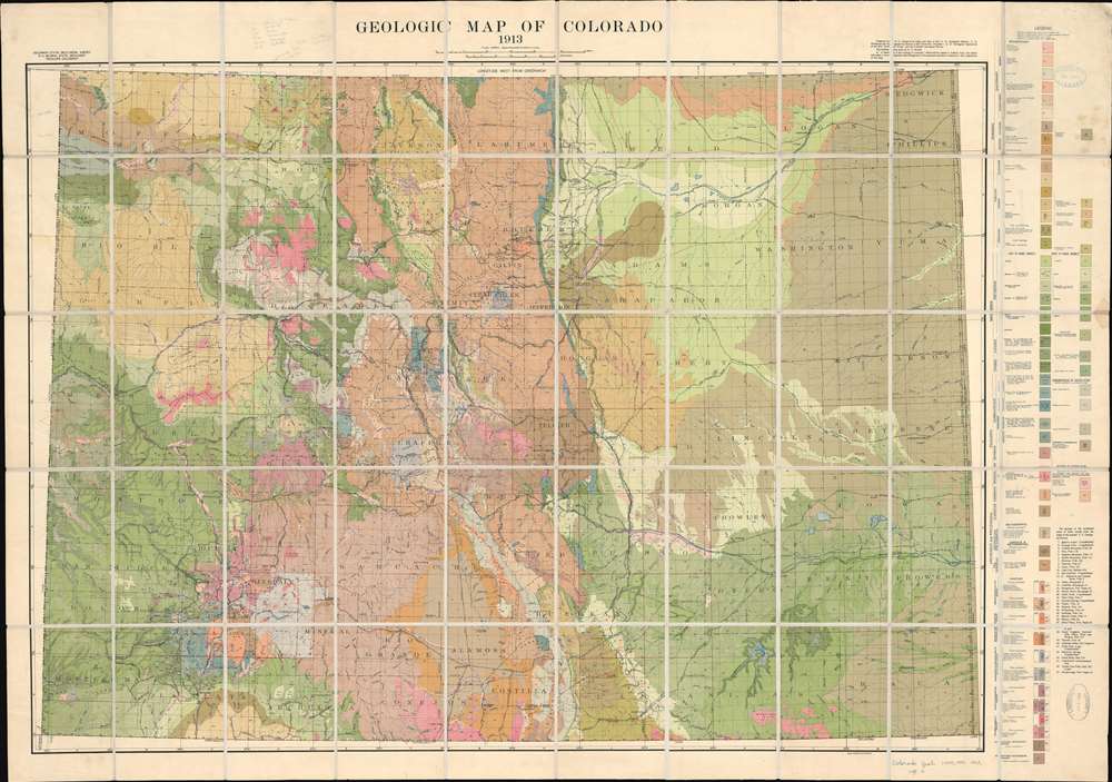
Seventy-three color and pattern combinations highlight geologic formations across the state. A legend along the right border breaks down formations into sedimentary, metamorphic, extrusive igneous, and intrusive igneous types. Counties are illustrated, and several cities and towns are labeled. Colorado's rail network appears in detail. Particular attention is given to the Denver and Rio Grande Railroad, the most extensive in the state.Colorado Coal
In 1913, mining in Colorado was a major industry and a key driver of the state's economy, with coal and precious metals like gold and silver being the primary resources. Gold mining, which had spurred Colorado's initial boom during the Gold Rush of the late 19th century, continued in regions like Cripple Creek, where new technologies like cyanide processing helped extract gold from lower-grade ore. However, coal mining had become the dominant resource, especially in southern Colorado, supplying fuel for the state's growing railroads and steel industries. Conditions in the coal mines were harsh, with long hours, dangerous working environments, and minimal pay, leading to widespread labor unrest. This culminated in the Colorado Coalfield War, a series of violent clashes between miners and mining companies, including the infamous Ludlow Massacre in 1914.Publication History and Census
This map was compiled by Russell D. George, drafted by H. C. Woods, and lithographed by August Hoen in 1913. It is well-represented institutionally but scarce on the market.CartographerS
Russell D. George (May 5, 1866 - January 2, 1955) was a geologist. Born in Claremont, Canada, George received his Bachelor of Arts degree from McMaster University in Toronto in 1897 followed by a Master of Arts in 1898. He became a member of the field staff of the Ontario Bureau of Mines in 1898, and not long after arrived in the United States after accepting a position as a Fellow in geology and an instructor in mineralogy at the University of Chicago, which he held until 1901. He then received a position with the United States Geological Survey in 1899. While at the University of Chicago, he had the titles of Instructor of Geology in 1900 and Assistant Professor in 1901. He also taught geology over the summers at the University of Chicago from 1900 until 1902. In 1902 he was a Professor of Geology at the State University of Iowa. From 1903 until 1934, George held the position of Head of the Department of Geology at the University of Colorado and was an Emeritus Professor from 1934 until his death. Her served as Colorado State Geologist from 1907 until 1928. He received his Ph.D. in 1923. He married Marcia Chipman (1880 - 1951) on June 4,l 1908. More by this mapmaker...
August Hoen and Company (fl. c. 1840 - 1981) was a Baltimore based engraving and lithography firm active in the middle part of the 19th century. A. Hoen and Co. was originally founded by Edward Weber under the name 'E. Weber and Company.' Weber died in the early 1850s and his company was taken over by German immigrant August Hoen (18?? - 1886) and his brothers, Henry and Ernest Hoen. As general interest lithographers, the Hoen firm's corpus includes posters, cigar boxes, sheet music covers, and posters as well as maps. They are best known for their pioneering multi-color lithographic techniques. After the death of August Hoen, the business passed on to his son, Albert Hoen. Another son, Earnest A. Hoen, moved to Richmond, Virginia and opened a branch of the firm there where he was granted a charter to produce Civil War era Confederate Currency. Their contributions to the cartographic field are generally in association with engraving and printing work done for Jacob Monk and the U.S. Geological Survey. The Hoen family maintained an active interest in the firm for the next 100 years or so until it finally filed for bankruptcy in 1981. Learn More...


