Digital Image: 1728 Laval Map of the Gulf Coast from the Mississippi River to Flordia
GulfCoast-laval-1728_d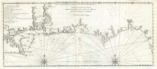

Title
Carte de la Coste de la Louisiane depuis l'embouchure de la Riviere de Micissipi jusques à la Riviere de S. Martin.
1728 (undated) 8.5 x 19.5 in (21.59 x 49.53 cm) 1 : 600000
1728 (undated) 8.5 x 19.5 in (21.59 x 49.53 cm) 1 : 600000
Description
FOR THE ORIGINAL ANTIQUE MAP, WITH HISTORICAL ANALYSIS, CLICK HERE.
Digital Map Information
Geographicus maintains an archive of high-resolution rare map scans. We scan our maps at 300 DPI or higher, with newer images being 600 DPI, (either TIFF or JPEG, depending on when the scan was done) which is most cases in suitable for enlargement and printing.
Delivery
Once you purchase our digital scan service, you will receive a download link via email - usually within seconds. Digital orders are delivered as ZIP files, an industry standard file compression protocol that any computer should be able to unpack. Some of our files are very large, and can take some time to download. Most files are saved into your computer's 'Downloads' folder. All delivery is electronic. No physical product is shipped.
Credit and Scope of Use
You can use your digial image any way you want! Our digital images are unrestricted by copyright and can be used, modified, and published freely. The textual description that accompanies the original antique map is not included in the sale of digital images and remains protected by copyright. That said, we put significant care and effort into scanning and editing these maps, and we’d appreciate a credit when possible. Should you wish to credit us, please use the following credit line:
Courtesy of Geographicus Rare Antique Maps (http://www.geographicus.com).
How Large Can I Print?
In general, at 300 DPI, you should at least be able to double the size of the actual image, more so with our 600 DPI images. So, if the original was 10 x 12 inches, you can print at 20 x 24 inches, without quality loss. If your display requirements can accommodate some loss in image quality, you can make it even larger. That being said, no quality of scan will allow you to blow up at 10 x 12 inch map to wall size without significant quality loss. For more information, it is best consult a printer or reprographics specialist.
Refunds
If the high resolution image you ordered is unavailable, we will fully refund your purchase. Otherwise, digital images scans are a service, not a tangible product, and cannot be returned or refunded once the download link is used.
Cartographer
Antoine Jean de Laval (1664 – 1728) was a French Jesuit priest and scientist active in the late 16th and early 17th century. Laval was a royal professor of hydrography and mathematics based in the city of Toulon. Laval is best known for his 1720 voyage along the Gulf Coast to triangulate the exact longitude of the Mouth of the Mississippi River. Laval never obtained his objective, in fact may never have seen the Mississippi River, but did publish an important account of the region in his 1728, Voyage de la Louisiane. More by this mapmaker...
Source
Laval, Antoine Jean de, Voyage de la Louisiane (Paris: Jean Mariette), 1728.
References
Phillips (America) page 368. OCLC 494647588. Jackson, J., Flags along the Coast: Chart the Gulf of Mexico, 1519 - 1759: A reappraisal, pages 64-65, plate opposite page 59.