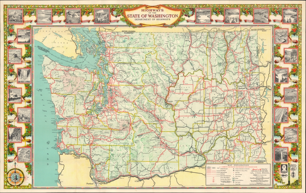
This is a 1944 pictorial highway map of the state of Washington, prepared by Rand McNally for the Washington Department of Highways.
A Closer Look
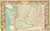
Bright red highlights state highways, with notations indicating road grades (double pavement, paved, improved, and dirt roads). Cities and towns are labeled throughout the state, with Spokane, Seattle, and Tacoma appearing in large bold lettering. Bright red areas highlight Mount Rainier National Park and Olympic National Park. Counties are divided by yellow lines to allow for differentiation. The whole is surrounded by a pictorial border featuring images of Olympic National Park, Grand Coulee, Mount Rainier, Yakima Canyon, and the Grand Coulee Dam, along with others.Verso Content
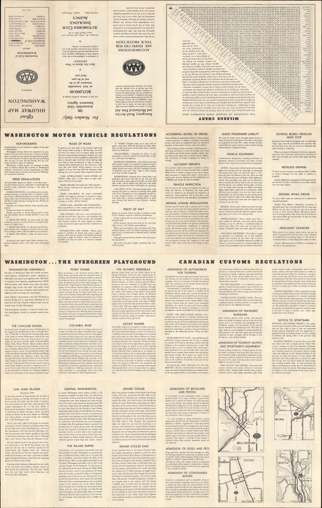
The verso contains information provided by the Automobile Club of Washington, the local affiliate of the Automobile Association of America (AAA), including the state's motor vehicle regulations and information for dealing with Canadian customs when crossing the border. Promotional text also discusses various attractions in the 'evergreen playground,' such as Puget Sound, Mount Rainier, and the Grand Coulee Dam, which had only become operational two years prior. A mileage chart with distances between various sites and cities in Washington appears near the title panel. Four inset maps of Tacoma, Seattle, Bellingham, and Yakima appear at the bottom right.Publication History and Census
This map was prepared by Rand McNally and Company, lithographed by the North Pacific Bank Note Company, and published in 1944 by the State of Washington Department of Highways and AAA. Editions of this map were published in 1939, 1941, 1942, 1944, and 1949 (all of which have been digitized by the Washington State Department of Transportation Library), leading to some confusion in catalog listings. In fact, there are two 1944 printings, one with images and photographs on the verso published solely by the Department of Highways and the present example with information for AAA on the verso. From one edition to the next, the map appears to be unchanged while the verso content differs. Nonetheless, the map is scarce on the market, and the OCLC seems to record both 1944 printing in only six institutions, while an example is also held by the Washington State Department of Transportation Library (with the Department of Highways verso) and the David Rumsey Historical Map Collection.
CartographerS
Rand, McNally and Co. (fl. 1856 - present) is an American publisher of maps, atlases and globes. The company was founded in 1856 when William H. Rand, a native of Quincy, Massachusetts, opened a print shop in Chicago. Rand hired the recent Irish immigrant Andrew McNally to assist in the shop giving him a wage of 9 USD per week. The duo landed several important contracts, including the Tribune's (later renamed the Chicago Tribune) printing operation. In 1872, Rand McNally produced its first map, a railroad guide, using a new cost effective printing technique known as wax process engraving. As Chicago developed as a railway hub, the Rand firm, now incorporated as Rand McNally, began producing a wide array of railroad maps and guides. Over time, the firm expanded into atlases, globes, educational material, and general literature. By embracing the wax engraving process, Rand McNally was able to dominate the map and atlas market, pushing more traditional American lithographic publishers like Colton, Johnson, and Mitchell out of business. Eventually Rand McNally opened an annex office in New York City headed by Caleb S. Hammond, whose name is today synonymous with maps and atlases, and who later started his own map company, C. S. Hammond & Co. Both firms remain in business. More by this mapmaker...
The North Pacific Bank Note Company (fl. c. 1903 - 1970) was a lithographic printer based in Tacoma, Washington with a penchant for producing maps, including for local cartographic firms Metsker's and Kroll. They also printed promotional materials for hotels, banks, and local chambers of commerce in the Seattle-Tacoma area. Among their works was a 1925 companion to Samuel Augutus Mitchell's seminal 1845 'New Map of Texas, Oregon, and California' and a 1939 book of salmon recipes. Learn More...
Very good. Light wear along original fold lines. Text on verso.
Washington State Department of Transportation Library Highways of the State of Washington, 1944 1. Rumsey 9783.002. OCLC 35226338.