Digital Image: 1535 Fries / Sanuto-Vesconte Map of the Holy Land - Medieval Mapping of the Levant
HolyLand-fries-1522_d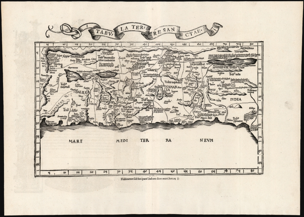

Title
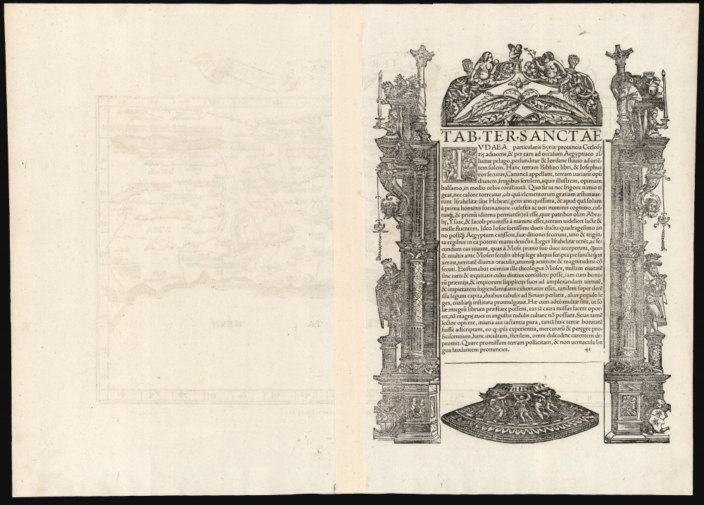
Tabula Terre Sanctae.
1522 (undated) 11.25 x 16.25 in (28.575 x 41.275 cm) 1 : 750000
1522 (undated) 11.25 x 16.25 in (28.575 x 41.275 cm) 1 : 750000
Description
FOR THE ORIGINAL ANTIQUE MAP, WITH HISTORICAL ANALYSIS, CLICK HERE.
Digital Map Information
Geographicus maintains an archive of high-resolution rare map scans. We scan our maps at 300 DPI or higher, with newer images being 600 DPI, (either TIFF or JPEG, depending on when the scan was done) which is most cases in suitable for enlargement and printing.
Delivery
Once you purchase our digital scan service, you will receive a download link via email - usually within seconds. Digital orders are delivered as ZIP files, an industry standard file compression protocol that any computer should be able to unpack. Some of our files are very large, and can take some time to download. Most files are saved into your computer's 'Downloads' folder. All delivery is electronic. No physical product is shipped.
Credit and Scope of Use
You can use your digial image any way you want! Our digital images are unrestricted by copyright and can be used, modified, and published freely. The textual description that accompanies the original antique map is not included in the sale of digital images and remains protected by copyright. That said, we put significant care and effort into scanning and editing these maps, and we’d appreciate a credit when possible. Should you wish to credit us, please use the following credit line:
Courtesy of Geographicus Rare Antique Maps (http://www.geographicus.com).
How Large Can I Print?
In general, at 300 DPI, you should at least be able to double the size of the actual image, more so with our 600 DPI images. So, if the original was 10 x 12 inches, you can print at 20 x 24 inches, without quality loss. If your display requirements can accommodate some loss in image quality, you can make it even larger. That being said, no quality of scan will allow you to blow up at 10 x 12 inch map to wall size without significant quality loss. For more information, it is best consult a printer or reprographics specialist.
Refunds
If the high resolution image you ordered is unavailable, we will fully refund your purchase. Otherwise, digital images scans are a service, not a tangible product, and cannot be returned or refunded once the download link is used.
Cartographer S
Lorenz Fries (c. 1490 – 1531) was a German cartographer, cosmographer, astrologer, and physician based in Strasbourg. Little is known of Fries' early life. He may have studied in Padua, Piacenza, Montpellier and Vienna, but strong evidence of this is unfortunately lacking. The first recorded mention of Fries appeared on a 1513 Nuremberg broadside. Fries settled in Strasbourg in March 1519, where he developed a relationship with the St. Die scholars, including Walter Lud, Martin Ringmann and Martin Waldseemüller. There he also befriended the printer and publisher Johann Grüninger. Although his primary profession was as a doctor, from roughly 1520 to 1525 he worked closely with Grüninger as the geographic editor of various maps and atlases based upon the work of Martin Waldseemüller. Although his role is unclear, his first map seems to have been a 1520 reissue of Waldseemüller's world map of 1507. Around this time he also began working on Grüninger's reissue of Waldseemüller's 1513 edition of Ptolemy, Geographie Opus Novissima. That edition included three new maps by Fries based upon the Waldseemüller world map of 1507 – two of these, his maps of East Asia and Southeast Asia are quite significant as the first specific maps of these regions issued by a European publisher. In 1525 Fries decided to leave Strasbourg and surrendered his citizenship, relocating to Trier. In 1528 he moved to Basel. Afterwards he relocated to Metz where he most likely died. In addition to his cartographic work, Fries published tracts on medicine, religion, and astrology. More by this mapmaker...
Marino Sanudo (or Sanuto) Torsello (c. 1270 – 1343) was a Venetian statesman and geographer. He is best known for his efforts to instigate a new crusade to the Holy Land. This lifelong task resulted in his book, 'Liber Secretorum Fidelium Crucis (Book of Secrets for True Crusaders) which would be supplented by an array of the earliest surviving portolan charts of the Mediterranean coast and the Black Sea, executed by Pietro Vesconte. Sanudo was born to an aristocratic trading family in Venice around 1270; his father was a member of the Venetian Senate. In his youth Sanuto traveled broadly, visiting in time Acre, Greece, Romania, Palestine, Egypt, Armenia, Cyprus and Rhodes. He would eventually join the entourage of the Doge of Venice; after 1305 he attended Cardinal Riccardo Petroni in Rome.
He was a vigorous correspondent, particularly with travelers whose reach had extended beyond his own.
Perhaps related to his early experiences in Acre - which fell rapidly to Muslim forces shortly after his visit there - Sanuto was a lifelong advocate of a crusade to capture the Holy Lands for the west. While he was certainly not alone among such instigators, his emphasis on strategy, practical financial backing, and detailed modern cartography set his proposals apart. His long term approach - with a preparatory blockade of and capture of Egypt to secure the invasion's flank - was never implemented. Nevertheless his book, often revised and updated, would find its way into the hands of not only the Pope but also King Charles IV of France. At least eleven manuscript copies are known to survive. Its complement of maps by Vesconte are the earliest medieval maps intended for military purposes. Learn More...
Pietro Vesconte (fl. 1310-1330) was a Genoese cartographer and geographer. His early portolan charts set the standard for such works produced in both Italy and Spain throughout the fourteenth and fifteenth centuries. Very little is known of his life. He was born in Genoa, but produced the bulk of his work in Venice. His charts - among the first of any to be signed and dated - remain among the earliest to accurately chart the coasts of the Mediterranean Sea and the Black Sea; his works contain some of the earliest attempts to chart the British Isles. In addition to his separate charts, he is known to have authored no fewer than four manuscript navigational 'atlases,' consisting of particular navigational charts that could be joined to make a larger, general one. His work was groundbreaking in its accuracy: the mappamundae that characterize this period were not characterized by precision, being more in the way of mnemonic aids for the study of the world by people unlikely to actually travel it. Many of his works, however, focused on the Holy Land, and these were produced in order to encourage a crusade to those regions. Learn More...
Source
Ptolemy, C., Geographicae Enarrationis..., (Lyons: Servetus) 1535.
References
OCLC 165598600. Nebenzahl, K., Maps of the Holy Land #19. Laor, E., Maps of the Holy Land: Cartobibliography of Printed Maps, 1475 - 1900, #612.