1930 Ye Olde Printerie Map of Hong Kong, Kowloon, and the New Territories
HongKongNT-yeoldeprinterie-1930$1,000.00

Title
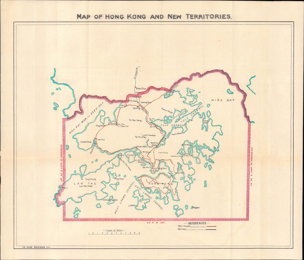
Map of Hong Kong and New Territories.
1930 (undated) 11.75 x 14.25 in (29.845 x 36.195 cm) 1 : 260000
1930 (undated) 11.75 x 14.25 in (29.845 x 36.195 cm) 1 : 260000
Description
A rare and intriguing c. 1930 map of British Hong Kong and associated territories, printed locally by Ye Olde Printerie.
The fortified area remained a sticking point between Britain and China for the next century, until the eve of Hong Kong's handover to Chinese sovereignty. As the British were unsure of what to do with it but reluctant to grant the Chinese government full control over the enclave, the area became home to many squatters and refugees from conflicts in the mainland, as well as a hotbed of organized crime and drugs. The Japanese destroyed the wall during World War II to build Kai Tak Airport, but the layout and name of the area remained. After the war, the area's population skyrocketed as refugees fled the Chinese Civil War on the mainland, likely making it the most densely populated neighborhood in an already very densely populated city. Ramshackle apartment buildings were set up with no safety standards, leading to many fires and the risk of buildings collapsing. Structures were lined up with no space between them, and residents built passageways across roofs and between buildings so that one could transit the entire 2.6-hectare area without ever touching the ground. Less so than proper streets, groups of buildings were separated by alleyways so narrow that residents could shake hands with their neighbors on the other side of the street.
The area became a symbol of British indifference to poverty in Hong Kong, prompting efforts to reduce crime and institute basic safety and health standards, part of a wider anti-poverty campaign in the last years of British rule. Eventually, on the eve of Britain's handover of Hong Kong, the complex was demolished and replaced with a park. To Chinese nationalists, the walled city was a clear manifestation of imperial aggression against China and British apathy towards the people of Hong Kong, as well as a product of the perversions caused by leased territories on Chinese land. But since the area's demolition and Hong Kong's return to Chinese sovereignty, a degree of nostalgia has developed towards the Kowloon Walled City, part of a wider idealization of the ad hoc, chaotic, and even lawless nature of 'Old Hong Kong' in contrast to the increasingly austere, efficient, and tightly-controlled society that has emerged since 1997.
A Closer Look
Covering the British possessions, this map is notable for its detailed coverage of the New Territories, that is, the mountainous peninsula and islands beyond the heavily populated Hong Kong Island and Kowloon. In 1898, the British acquired a 99-year lease on these territories, which were demarcated from Qing China at the Sham Chun (Shenzhen) River. This map highlights roads and railways that connected a string of villages in the New Territories with the main core of the colony around Victoria Harbour. It also records additional waterways, mountain ranges, islands, and coastal features like bays, channels, harbors, and coves.Kowloon-Canton Railway
One of the more important elements of the map is the Kowloon-Canton Railway, built in the years after Britain's acquisition of the New Territories and completed in 1910. The railroad connected Hong Kong to Canton (Guangzhou) and other parts of Guangdong Province and, eventually, extended throughout China. Stations were located on or near the border at Sham Chun (Shenzhen), which today has sprawled to a population roughly double that of Hong Kong, and at Lo Wu, where a ferry was also operated for shorter-distance cross-border travel. In the early Cold War period, the line saw limited use due to the restrictions on trade and travel between Hong Kong and the mainland. However, since the late 1970s and Hong Kong return to Chinese sovereignty in 1997, the railway has been upgraded and has seen considerable use. In 2007, the railway was merged into the Hong Kong Mass Transit Railway (MTR), allowing for seamless travel throughout the Special Administrative Region.Kowloon Walled City
Another notable feature is the Kowloon Walled City, here as 'Kowloon City,' situated near the center. The origins of the walled city date back to the Song Dynasty, and the area was used for government offices and fortifications for many centuries afterward. After the arrival of the British on Hong Kong Island in the early 1840s, the Qing government used the Kowloon Walled City to monitor the nearby foreign presence. Even still, when Kowloon was ceded to Britain in 1860, and the New Territories leased in 1898, the Qing were allowed to continue to station officials there, along with a population of several hundred civilians, and the walled city became an enclave of Chinese sovereign territory. Unsurprisingly, this occasionally caused tensions, as when British troops raided the area in 1899, suspecting it was being used as a base for resistance to their rule over Hong Kong and Kowloon.The fortified area remained a sticking point between Britain and China for the next century, until the eve of Hong Kong's handover to Chinese sovereignty. As the British were unsure of what to do with it but reluctant to grant the Chinese government full control over the enclave, the area became home to many squatters and refugees from conflicts in the mainland, as well as a hotbed of organized crime and drugs. The Japanese destroyed the wall during World War II to build Kai Tak Airport, but the layout and name of the area remained. After the war, the area's population skyrocketed as refugees fled the Chinese Civil War on the mainland, likely making it the most densely populated neighborhood in an already very densely populated city. Ramshackle apartment buildings were set up with no safety standards, leading to many fires and the risk of buildings collapsing. Structures were lined up with no space between them, and residents built passageways across roofs and between buildings so that one could transit the entire 2.6-hectare area without ever touching the ground. Less so than proper streets, groups of buildings were separated by alleyways so narrow that residents could shake hands with their neighbors on the other side of the street.
The area became a symbol of British indifference to poverty in Hong Kong, prompting efforts to reduce crime and institute basic safety and health standards, part of a wider anti-poverty campaign in the last years of British rule. Eventually, on the eve of Britain's handover of Hong Kong, the complex was demolished and replaced with a park. To Chinese nationalists, the walled city was a clear manifestation of imperial aggression against China and British apathy towards the people of Hong Kong, as well as a product of the perversions caused by leased territories on Chinese land. But since the area's demolition and Hong Kong's return to Chinese sovereignty, a degree of nostalgia has developed towards the Kowloon Walled City, part of a wider idealization of the ad hoc, chaotic, and even lawless nature of 'Old Hong Kong' in contrast to the increasingly austere, efficient, and tightly-controlled society that has emerged since 1997.
Publication History and Census
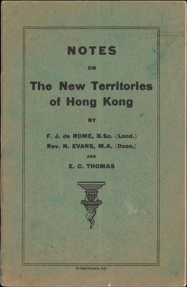
This map was printed by Ye Olde Printerie for their guidebook Notes on the New Territories of Hong Kong, published c. 1930. It is based on an earlier (1920), equally rare map of the same title by Waterlow and Sons. Regardless of edition and printer, the map is not independently cataloged in the OCLC, while a single example of the entire Notes is listed in the OCLC, though without an institution noted. A search of catalogs in Hong Kong reveals an example of the Notes guidebook held by the University of Hong Kong, a third edition dated to 1937.Cartographer
Victor Charles Labrum (June 14, 1887 – March 8, 1964) was the founder of Ye Olde Printerie, a printshop based in Hong Kong specializing in stationary and pocket-sized publications. After apprenticing at Eyre and Spottiswoode in Warminster, Labrum left England in 1909 to become the Assistant Manager for the Singapore office of the printers Kelly and Walsh, before moving to become manager of their Hong Kong Office in 1913. He served on the Balkan Front in the First World War (in the Hampshire Regiment) but was back in Hong Kong working for Kelly and Walsh when their building was destroyed in a fire in 1922. In 1923, Labrum founded Ye Olde Printerie, handling the technical aspect of printing while his younger brother G. B. managed the business side of the operation. Ye Olde Printerie published, in addition to stationary, tourist guides and local histories of Hong Kong, works on other nearby British colonies in Asia, and works relating to Macao and mainland China. Labrum was a colorful character well-known among the British community in Hong Kong, an avid golfer and cricketeer, a supporter and actor with the Hong Kong Philharmonic Society, an accomplished shooter with a rifle, and a talented printer. He and his brother both served in the Hong Kong Volunteer Defense Corps in 1941 and were subsequently interned by the Japanese. A Hungarian employee of theirs managed to keep the printshop operational during the war, but was forced to publish banknotes by the Japanese military. In the early 1950s, V.C. Labrum retired and relocated to New Zealand, handing the business over to his brother, who quickly sold it to the Local Printing Press (樂古印務公司), headed by Lee Yat-Ngok (李一諤, 1892 - 1974). V.C. Labrum appears to have later moved back to England, where he died in 1964. More by this mapmaker...
Condition
Very good. Light wear along original folds. Ship with book.
References
OCLC 14437724.