Digital Image: 1927 Alexander Samuel MacLeod Pictorial Map of Honolulu, Hawaii
Honolulu-macleod-1927_d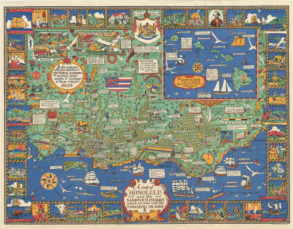

Title
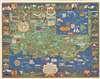
A Map of Honolulu and the Sandwich Islands, which we now call the Hawaiian Islands.
1927 (dated) 28.5 x 36.5 in (72.39 x 92.71 cm) 1 : 19500
1927 (dated) 28.5 x 36.5 in (72.39 x 92.71 cm) 1 : 19500
Description
FOR THE ORIGINAL ANTIQUE MAP, WITH HISTORICAL ANALYSIS, CLICK HERE.
Digital Map Information
Geographicus maintains an archive of high-resolution rare map scans. We scan our maps at 300 DPI or higher, with newer images being 600 DPI, (either TIFF or JPEG, depending on when the scan was done) which is most cases in suitable for enlargement and printing.
Delivery
Once you purchase our digital scan service, you will receive a download link via email - usually within seconds. Digital orders are delivered as ZIP files, an industry standard file compression protocol that any computer should be able to unpack. Some of our files are very large, and can take some time to download. Most files are saved into your computer's 'Downloads' folder. All delivery is electronic. No physical product is shipped.
Credit and Scope of Use
You can use your digial image any way you want! Our digital images are unrestricted by copyright and can be used, modified, and published freely. The textual description that accompanies the original antique map is not included in the sale of digital images and remains protected by copyright. That said, we put significant care and effort into scanning and editing these maps, and we’d appreciate a credit when possible. Should you wish to credit us, please use the following credit line:
Courtesy of Geographicus Rare Antique Maps (http://www.geographicus.com).
How Large Can I Print?
In general, at 300 DPI, you should at least be able to double the size of the actual image, more so with our 600 DPI images. So, if the original was 10 x 12 inches, you can print at 20 x 24 inches, without quality loss. If your display requirements can accommodate some loss in image quality, you can make it even larger. That being said, no quality of scan will allow you to blow up at 10 x 12 inch map to wall size without significant quality loss. For more information, it is best consult a printer or reprographics specialist.
Refunds
If the high resolution image you ordered is unavailable, we will fully refund your purchase. Otherwise, digital images scans are a service, not a tangible product, and cannot be returned or refunded once the download link is used.
Cartographer
Alexander Samuel MacLeod (1888 - 1956) was a Canadian painter and printmaker active in California curing the first half of the 20th century. He was born on Prince Edward Island, Canada. After moving to San Francisco, he continued his artistic training at the California School of Design under Frank Van Sloun. In 1921, MacLeod relocated to Hawaii, where he worked in the art departments of the magazine Paradise of the Pacific and the local papers, The Honolulu Advertiserand the Honolulu Star-Bulletin. By 1929, he had returned to Canada and resided there for ten years. Returning once again to Hawaii, MacLeod became the director of the graphic art department for the United States Army in the Pacific. In 1943, he published a book of Hawaiian prints, The Spirit of Hawaii, Before and After Pearl Harbor. MacLeod retired to Palo Alto, California, where he died in 1956. More by this mapmaker...
References
Rumsey 7983.000. OCLC 953572719.