This copy is copyright protected.
Copyright © 2025 Geographicus Rare Antique Maps
1978 Astroworld Pictorial Map of Houston, Texas
Houston-astroworld-1978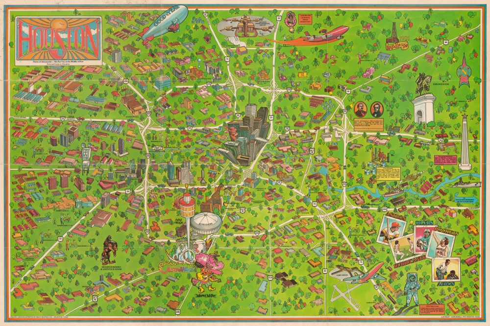


Copyright © 2025 Geographicus Rare Antique Maps | Geographicus Rare Antique Maps
This copy is copyright protected.
Copyright © 2025 Geographicus Rare Antique Maps