1902 Cram Railroad and Shipping Guide Map of Idaho

IdahoCountyMap-cram-1902
$850.00
Idaho. / Cram's Indexed Township County Map and Shipper's Guide of Idaho. - Main View
Processing...

1902 Cram Railroad and Shipping Guide Map of Idaho

IdahoCountyMap-cram-1902

Mining the Gem State.
$850.00

Title


Idaho. / Cram's Indexed Township County Map and Shipper's Guide of Idaho.
  1902 (dated)     22 x 16 in (55.88 x 40.64 cm)     1 : 1500000

Description


This is rare first edition of George Cram's separate-issue 1902 pocket map of Idaho, that appeared in that year's Indexed Township County Map and Shipper's Guide for the state.
A Closer Look
Covering the state of Idaho with portions of neighboring states, especially Montana, the map provides information on settlements, railroads, mines, and topographic features. The map is overprinted in red and updated in manuscript to indicate railway lines, including electric lines. 'Banking towns' are also indicated with red overprint. Similarly, mining districts are indicated with yellow overprint, as are wagon roads (although Idaho's gold rush had subsided by this point, new mines extracting silver, zinc, lead, and other minerals were still being established). Survey lines overlie the terrain, particularly in more heavily populated parts of the state. Indian Reservations are noted, while other placenames (Blackfoot, Nez Perces, Custer County) harken to the recent frontier history.

Interestingly, the map includes degrees of longitude from both Greenwich and Washington, D.C., when most American maps had adopted Greenwich as the sole Prime Meridian by this point (the determination of Greenwich as the international standard prime meridian was determined at an 1884 conference which, ironically, took place in Washington, D.C.). This inclusion is likely due to the fact that the Washington Meridian was crucial to the demarcation of territory/state borders and surveying throughout the American West in the 19th century.
Publication History and Census
This map was prepared by George Cram for the 1902 edition of his Indexed Township County Map and Shipper's Guide of Idaho. Cram published several atlases per year around this time aimed at different audiences, and the present map visually resembles that in his Cram's Standard American Railway System Atlas of the World, though it remains noticeably different. While maps from the Indexed Township County Map and Shipper's Guide series do come to market from time to time, the present map of Idaho is extremely rare. We only note a single example of this edition of the map in the OCLC, held by Boise State University.

Cartographer


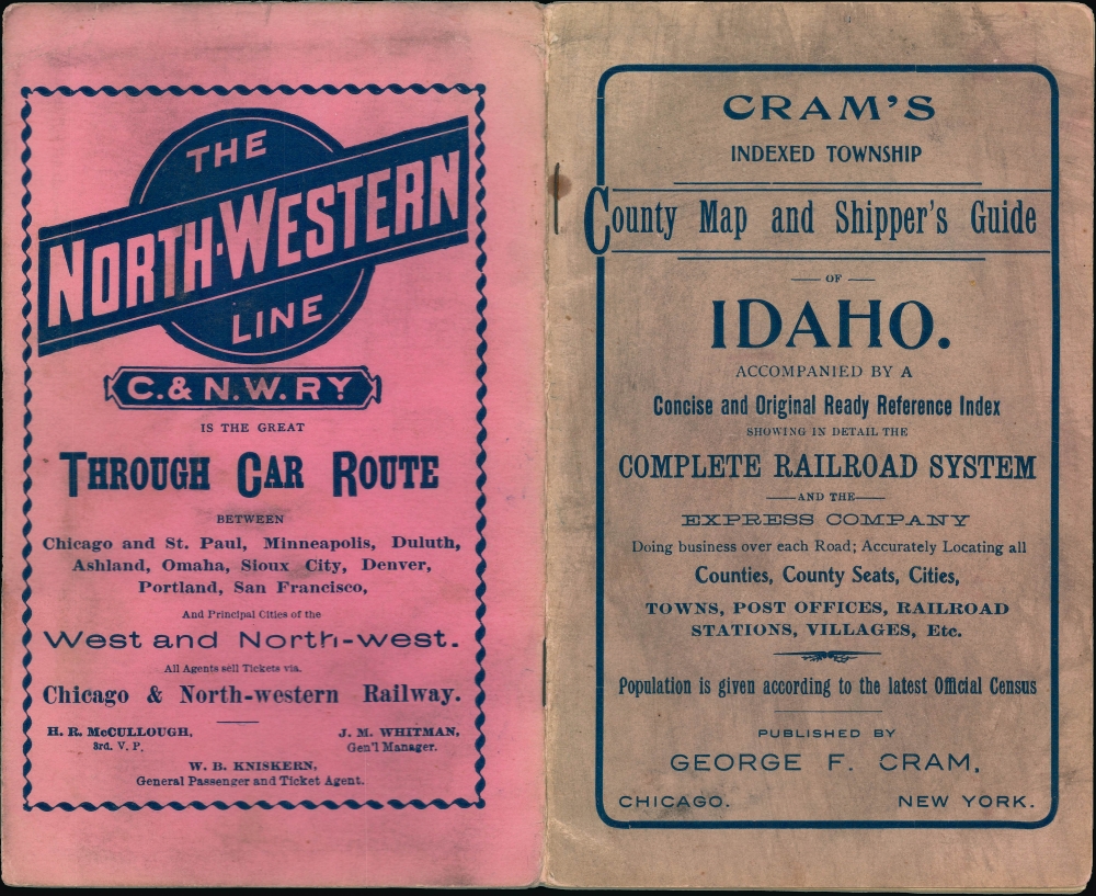
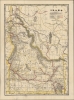
George Franklin Cram (May 20, 1842 - 1928) was an American map publisher active in the late 19th and early 20th centuries. During the American Civil War, Cram served as a staff cartographer for the Union General Ulysses S. Grant and participated in Sherman's 'March to the Sea'. In 1867, after being discharged from the army, George Cram moved to Chicago, where he founded 'Blanchard and Cram' with his uncle Rufus Blanchard Evanston. Blanchard and Cram was a supply house for the book trade - though they also published a few maps during this period. This short lived business was destroyed in the 1871 by the Great Chicago Fire. After the fire, recognizing a business opportunity in the burgeoning railroad industry, Cram reinvented himself as cartographic publisher, opening the Cram Map Depot. Like fellow Chicago publisher Rand McNally, Cram took advantage of the economical wax engraving processes to inexpensively produce maps in vast quantities. His signature publication, the Unrivaled Atlas of the World became the world's best-selling atlas and was published from the 1880s to 1952. On retiring in 1921, Cram sold his company to Edward A. Peterson of the National Map Company (Scarborough Company). Peterson moved the company to Indianapolis where, following Cram's death, he rebranded the National Map Company as the George F. Cram Company, surely thinking to capitalize on the established identity of the firm. In 1930 he entered the globe market for which the firm was best known from the mid-20th century. In time the firm expanded globally passing becoming a major concern. Loren B. Douthit became company president in 1968 and the Douthit family ran the business until Herff Jones, Inc., bought the company in 2005. More by this mapmaker...

Condition


Good. Wear along original fold lines. Verso repairs to fold separations and at fold intersections. Verso reinforcement where previously attached to booklet with small area of infill.

References


OCLC 41588398.