This copy is copyright protected.
Copyright © 2025 Geographicus Rare Antique Maps
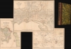
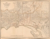
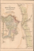
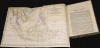
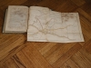
Digital Image: 1837 Moor 'Notices of the Indian Archipelago' with Maps: Coleman's Singapore, Penang,
IndianArchipelago-moor-1837_d


FOR THE ORIGINAL ANTIQUE MAP, WITH HISTORICAL ANALYSIS, CLICK HERE.
Digital Map Information
Geographicus maintains an archive of high-resolution rare map scans. We scan our maps at 300 DPI or higher, with newer images being 600 DPI, (either TIFF or JPEG, depending on when the scan was done) which is most cases in suitable for enlargement and printing.
Delivery
Once you purchase our digital scan service, you will receive a download link via email - usually within seconds. Digital orders are delivered as ZIP files, an industry standard file compression protocol that any computer should be able to unpack. Some of our files are very large, and can take some time to download. Most files are saved into your computer's 'Downloads' folder. All delivery is electronic. No physical product is shipped.
Credit and Scope of Use
You can use your digial image any way you want! Our digital images are unrestricted by copyright and can be used, modified, and published freely. The textual description that accompanies the original antique map is not included in the sale of digital images and remains protected by copyright. That said, we put significant care and effort into scanning and editing these maps, and we’d appreciate a credit when possible. Should you wish to credit us, please use the following credit line:
Courtesy of Geographicus Rare Antique Maps (http://www.geographicus.com).
How Large Can I Print?
In general, at 300 DPI, you should at least be able to double the size of the actual image, more so with our 600 DPI images. So, if the original was 10 x 12 inches, you can print at 20 x 24 inches, without quality loss. If your display requirements can accommodate some loss in image quality, you can make it even larger. That being said, no quality of scan will allow you to blow up at 10 x 12 inch map to wall size without significant quality loss. For more information, it is best consult a printer or reprographics specialist.
Refunds
If the high resolution image you ordered is unavailable, we will fully refund your purchase. Otherwise, digital images scans are a service, not a tangible product, and cannot be returned or refunded once the download link is used.
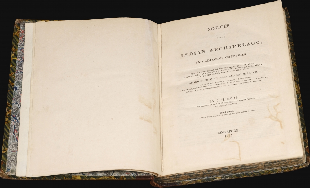
John Hamilton Moore (1738 - 1807) was a Scottish teacher of navigation, chartseller, and hydrographer active in London during the latter part of the 18th century. He is best known as a publisher of Blueback Nautical Charts and the founder of the firm that would one day become Imary and Son. Moore was born in Edinburgh and was educated in Ireland before joining the Royal Navy. After leaving the navy he set up a navigation academy in Brentford, Middlesex. Around 1772 he published the navigation textbook The New Practical Navigator and Daily Assistant. The work became the most popular such text of its day and ran into some 17 editions, firmly establishing Moore's credentials. Around 1781 Moore established himself at 127 Minories, near Tower Hill, London, where he taught navigation to a select audience as well as traded in navigational instrument and nautical charts. Moore began publishing his own charts. These were among the earliest blueback charts, called such for their distinctive blue paper backing. Moore took on draughtsman William Heather and John Noire, both future publishers of blueback nautical charts in their own right, to drawn and engraves his charts. Personally more was known to be boastful and somewhat controversial. He apparent once described himself as 'having a propensity for genius'. He was also accused of 'debauching a servant'. In the 1790s he started calling himself, 'Hydrographer and Chartmaker to his Royal Highness the Duke of Clarence'. It is unclear whether or not his claim was based on fact, but certainly Moore's many enemies in the chart publishing industry called him out on the matter, publishing a broadside declaring Moore a 'Pretender'. Either way, Moore dropped this claim by 1804. Moore was succeeded by a son, also John Hamilton Moore, and several daughters, one of whom married Robert Blachford, who became a prominent chart publisher in Moore's wake. Despite the seeming prosperity of his business, Moore seems to have died in relative poverty in Chingford, Essex. Nonetheless, his obituary in The Gentleman's Magazine, a sign in and of itself of Moore's social significance, offered him high praise, "he caused the best Charts to be published that had ever been done by any individual in this or any other nation." More by this mapmaker...
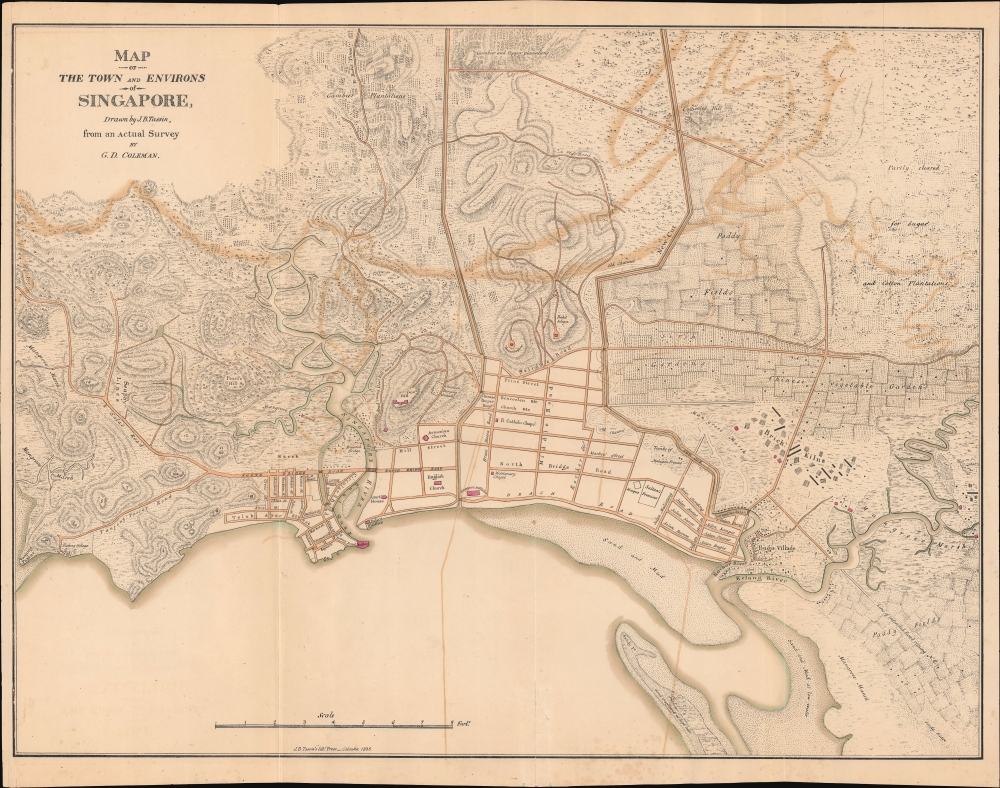
George Drumgoole Coleman (1795 - March 27, 1844) was an Irish architect and civil engineer active in the East Indies in the early 19th century. Coleman was born in Drogheda, County Louth, Ireland. He moved to Calcutta in 1815 to work as an architect. In 1820, was invited, through the patronage of John Palmer, to build two churches in Batavia (Jakarta) in the Dutch East Indies. The churches were never built, despite two years of work in Java. Two years later, in 1822, he was in Singapore, under contract from Stamford Raffles (1782 - 1826) to draft the layout of Singapore and plan the town center. He briefly returned to Java in June of 1823, but coming into conflict with local authorities, returned to Singapore in 1825. He designed several important Singapore residences in 1826, before becoming a Revenue Surveyor in June 1827. He built his own Singapore estate in 1828. In 1829, Coleman worked as a Topographical Surveyor, producing a detailed survey of Singapore and the islands where the new harbor was being built. While in this position he surveyed all of Singapore, producing the largest and most detailed yet map of the city yet seen, despite not being engraved and published until 1836. Between in 1833 and 1840, he held the post of Superintendent of Public works and Surveyor of Lands. During this time, he also designed and oversaw the construction of the Armenian Church, St. Andrew's Cathedral, the Court House (former Parliament House), the Convent of the Holy Infant Jesus, and the Singapore Institution (Raffles Institution). After a career of some 15 years in the orient, Coleman left for England in 1841. He married Maria Frances Vernon, of Clontarf Castle, Dublin, in 1842. Unable to re-adjust to Irish life and climate, he returned to Singapore in 1843. There he died in 1844 of a 'fever', likely Malaria. Learn More...
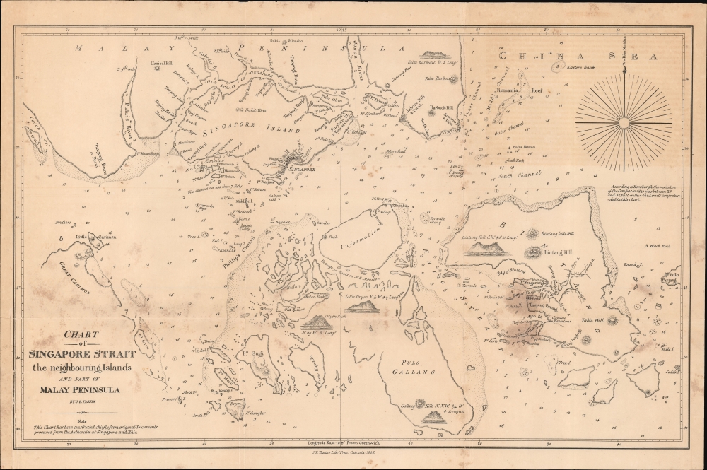
Jean-Baptiste Athanase Tassin (May 3, 1800 - January 25, 1868) was a publisher and lithographic printer active in early 19th century Calcutta, India. Tassin was born in Aix, France, where he trained as a naturalist. He joined a French government expedition to the East Indies as a naturalist. During this voyaged he became a master draughtsman. His ship wrecked in the Malayan archipelago in the late 1820s, leaving Tassin stranded in Singapore. He somehow worked his way to Calcutta, where, receiving a loan of 10,000 Rupees from Henry Thoby Prinsep, he founded publishing house, the Oriental Lithographic Press, specializing in government work. His skill as a draughtsman brought him business as map printer, leading to rich government contracts for such work, his skill often granting him precedence over official government-operated presses. The Oriental Lithographic Press continued to published until c. 1941, but Tassin left India around 1839, with a nest-egg of some 16,000 GBP. He was described with praise in the Calcutta Courier (June 27, 1832),
Mr. Tassin is a gentleman of much sterling worth. He is the most successful of all the lithographer of the East, but he owes much to the aid afforded to him by the experience of others. His zeal, and I may say enthusiasm, for lithography, as well as his industry and perseverance, make up for much of the other requisites.Tassin remained in France throughout the 1840s employed as a cartographer with the French Army. The 1848 February Revolution drove him into exile to San Francisco - just in time for the Gold Rush. He published several maps of San Francisco and California in the mid-1850s and may have been an owner of the Adelphi Theater. The Adelphi burned in 1858, after which Tassin returned to Paris. Ernest de Massey, a fellow Frenchman in San Francisco, recorded meeting Tassin,
Another silhouette ... This one is of Sieur Tassin, Chevalier of the Legion d’Honneur, ex-engineer of geography of the French government, commissioned in the Orient. He seemed to do his work with honesty. He was in haste to leave his business which must have been repugnant to him. Very ingratiating, pleasant and polite, he would have been better suited to a drawing room than a gambling house. He made a fortune and went away. In 1860 I met him on the street of Paris. He was then a 'big' Monsieur Tassin. If I had met him in a drawing-room his face would have shown much more embarrassment, as I do not believe he advertised his ability at the green-covered table where the nuggets were easier to gather than they were in the mines.Tassin died in France of unknown causes. For our research on Tassin we are somewhat indebted to Ashley Baynton-Williams. Learn More...
Copyright © 2025 Geographicus Rare Antique Maps | Geographicus Rare Antique Maps
This copy is copyright protected.
Copyright © 2025 Geographicus Rare Antique Maps