This item has been sold, but you can get on the Waitlist to be notified if another example becomes available, or purchase a digital scan.
1940 Japan Association Terrain Map of French Indochina: Vietnam, Laos, Cambodia
IndochinaTerrain-japanese-1940$200.00

Title
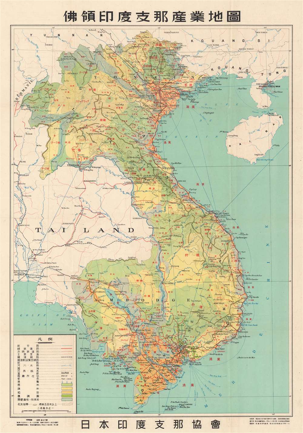
俳領印度支那産業地園. / Indochina Industrial Land.
1940 (dated) 36.5 x 25 in (92.71 x 63.5 cm) 1 : 19700000
1940 (dated) 36.5 x 25 in (92.71 x 63.5 cm) 1 : 19700000
Description
This is a 1940 or Showa 15 Japan Indochina Association map of French Indochina / Vietnam detailing terrain. At the time, French Indochina consisted of modern-day Vietnam, Laos, and Cambodia. Indochinese cities and villages, such as Hanoi, Haiphong, Saigon, Vientiane, and Phnom Penh, are labeled with either their Vietnamese name or their French name. Geographic locations throughout are labeled in the same manner, either in Vietnamese or French. A table in the lower left corner details different notations used to illustrate roads, railroads, rivers, and international borders. Different kinds of terrain, including dense forests, woodlands, and land suitable for clearing and exploitation. The Latin alphabet content underscores that this was a French map that was repurposed by the Japanese - who added extensive overprinting in this new revised issue.
Japanese Invasion of Indochina
The Japanese invasion of French Indochina was unlike any of the other conflicts between the Japanese and their enemies during the Second Sino-Japanese War and World War II. The Japanese wanted to ensure that the Chinese could resupply from Haiphong, a port in northern Vietnam. Thus, the Japanese invaded in September 1940. Fighting lasted for less than a week, and the allied French (Vichy) were allowed to regain control of northern Vietnam. It was not until the spring of 1945 that the Japanese overthrew French governance, taking tenuous control of the region.Publication History
This map was printed on November 1, 1940, or Showa 15. It was distributed on November 3. The map shortly follows the WWII Japanese invasion of Vietnam and was intended to assess the potential of their newest puppet state.Condition
Very good. Exhibits light wear and toning along original fold lines.