1869 Balatri Italian-Language Map of the Suez Canal
IstmoDiSuez-balatri-1869$500.00


Title
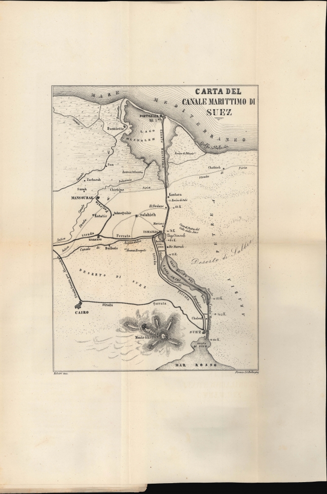
Carta del Canale Marittimo di Suez.
1869 (dated) 18.25 x 12.75 in (46.355 x 32.385 cm) 1 : 3925000
1869 (dated) 18.25 x 12.75 in (46.355 x 32.385 cm) 1 : 3925000
Description
A scarce, early Italian language folding map of the Suez Canal, engraved by Luigi Balatri and printed by Litografia Ballagny in 1869. It is significant for being among the very first published maps of the canal in Italian.
Work began on April 25, 1859, shortly after the developer Ferdinand de Lesseps obtained a concession from Sa'id Pasha, the Khedive of Egypt and Sudan. He created an international commission consisting of 13 experts from 7 countries to construct the canal. Much of the construction force was conscripted labor under the corvée system, which was common in Egypt until 1882, when it was outlawed. The British initially opposed the canal, out of fear it would disrupt English dominance of maritime trade, but in 1875 when Said Pasha's successor, Isma'il Pasha, ran up excessive debt, the British government acquired 44% of canal. In 1888, it was declared a neutral zone under British protection (today, the canal is under Egyptian control). Combined with the completion of the Transcontinental Railroad in the United States six months earlier and a rail link across the Indian Subcontinent the following year, the Suez Canal signaled a new era of long-distance transportation and was quickly the subject of related cultural production, such as Jules Vernes' Around the World in Eighty Days (1872).
A Closer Look
Focusing on the canal between Port Said and Suez, this map traces the canal itself along with a freshwater canal that parallels it along its southern portion, additional canals (including ancient ones), railways, roads, ruins (rovine and avanzi), towns and settlements, mountains, deserts, and kilometer markings at mooring points along the canal.Suez Canal
The Suez Canal was construed by the Suez Canal Company between 1859 and 1869, officially opening to maritime traffic on November 17, 1869. The canals cuts through the western Sinai Peninsula between the Mediterranean at Port Said and the Red Sea, at Suez. The completion of the canal allowed for significantly faster communication between European ports and the lucrative markets of Asia, as they nullified the need to round Africa.Work began on April 25, 1859, shortly after the developer Ferdinand de Lesseps obtained a concession from Sa'id Pasha, the Khedive of Egypt and Sudan. He created an international commission consisting of 13 experts from 7 countries to construct the canal. Much of the construction force was conscripted labor under the corvée system, which was common in Egypt until 1882, when it was outlawed. The British initially opposed the canal, out of fear it would disrupt English dominance of maritime trade, but in 1875 when Said Pasha's successor, Isma'il Pasha, ran up excessive debt, the British government acquired 44% of canal. In 1888, it was declared a neutral zone under British protection (today, the canal is under Egyptian control). Combined with the completion of the Transcontinental Railroad in the United States six months earlier and a rail link across the Indian Subcontinent the following year, the Suez Canal signaled a new era of long-distance transportation and was quickly the subject of related cultural production, such as Jules Vernes' Around the World in Eighty Days (1872).
Publication History and Census
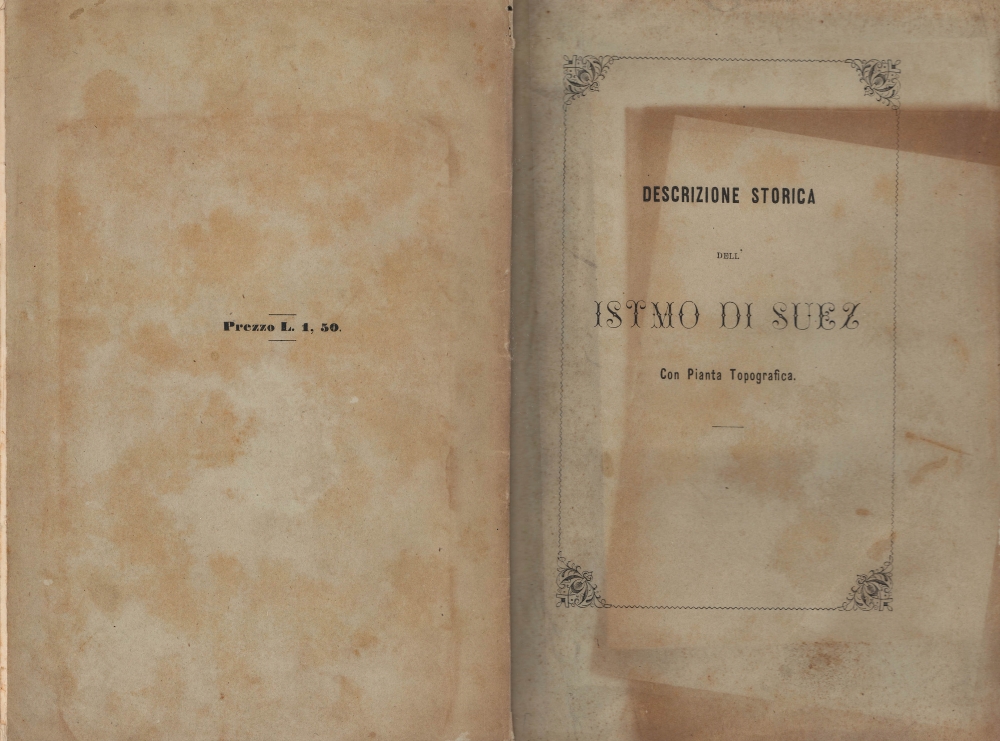
This folding map was engraved by Luigi Balatri and printed by Litografia Ballagny in Florence, part of an 1869 booklet titled Descrizione Storica dell Istmo di Suez con Pianta Topografica. It was one of the earliest published Italian maps of the canal, along with Cesare Vimercati's 'Panorama del Basso-Egitto' in 1869 and an undated contemporary map ('Carta dell' Istmo') put out by the Compagnie Universelle du Canal Maritime de Suez itself. The booklet is cataloged (under the title L'Istmo di Suez : descrizione storica con la pianta topografica del nuovo canale e sue adiacenze) among the holdings of seven institutions in the OCLC, only one of which (Northwestern University) is outside of Italy.Source
Balatri, L., Descrizione Storica dell Istmo di Suez con Pianta Topografica, (Firenze: A Spese Degli Editori) 1869.
Condition
Very good. Map still attached to booklet. 47 pages.
References
OCLC 55613397.