This copy is copyright protected.
Copyright © 2025 Geographicus Rare Antique Maps
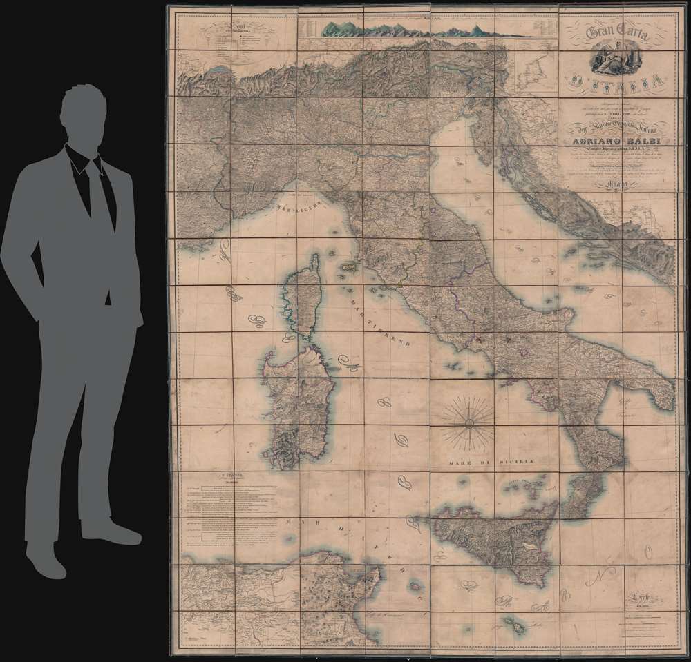
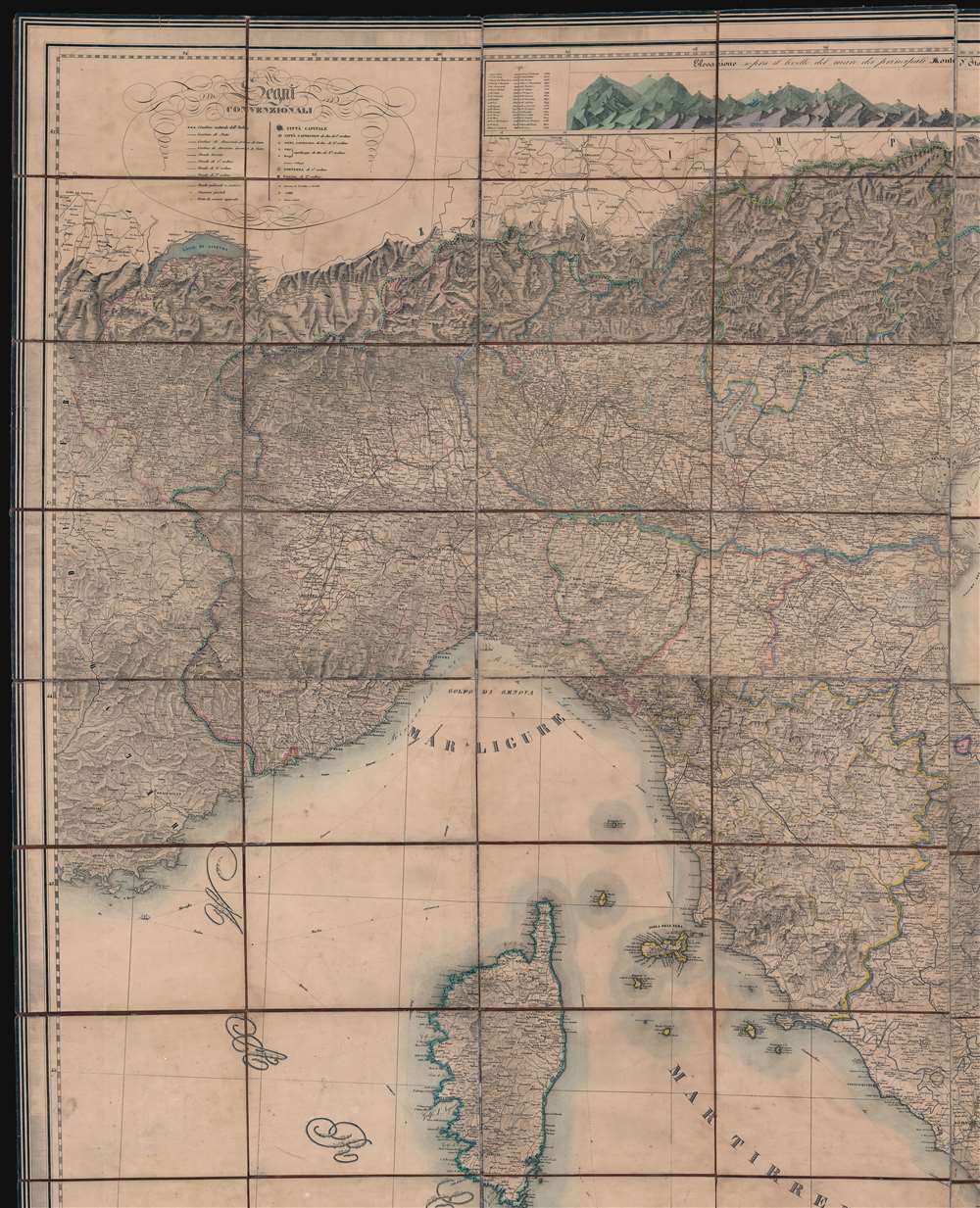
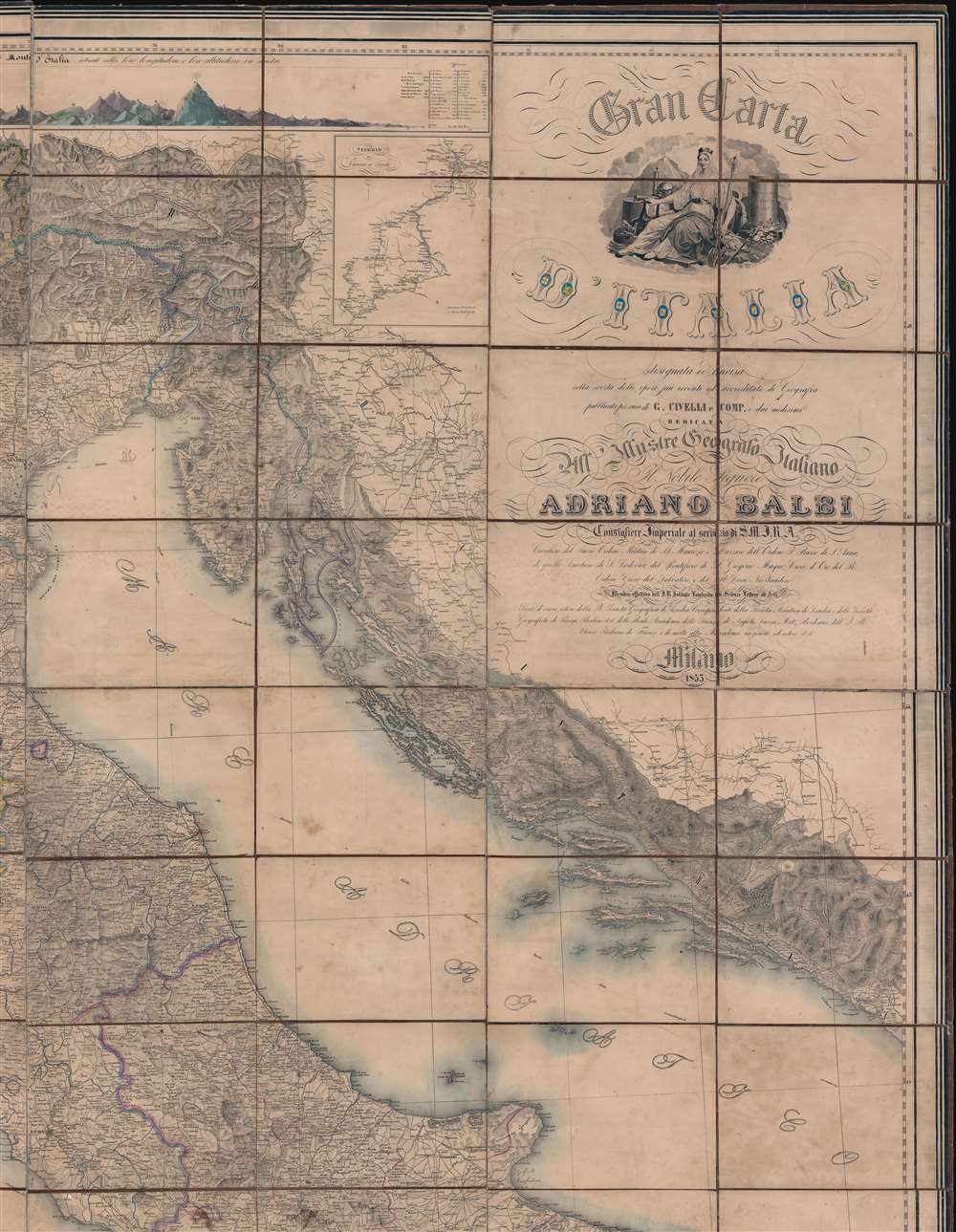
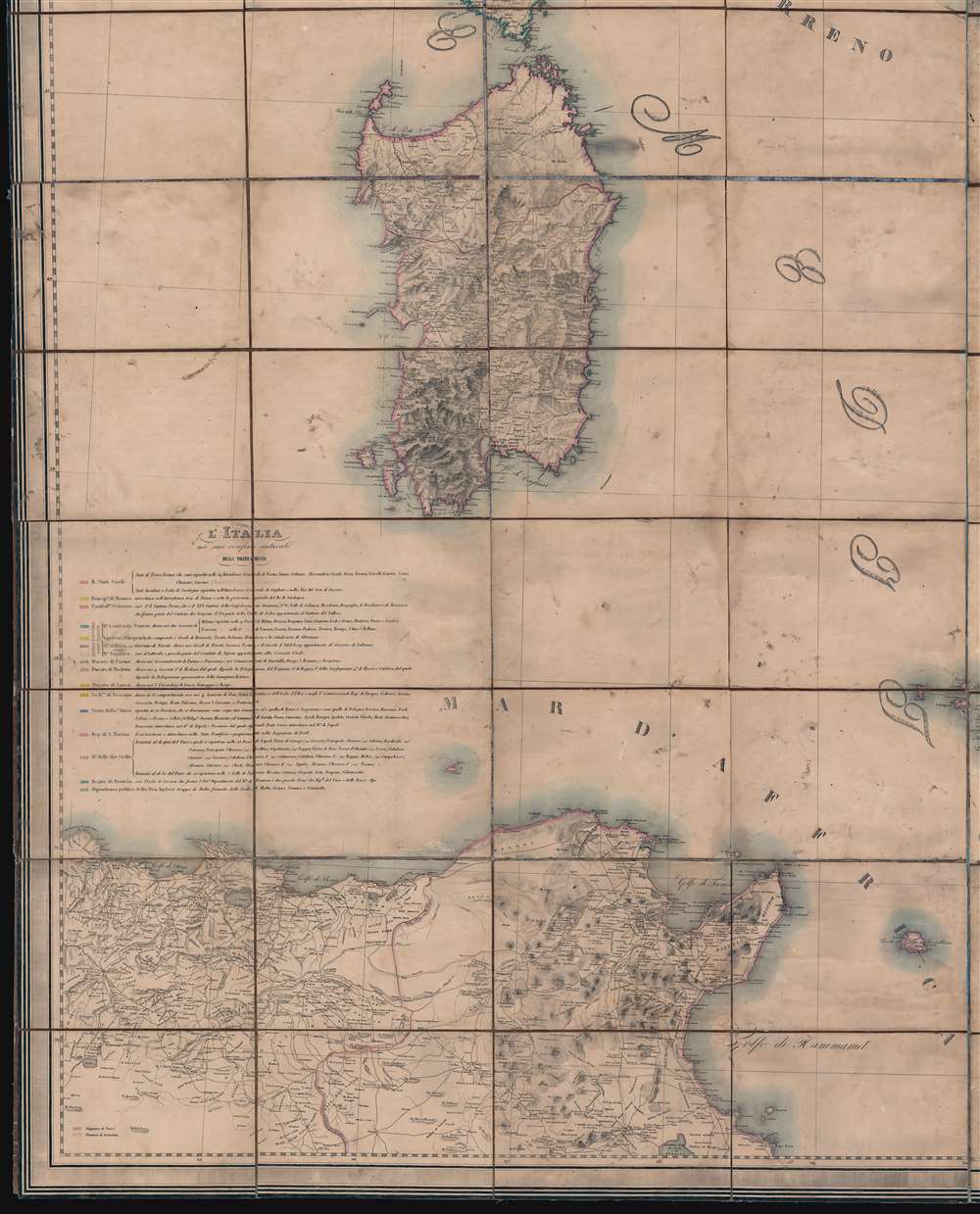
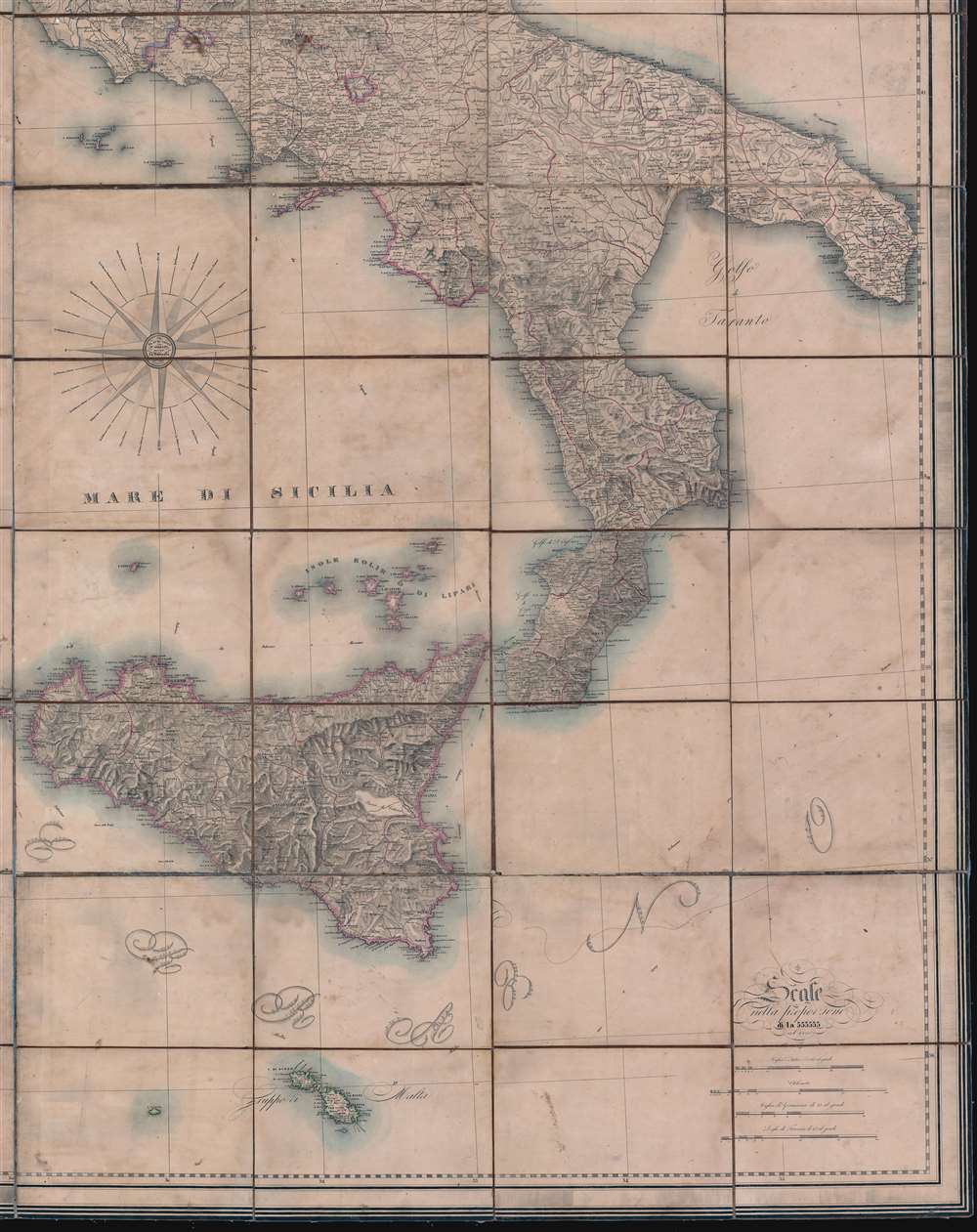
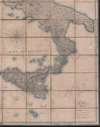
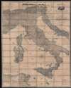
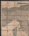
Digital Image: 1853 'Ginormous' Civelli Wall / Case Map of Italy
Italia-civelli-1853_d

FOR THE ORIGINAL ANTIQUE MAP, WITH HISTORICAL ANALYSIS, CLICK HERE.
Digital Map Information
Geographicus maintains an archive of high-resolution rare map scans. We scan our maps at 300 DPI or higher, with newer images being 600 DPI, (either TIFF or JPEG, depending on when the scan was done) which is most cases in suitable for enlargement and printing.
Delivery
Once you purchase our digital scan service, you will receive a download link via email - usually within seconds. Digital orders are delivered as ZIP files, an industry standard file compression protocol that any computer should be able to unpack. Some of our files are very large, and can take some time to download. Most files are saved into your computer's 'Downloads' folder. All delivery is electronic. No physical product is shipped.
Credit and Scope of Use
You can use your digial image any way you want! Our digital images are unrestricted by copyright and can be used, modified, and published freely. The textual description that accompanies the original antique map is not included in the sale of digital images and remains protected by copyright. That said, we put significant care and effort into scanning and editing these maps, and we’d appreciate a credit when possible. Should you wish to credit us, please use the following credit line:
Courtesy of Geographicus Rare Antique Maps (http://www.geographicus.com).
How Large Can I Print?
In general, at 300 DPI, you should at least be able to double the size of the actual image, more so with our 600 DPI images. So, if the original was 10 x 12 inches, you can print at 20 x 24 inches, without quality loss. If your display requirements can accommodate some loss in image quality, you can make it even larger. That being said, no quality of scan will allow you to blow up at 10 x 12 inch map to wall size without significant quality loss. For more information, it is best consult a printer or reprographics specialist.
Refunds
If the high resolution image you ordered is unavailable, we will fully refund your purchase. Otherwise, digital images scans are a service, not a tangible product, and cannot be returned or refunded once the download link is used.
Giuseppe Civelli (June 2, 1816 - March 7, 1882) was an Italian publisher, printer, geographer, and engineer active in Milan during the middle part of the 19th century. Civelli was born in Lombardy, Italy, apparently of modest origins. He established a printing house in Milan in 1840. Ten years later, having achieved considerable success with ambitious cartographic publications, he was able to open additional printing houses in Ancona and Turin. When the capital of Italy moved to Florence in 1865, he established a large printing house there to capitalize on government contracts. This process was later replicated in Rome. He died in Florence, but his successors continued to publish under his imprint, Stabilimento Tipografico già C. Civelli well into the 20th century. More by this mapmaker...
Francesco Valmagini (1783 - 1865) was a Milanese civil engineer, military topographer, and professor of geography at the Scuola Militare. He was a draftsman at the Milat War Depot in 1811. In the mid-19th century Valmagini was responsible for multiple large scale maps of Italy and Italian regions. Valmagini died in Venice in 1865. Learn More...
Clemente Folchi (November 14, 1780 - September 30, 1868) was a prominent Italian architect and engineer. Folchi was born in Rome. He initially studied mathematics and philosophy, but in 1800, apprenticed in architecture from 1800 under Andrea Vici (1743 - 1817). From 1806 became a member of the Commissione di Pesi e Misure and of the Académie des Lyncéens in Rome (equivalent of the French Académie des Beaux-Arts). In 1819, Barbara Vici the daughter of his teacher, Andrea Vici, became a widow and Folchi promptly married her. He leveraged the Vivi name to establish his own firm, Folchi Vici. In 1845, he oversaw the production of Giuseppe Civelli's enormous map of Italy. Folchi died in Rome at 88 years of age. Learn More...
Roberto Focosi (1806 - 1867) was an Italian painter and draftsman active in Milan in the first half of the 19th century. Focosi was born in Milan and studied from 1819 - 1827 at the Accademia di Belle Arti di Brera. Much of Focosi's work was related to the theater. Learn More...
Luigi Zuccoli (1815 - January 5, 1876) was an Italian painter and engraver. He was born in Milian and mastered painting under Pelagio Palagi (1775 - 1860). He was well regarded as a painter, becoming well known for his domestic scenes - a trope popular in Northern Europe and England. He was laid low by illness and died in Milan in 1876. Learn More...
Copyright © 2025 Geographicus Rare Antique Maps | Geographicus Rare Antique Maps
This copy is copyright protected.
Copyright © 2025 Geographicus Rare Antique Maps