1964 Phillips Map of Katahdin and Baxter State Park, Maine

Katahdin-phillips-1964
$400.00
Phillips' Map of the Part of Northern Maine 'East of Katahdin' Showing Approaches to Baxter State Park. - Main View
Processing...

1964 Phillips Map of Katahdin and Baxter State Park, Maine

Katahdin-phillips-1964

'The Greatest Mountain.' -Penobscot Peoples
$400.00

Title


Phillips' Map of the Part of Northern Maine 'East of Katahdin' Showing Approaches to Baxter State Park.
  1964 (dated)     25.25 x 19 in (64.135 x 48.26 cm)     1 : 180000

Description


This is Augustus D. Phillips' scarce 1964 map of northeastern Maine showing Mount Katahdin and Baxter State Park. It is among the rarest maps issued by the Maine artist, with only two other examples known.
Publication History and Census
Coverage embraces Northeastern Maine from Pemadumcook Lake in the west, east as to the New Brunswick border, and from Squapan Lake and Mountain in the north, as far south as Brownville and Schoodic Lake. Mount Katahdin and Baxter State Park appear on the left. Hiking trails, including the Appalachian Trail, which terminates at Katahdin, are marked. So, too, are public and private boat launches, other hiking trains, forest service towers, state and federal highways, campsites, and fish hatcheries.
Mount Katahdin
Mount Katahdin, located in Baxter State Park in north-central Maine, is the highest peak in the state, standing at 5,269 feet (1,606 meters). It is renowned for its rugged beauty and is a focal point of the Appalachian Trail, marking its northern terminus. The mountain, whose name means 'The Greatest Mountain' in the Penobscot language, holds significant cultural and spiritual importance for the Penobscot Native American tribe. Established as a protected area in 1931 by former Maine Governor Percival Baxter, the surrounding Baxter State Park ensures the preservation of Mount Katahdin’s pristine environment, allowing visitors to experience the natural beauty and solitude of this iconic mountain.
Publication History and Census
This map was drawn and published in 1964 by Augustus D. Phillips of Northeast Harbor, Mount Desert Island, Maine. We note only two other examples, one in the Northeast Harbor Library and the other at the Osher Library in Portland, making this one of the scarcest of Phillips' maps.

Cartographer


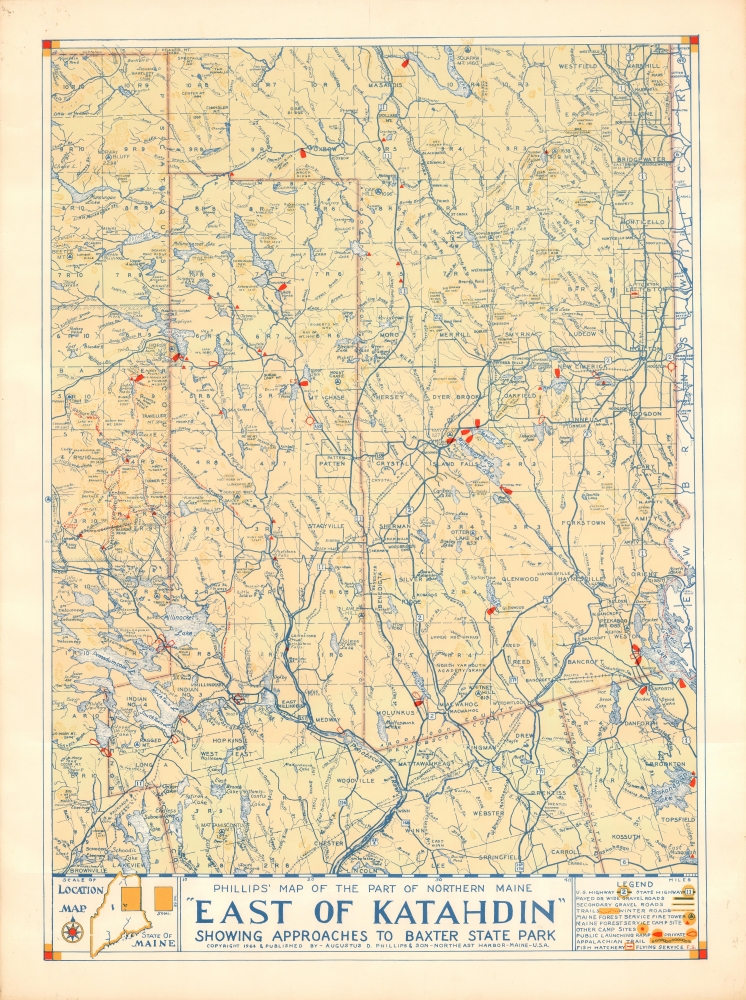
Augustus Dewey Phillips (May 6, 1898 - December 14, 1975), a.k.a. 'Gus', was an American artist, cartographer, and publisher. Born on Mount Desert Island, Maine, as a boy Augustus and his brother Luther Savage Phillips (1891 - 1960) helped their dad in a variety of odd jobs, including maintaining a boat rental business and harvesting and selling ice. Augustus graduated from Hebron Academy and then attended the University of Maine for a short time. After leaving university, Phillips became a Maine Guide and worked as a carpenter and draftsman in the South Portland and Boothbay Harbor ship and boat yards. The brothers traveled together widely throughout Maine. Luther went on to start a popular map and postcard business out of Northeast Harbor, Maine. After Luther died in 1960, Augustus took over the map businesses. In a tragic turn of events, in 1973 an out of control bush fire destroyed the Phillips studio and much of the surviving stock, making all Phillips' maps issued prior to that date rare. His passion for landscapes helped Augustus create his own map style. Augustus expanded the business and continued making new maps until he died in 1975. Augustus' son, Donald Beekman Phillips (1935 - 2009) continued the business after his father's death. Augustus married Mary Fletcher on April 26, 1922, with whom he had four children. More by this mapmaker...

Condition


Very good. Slight edge wear.

References


Northeast Harbor Library, MAP 0050 ADP. University of Southern Maine, Osher Map Library, Accession #OML-1964-40.