1972 Survey of Kenya Route Map of Kenya and Northern Tanzania, w/ Kilimanjaro
Kenya-surveyofkenya-1972
Title
1972 (dated) 24 x 35 in (60.96 x 88.9 cm) 1 : 1000000
Description
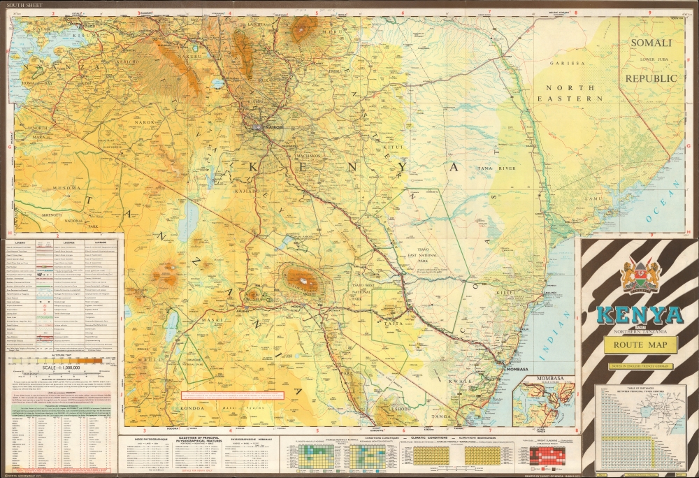
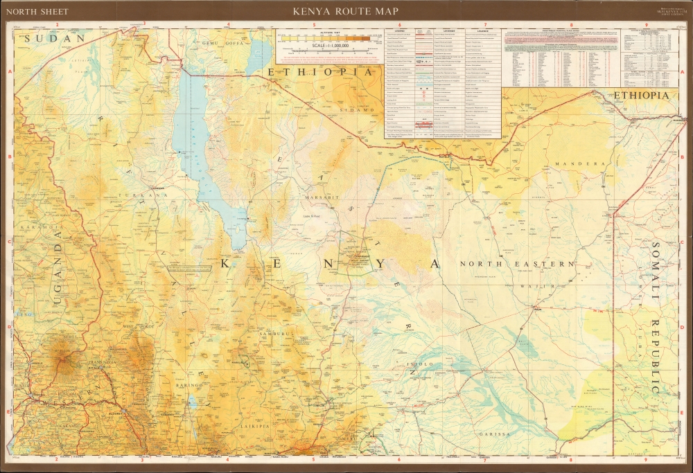
A Closer Look
The map's recto with the title panel covers the southern portion of southern Kenya and northern Tanzania, including Mt. Kilimanjaro, a portion of the Serengeti National Park, and Kenya's largest cities (Nairobi, Mombasa, Kisumu, Nakuru), while the verso takes in northern Kenya, along with portions of Uganda, Sudan (now South Sudan), Ethiopia, and Somalia. Roads of various classes (including those under construction), railways, administrative boundaries, airports and landing strips, hotels, sources of drinking water, and settlements are noted throughout, along with natural features, such as waterways, mountains (with elevation recorded), and various sorts of terrain. Along major roads, distances between larger settlements are noted in miles and kilometers. A grid surrounds the map, providing coordinates for indexes of placenames and physiographic features on the recto at bottom. Tables also give information on average monthly rainfall, climatic conditions, average hours of bright sunshine per day, and a table of distances with a simple map of the major cities of the region. An inset map of Mombasa appears near bottom-right on the recto.Historical Context
At this time, Kenya was undergoing a process of transition, with President Jomo Kenyatta (r. 1964 - 1978) leading the country out of the era of colonization. Kenyatta aimed to centralize power, both in the national government and in his own office, pursuing policies widely regarded as dictatorial. One of his aims in doing so was to strengthen unity among the country's disparate ethnic groups, including small minorities of European, Indian, and Arab descent. Several potentially explosive issues were handled deftly (including land reform and redistribution from white settler farmers and the peaceful end of apartheid-like racial discrimination), but heavy-handed tactics were used against groups with separatist tendencies, most notably in the Shifta War (1963 - 1967), fought against Somali pastoralists and other ethnic minorities in the North Eastern Province.Publication History and Census
This map was published by the Survey of Kenya in 1972. It is the first edition of the map, with a second 1978 edition being more widespread. Although digitized examples of this map appear in multiple catalogs, physical examples of the 1972 edition are only held by Boston University, Northwestern University, the Instituto Geográfico Nacional in Madrid, and the University of Groningen.Cartographer
Survey of Kenya (1903 - present) is the official government body in charge of mapping and land surveying in Kenya. Established in the British colonial period, the body continued to function as before with the same name after Kenyan independence in 1963. In the years just before independence, the body produced the impressive Atlas of Kenya (editions in 1959 and 1962, both offered by us), which after independence was updated and expanded as the National Atlas of Kenya (1970). In the following decades, much of the Survey's work entailed creating land registries for the newly-independent country. Along with bureaucratic reorganization, the Survey's name was changed to the Ministry of Lands, and then the State Department for Lands and Physical Planning, housed within the Ministry of Lands, Public Works, Housing, and Urban Development. More by this mapmaker...


