This item has been sold, but you can get on the Waitlist to be notified if another example becomes available, or purchase a digital scan.
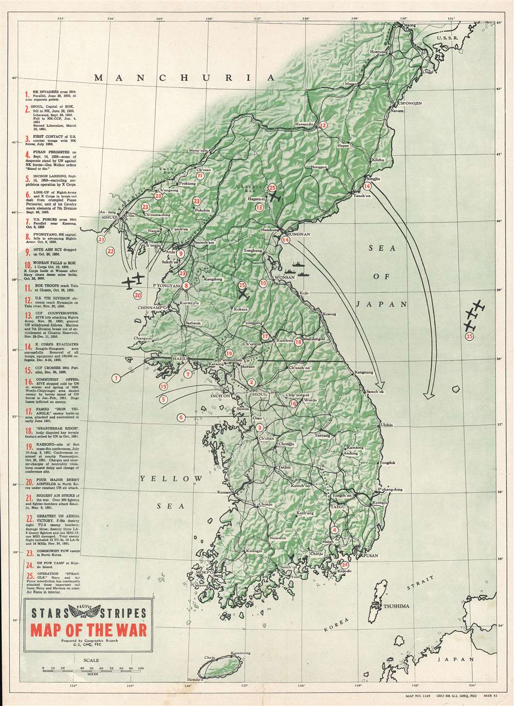
1952 Pacific Stars and Stripes Map of the Korean War
Korea-pacific-1952$112.50

Title
Map of the War.
1952 (dated) 20.5 x 14.75 in (52.07 x 37.465 cm) 1 : 2534400
1952 (dated) 20.5 x 14.75 in (52.07 x 37.465 cm) 1 : 2534400
Description
This is a 1952 Pacific Stars and Stripes map of the Korean War. The map depicts the region from Manchuria to Japan and from the Yellow Sea to the Sea of Japan. Tracing events from the North Korean invasion of South Korea on June 25, 1950 through Operation Strangle launched, a sustained attack on North Korean communication and supply lines in late August 1951. Twenty-five different locations are numerically identified, these include U.N. attacks, North Korean or Chinese counterattacks, air strikes, 'Heartbreak Ridge', U.N. and Communist POW camps, and the site of the first ceasefire talks at Kaesong. Each action or location corresponds with an index along the left border. Major cities throughout both North and South Korea are labeled, as is the Yalu River (the border between North Korea and China). The 38th parallel, the border the North Koreans crossed to start the war, is highlighted by a solid black line.
Publication History and Census
This map was prepared by the Geographic Branch of the Intelligence Section of the General Headquarters of the Far Eastern Commission as map no. 1129 in March 1952. Three examples are cataloged in the OCLC as being part of the collections at the Pritzker Military Museum and Library in Chicago, Illinois, the Wisconsin Veterans Museum Research Center in Madison, Wisconsin, and the University of Alabama.Cartographer
Stars and Stripes, Pacific Editions (1945-1963) began publishing the week of VE Day in May, 1945 in Honolulu, Hawaii. Later that year editions were published in China and Japan as well. When the war ended, the newspaper’s readership and staff both fell, although it was still published for occupational forces and other armed forces still employed. In 1951, during the Korean War, a Korean edition was published. More by this mapmaker...
Condition
Very good. Light wear along original fold lines. Light soiling. Vero repairs to fold separations. Closed margin tears professionally repaired on verso. Closed tear extending 1.25 inches into printed area from right margin professionally repaired on verso. Blank on verso.
References
OCLC 944959232.

