This item has been sold, but you can get on the Waitlist to be notified if another example becomes available, or purchase a digital scan.
1930 Pictorial Map of Korea and Manchuria
KoreaMachuria-showa5-1930$975.00

Title
Conceptual Map of Manchuria and Korea. / 满鲜概念图
1930 (dated) 42 x 30 in (106.68 x 76.2 cm) 1 : 1800000
1930 (dated) 42 x 30 in (106.68 x 76.2 cm) 1 : 1800000
Description
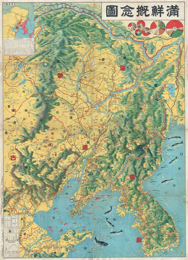
A spectacularly graphic 1930 or Showa 5 pictorial map of Korea and Manchuria. It covers all of Manchuria and Korea as well as parts of Shandong and Liaoning provinces, China. This map was created to illustrate railroads, regional port output, and fisheries. Topography is stunningly rendered in profile with bright color work. This map's most striking features is probably its remarkable pictorial illustration of regional fisheries in the Yellow Sea and Sea of Japan / Korea. Different type of fish are identified pictorially along with their annual output. Similarly, the countryside is full of farm animals, but few of these are associated with textual references regarding production and are most likely purely decorative. Pie charts in the upper right detail production and output at regional ports, including Dalian.
This map was notably issued on year before the July 1931 Wanpaoshan Incident, the September 1931 Mukuden Incident, and the subsequent Japanese Invasion of Manchuria. From their staging points in Japan and Korea, the Japan had long viewed a takeover of Manchuria s the first step towards the conquest of China. This map, with its highlight of regional resources, capitalizes on general Japanese interest in this region and what it might add to the ascendant Japanese Empire.
This map was notably issued on year before the July 1931 Wanpaoshan Incident, the September 1931 Mukuden Incident, and the subsequent Japanese Invasion of Manchuria. From their staging points in Japan and Korea, the Japan had long viewed a takeover of Manchuria s the first step towards the conquest of China. This map, with its highlight of regional resources, capitalizes on general Japanese interest in this region and what it might add to the ascendant Japanese Empire.
Condition
Good. Older verso repairs along some of the fold lines and minor loss here and there at folds.

