This item has been sold, but you can get on the Waitlist to be notified if another example becomes available, or purchase a digital scan.
1929 Floercky Pictorial Map of Los Angeles County
LACounty-floercky-1929$250.00

Title
Amusement Map of Los Angeles County / Places of Interest, Amusement, Sport, Los Angeles County.
1929 (dated) 15 x 20.75 in (38.1 x 52.705 cm) 1 : 155000
1929 (dated) 15 x 20.75 in (38.1 x 52.705 cm) 1 : 155000
Description
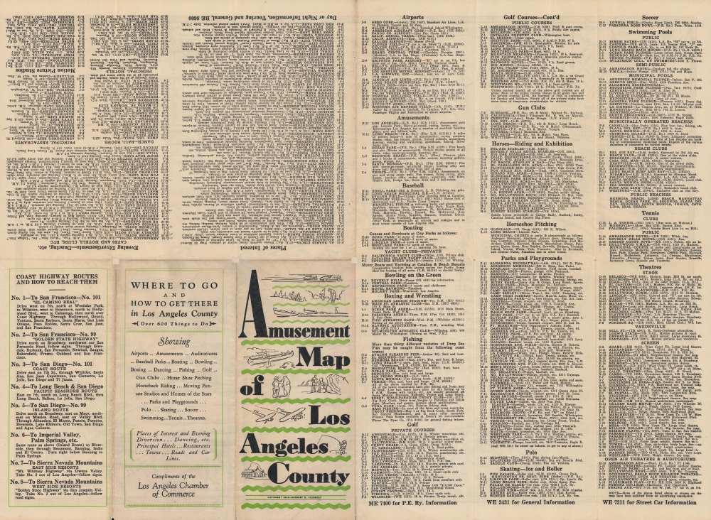
An entertaining 1929 Herbert Edward Floercky pictorial map of Los Angeles County. It highlights the many 'amusements' and 'divertisements' available throughout the county, ranging from beachside attractions to skiing, polo, movie theaters, a plethora of golf courses, and more.
The inset map of Hollywood indicates the locations of major movie studios. The downtown L.A. map is notable, among other things, because it predates the construction of Union Station. The two depots at right, Central Station serving the Union Pacific and Southern Pacific Lines and La Grande Station serving the Atchison, Topeka, and Santa Fe Railway, were consolidated at the new station, opened in 1939. The Chinatown drawn here was demolished to make way for the station and afterwards a new Chinatown developed nearby.
A small legend next to the downtown L.A. inset map explains that small boxes with numbers denote distances from Los Angeles. The verso includes a comprehensive list of attractions, clubs, and restaurants arranged thematically, as well as a list of highway routes reaching Los Angeles.
A Closer Look
Though billed as a map of L.A. County, the northern half of the county, beyond the San Gabriel Mountains, is not included. Cities appear throughout, along with a wide array of recreational activities: golf courses, parks, animal-themed amusement parks, horseback riding, fishing, gun clubs, social clubs, and more. Santa Catalina Island is squeezed in at bottom-left. It emerged as a posh playground for Hollywood stars around this time. The promotion of the island was spearheaded by William Wrigley Jr. (of chewing gum fame), who bought up the city of Avalon and opened a casino the same year this map was published, and designated Catalina as the spring training home of the Chicago Cubs, which he also owned.Insets
Three inset maps appear at top-left, top-right, and bottom-right, providing a smaller scale plan of Beverly Hills, Hollywood, and downtown Los Angeles, respectively. The inset map of Beverley Hills includes the locations of the homes of movie stars, including Charlie Chaplin, Harold Llyod, and Will Rogers, who also owned an estate near the ocean that is now an eponymous state park.The inset map of Hollywood indicates the locations of major movie studios. The downtown L.A. map is notable, among other things, because it predates the construction of Union Station. The two depots at right, Central Station serving the Union Pacific and Southern Pacific Lines and La Grande Station serving the Atchison, Topeka, and Santa Fe Railway, were consolidated at the new station, opened in 1939. The Chinatown drawn here was demolished to make way for the station and afterwards a new Chinatown developed nearby.
Airports, Oil, and Resorts
The copious airports and oil fields, especially in the west, is noteworthy. Also immediately evident are the density of seaside attractions in Santa Monica and Venice Beach, which were then more resort towns more than cities. The 'red car' system of the Pacific Electric Railway is nearly ubiquitous, a reminder of L.A.'s transit system before highways and automobiles.A small legend next to the downtown L.A. inset map explains that small boxes with numbers denote distances from Los Angeles. The verso includes a comprehensive list of attractions, clubs, and restaurants arranged thematically, as well as a list of highway routes reaching Los Angeles.
Publication History and Census
This map was drawn by Herbert Edward Floercky and issued 'Compliments of the Los Angeles Chamber of Commerce' in 1929. It is listed among the institutional collections of the Los Angeles Public Library, the University of Michigan, the University of Wisconsin-Madison, and the University of Wisconsin-Milwaukee, and is scarce to the market.Cartographer
Herbert Edward Floercky (fl. c. 1929 - 1933) was a California-based geographer, cartographer, and illustrator. An engineer by training, he turned to maps after the stock market crash of 1929. He is best known for this 1929 'Amusement Map of Los Angeles County' and his popular, richly-illustrated 1933 book A Visual Geography of California, originally drawn and written for his own children, which became a textbook in the state's schools. More by this mapmaker...
Condition
Very good. Some wear along fold lines. Repairs to fold intersections on verso.
References
OCLC 63682103.


