This copy is copyright protected.
Copyright © 2025 Geographicus Rare Antique Maps
1955 Instituto Cartografico Nacional City Plan or Map of Havana, Cuba
LaHabana-cartographic-1955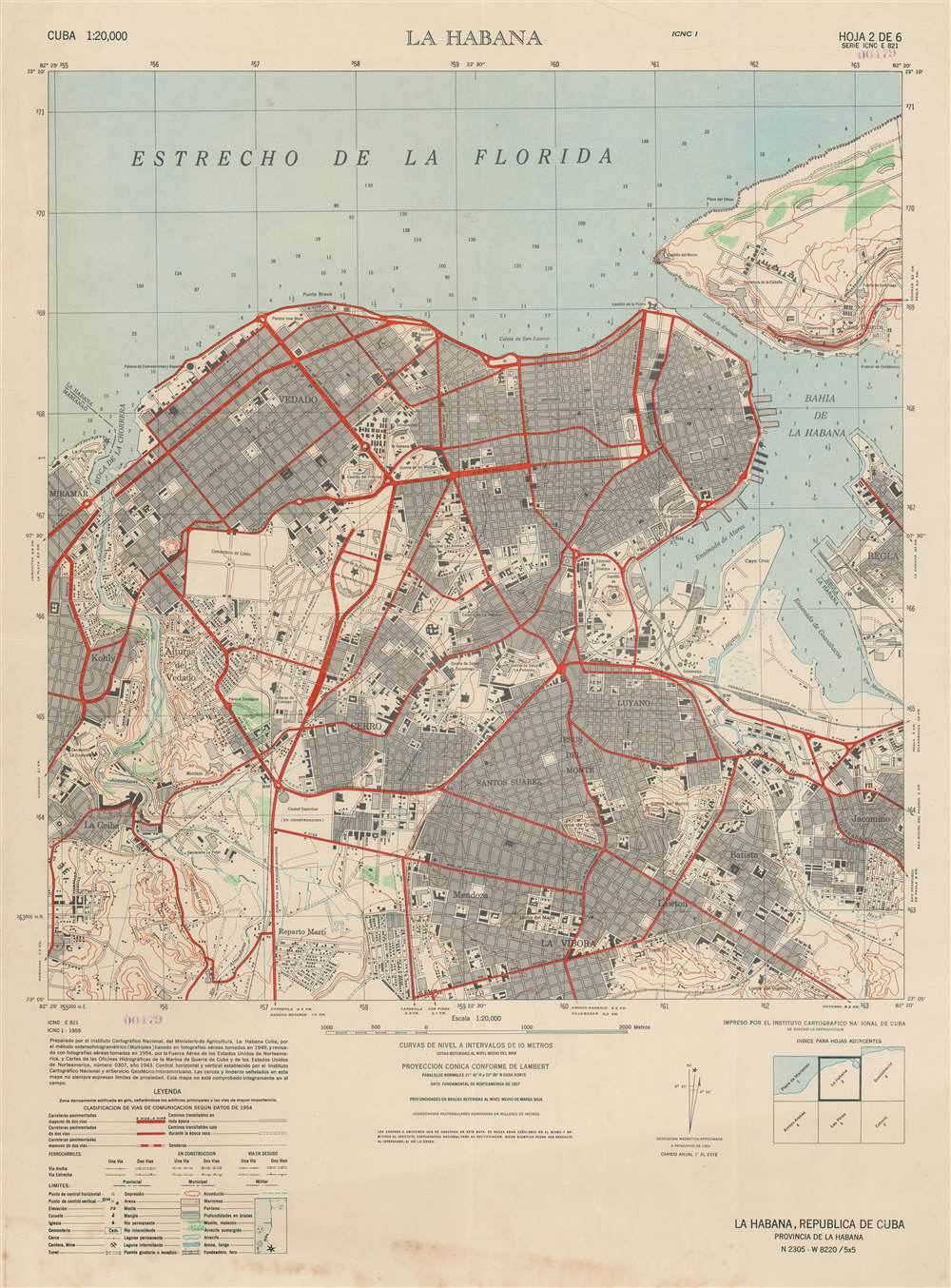

Copyright © 2025 Geographicus Rare Antique Maps | Geographicus Rare Antique Maps
This copy is copyright protected.
Copyright © 2025 Geographicus Rare Antique Maps