This copy is copyright protected.
Copyright © 2025 Geographicus Rare Antique Maps
Digital Image: 1756 Bellin Map of Lake Champlain, New York (German Edition)
LakeChamplain-bellin-1756_d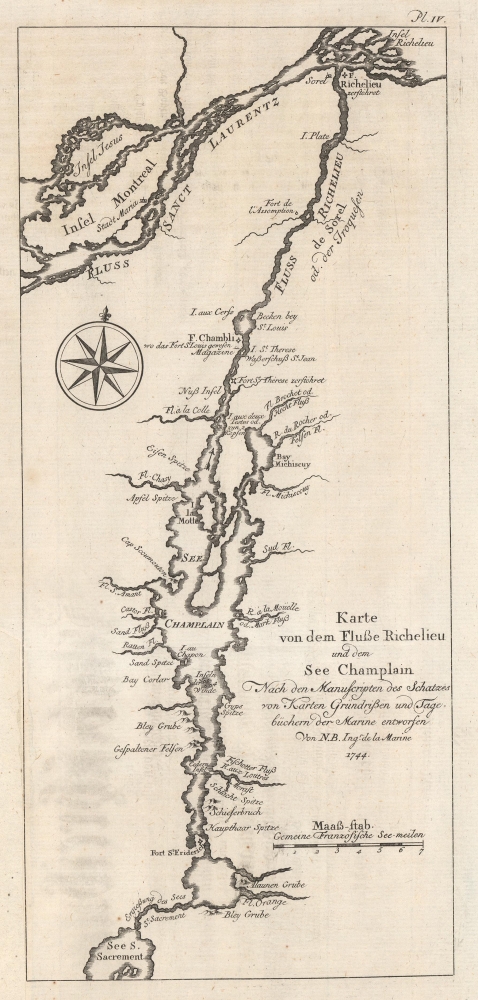

FOR THE ORIGINAL ANTIQUE MAP, WITH HISTORICAL ANALYSIS, CLICK HERE.
Digital Map Information
Geographicus maintains an archive of high-resolution rare map scans. We scan our maps at 300 DPI or higher, with newer images being 600 DPI, (either TIFF or JPEG, depending on when the scan was done) which is most cases in suitable for enlargement and printing.
Delivery
Once you purchase our digital scan service, you will receive a download link via email - usually within seconds. Digital orders are delivered as ZIP files, an industry standard file compression protocol that any computer should be able to unpack. Some of our files are very large, and can take some time to download. Most files are saved into your computer's 'Downloads' folder. All delivery is electronic. No physical product is shipped.
Credit and Scope of Use
You can use your digial image any way you want! Our digital images are unrestricted by copyright and can be used, modified, and published freely. The textual description that accompanies the original antique map is not included in the sale of digital images and remains protected by copyright. That said, we put significant care and effort into scanning and editing these maps, and we’d appreciate a credit when possible. Should you wish to credit us, please use the following credit line:
Courtesy of Geographicus Rare Antique Maps (http://www.geographicus.com).
How Large Can I Print?
In general, at 300 DPI, you should at least be able to double the size of the actual image, more so with our 600 DPI images. So, if the original was 10 x 12 inches, you can print at 20 x 24 inches, without quality loss. If your display requirements can accommodate some loss in image quality, you can make it even larger. That being said, no quality of scan will allow you to blow up at 10 x 12 inch map to wall size without significant quality loss. For more information, it is best consult a printer or reprographics specialist.
Refunds
If the high resolution image you ordered is unavailable, we will fully refund your purchase. Otherwise, digital images scans are a service, not a tangible product, and cannot be returned or refunded once the download link is used.
Jacques-Nicolas Bellin (1703 - March 21, 1772) was one of the most important cartographers of the 18th century. With a career spanning some 50 years, Bellin is best understood as geographe de cabinet and transitional mapmaker spanning the gap between 18th and early-19th century cartographic styles. His long career as Hydrographer and Ingénieur Hydrographe at the French Dépôt des cartes et plans de la Marine resulted in hundreds of high quality nautical charts of practically everywhere in the world. A true child of the Enlightenment Era, Bellin's work focuses on function and accuracy tending in the process to be less decorative than the earlier 17th and 18th century cartographic work. Unlike many of his contemporaries, Bellin was always careful to cite his references and his scholarly corpus consists of over 1400 articles on geography prepared for Diderot's Encyclopedie. Bellin, despite his extraordinary success, may not have enjoyed his work, which is described as "long, unpleasant, and hard." In addition to numerous maps and charts published during his lifetime, many of Bellin's maps were updated (or not) and published posthumously. He was succeeded as Ingénieur Hydrographe by his student, also a prolific and influential cartographer, Rigobert Bonne. More by this mapmaker...
Hendrik Kornelius Arkstée (c. 1700 - c. 1782) was a Dutch publisher active in Leipzig and Amsterdam. He was also, and more commonly, known as Johann Caspar Arkstée. He operated the publishing house Arkstée and Markus with his half-brother Henricus Merkus (1714 - 1774). Learn More...
Henricus Merkus (1714 - 1774) was a Dutch publisher. Born in Nijmegen, Markus worked with his half-brother Johann Caspar Arkstée (c. 1700 - c. 1782) in the publishing firm Arkstée and Markus in Leipzig and Amsterdam. Learn More...
Pierre François Xavier de Charlevoix, S.J. (October 24 or 29, 1682 – February 1, 1761) was a French Jesuit priest, traveller, and historian, often considered the first historian of New France. He is best known for his Histoire et description generale de la Nouvelle France, in spite of the work being primarily based upon the manuscripts compiled by Gaspard-Joseph Chaussegros de Lery, a French Canadian military engineer active throughout the Great Lakes region in the early 18th century. Charlevoix had been commissioned by the French Crown and the Duke of Orleans to explore French holdings in the Americas, primarily in order to find a profitable route to the Pacific - perhaps via the rivers and lakes west of the Great Lakes suggested by De l'Isle and Lahontan. Charlevoix was not above inventing discoveries: the imaginary islands in Lake Superior that appear frequently in 18th century maps can be laid at Charlevoix's feet, the results of his efforts to flatter his patrons (and patron saints.) Learn More...
Copyright © 2025 Geographicus Rare Antique Maps | Geographicus Rare Antique Maps
This copy is copyright protected.
Copyright © 2025 Geographicus Rare Antique Maps