Digital Image: 1853 Coffinières Map of the La Plata Basin: Argentina, Uruguay, Paraguay
LaPlataBasin-coffinieres-1853_d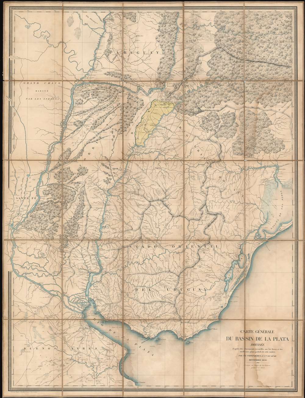

Title
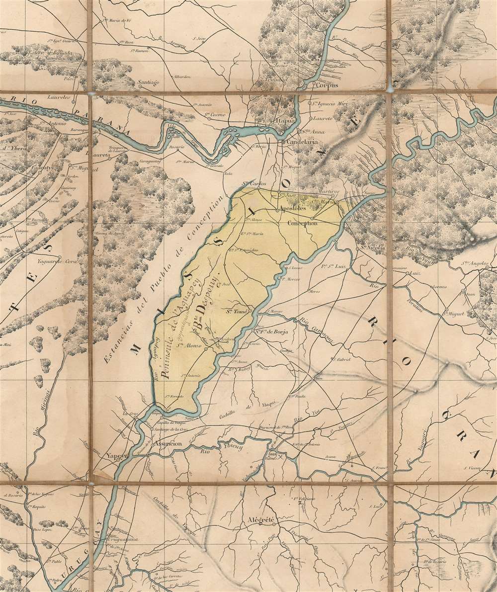
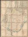
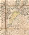
Carte Générale du Bassin de La Plata Dressée d'après des documents recueillis sur les lieux, et les milleurs plans partiels de cette contrée par m. Coffinières, Lt. Cnel. du Génie.
1853 (dated) 42.5 x 32.5 in (107.95 x 82.55 cm) 1 : 1518500
1853 (dated) 42.5 x 32.5 in (107.95 x 82.55 cm) 1 : 1518500
Description
FOR THE ORIGINAL ANTIQUE MAP, WITH HISTORICAL ANALYSIS, CLICK HERE.
Digital Map Information
Geographicus maintains an archive of high-resolution rare map scans. We scan our maps at 300 DPI or higher, with newer images being 600 DPI, (either TIFF or JPEG, depending on when the scan was done) which is most cases in suitable for enlargement and printing.
Delivery
Once you purchase our digital scan service, you will receive a download link via email - usually within seconds. Digital orders are delivered as ZIP files, an industry standard file compression protocol that any computer should be able to unpack. Some of our files are very large, and can take some time to download. Most files are saved into your computer's 'Downloads' folder. All delivery is electronic. No physical product is shipped.
Credit and Scope of Use
You can use your digial image any way you want! Our digital images are unrestricted by copyright and can be used, modified, and published freely. The textual description that accompanies the original antique map is not included in the sale of digital images and remains protected by copyright. That said, we put significant care and effort into scanning and editing these maps, and we’d appreciate a credit when possible. Should you wish to credit us, please use the following credit line:
Courtesy of Geographicus Rare Antique Maps (http://www.geographicus.com).
How Large Can I Print?
In general, at 300 DPI, you should at least be able to double the size of the actual image, more so with our 600 DPI images. So, if the original was 10 x 12 inches, you can print at 20 x 24 inches, without quality loss. If your display requirements can accommodate some loss in image quality, you can make it even larger. That being said, no quality of scan will allow you to blow up at 10 x 12 inch map to wall size without significant quality loss. For more information, it is best consult a printer or reprographics specialist.
Refunds
If the high resolution image you ordered is unavailable, we will fully refund your purchase. Otherwise, digital images scans are a service, not a tangible product, and cannot be returned or refunded once the download link is used.
Cartographer S
Grégoire-Gaspard-Félix Coffinières de Nordeck (September 3, 1811 - January 7, 1887) was a French military officer active in Europe and in Argentina in the middle part of the 19th century. Coffinières was born in Castelnaudary (Aude), France. He studied at the Paris École Polytechnique and later at the l’École d’application du Génie (Engineering College) at Metz. While in school, in participated in the July Revolution, which overthrew King Charles X in favor of Louis Philippe. After serving in Algeria and Morocco he was sent to Argentina - where the French had developing proto-colonial interests. There, in 1850 (published 1853), he compiled the first deatiled map of the La Plata basin, 'according to the documents collected on the spot and the best partial plans of this region' - a major cartographic achievement. Back in Europe he participated in the Crimean War (1853 - 1856) and the siege of Sébastopol. In 1860, he succeeded General Charles Eblé as head of the École Polytechnique. During the Franco-Prussian War of 1870 he was put in charge of the defenses of Metz. He is often accused of having surrendered the position without a defense, but passed the accusation fo treason to Francois Achille Bazaine (1811 - 1888). He moved to La réserve militaire in 1876 and retired fully from military life in 1881. Coffinières died in 1887 and is interred in his birth town of Castelnaudary. More by this mapmaker...
Depot de Guerre (1688 - 1887) was a branch of the French military devoted to creating, collecting, and publishing military memoirs, plans, and maps. The Depot was founded in 1688 by Francois Michel le Tellier, the Marquis de Louvois. Louvois held the post of Secretary of State for War under Louis XIV and his best known for composing the first letter regarding the mysterious "Man in the Iron Mask". During the French Revolution and the Napoleonic Wars the Depot de Guerre expanded its operations to include any and all topographical research in France. In 1887 the Depot de Guerre was disbanded and its duties split between the Institut Geographique National (IGN) and the Service Historique de L'Armee (SHA). Learn More...
Régnier et Dourdet (fl. c. 1840 - 1870) was a French engraving, printing, lithography, and publishing firm active in Paris during the middle to late 19th century. The firm is frequently associated with Lith. Gratia (fl. c. 1864 - 1865), another Paris firm. They were located at 8 Passage Ste. Marie (R. du Bac), Paris. They published a wide corpus of work, but are best known for engraving and publishing the impressive pioneering carto-infographic studies of French civil engineer Charles Joseph Mindard (1781 - 1870). The firm also engraved and printed extensively for the Dépôt de la Guerre. Régnier may have been Claude (1xxx - 1860), a known Paris painter and engraver. Learn More...
N. Gratia (fl. c. 1838 - 1865) was a French lithographic engraver and printer active in the late-middle part of the 19th century. His firm printed as Lithographe Gratia. They are frequently associated with the engraving and publishing firm Régnier et Dourdet (fl. c. 1840 - 1870). From 1848 - 1849 N. Gratia partnered with J. Schwaerzlé, publishing under the imprint 'Gratia et Schwaerzlé'. The firm also engraved and printed extensively for the Dépôt de la Guerre. They offices were located at 9, Esplanade des Invalides. Learn More...
References
OCLC 424633923. Bibliothèque nationale de France, département Cartes et plans, GE C-9812.