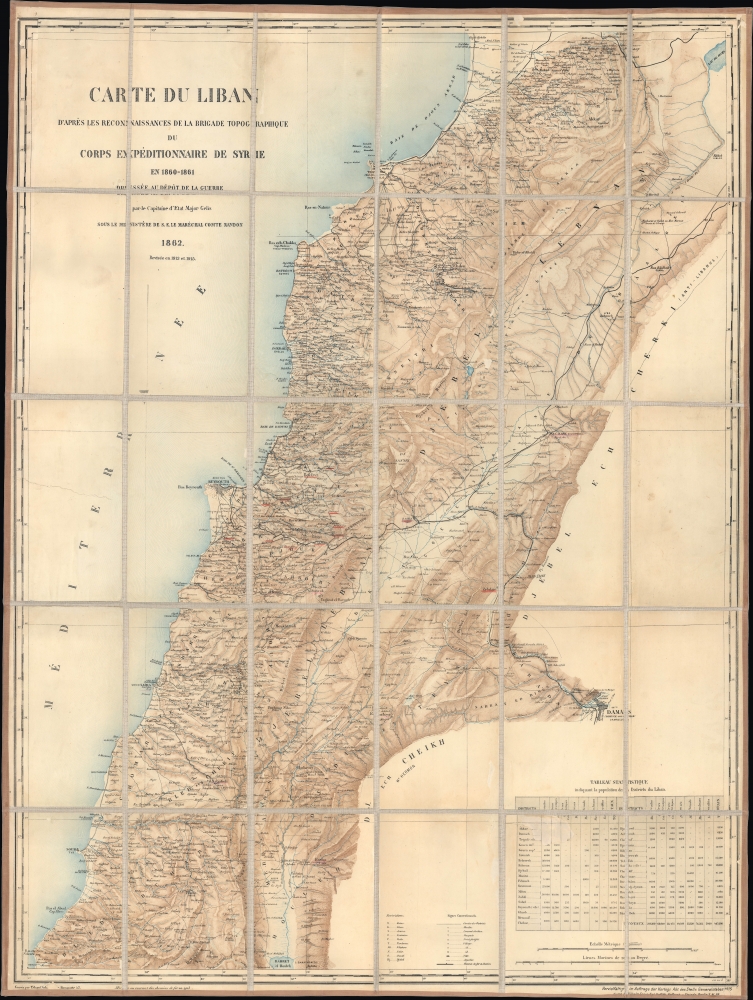
Title
Carte du Liban d'aprés les reconaissances de la Brigade Topographique du Corps Expéditionnaire de Syrie en 1860-1861.
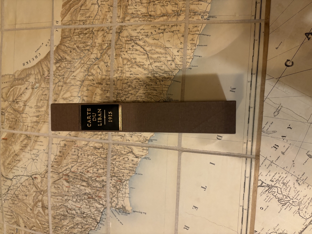
1915 (dated)
38 x 28.25 in (96.52 x 71.755 cm)
1 : 200000
Description
This is a 1915 WWI Era German Deputy General Staff issue of a French Dépôt de la Guerre map of Lebanon, then an Ottoman territory. It was issued in anticipation of combat action in the Lebanese Levant, an area then considered unstable due to weak Ottoman rule and ongoing sectarian violence.
A Closer Look
The map covers from the Nahr el Kabir, today's border with Syria along the Mediterranean, to Naqoura, near Acre, and the modern border with Israel. Cities, towns, villages, waterways, topography, roads, railways (including lines linking Beirut and Homs to Damascus and the Hejaz Railway beyond), and other features are noted in great detail throughout. Place names are mostly transliterated from Arabic, with some exceptions (such as Beyrouth), with ancient Greek names also noted where applicable. At the bottom-right is a legend, a table of abbreviations, and a statistical table noting the population of religious and ethnic groups. Manuscript underlining of settlement names is present east and southeast of Beirut, including at Zahlé, the site of one of the largest battles during the unrest of 1860 (discussed below)Wartime Cartography
This map's production was intimately tied to wars in both the mid-19th and early 20th centuries. It was originally produced in the wake of an 1860 French military expedition sent to intervene in a sectarian conflict between Christian Maronites and Druze, which had been brewing since 1840, when the ruling Shihab Dynasty of the semi-autonomous Emirate of Mount Lebanon converted to Christianity, and were impelled by Ottoman reforms, such as those creating legal equality between Muslims and non-Muslims. As civil strife worsened, outside powers became involved, with Christians siding with the French (which deemed itself the protector of all Christians, or at least all Catholics) and the Druze enlisting the British, as well as the Ottomans and auxiliaries of other Ottoman-aligned groups, such as the Kurds. By late May 1860, an all-out civil war had begun, defined by horrific massacres, including a pogrom that wiped out the Christian population of Damascus. Afterward, the Ottomans reluctantly agreed to an international intervention by European powers to prevent further massacres. France provided the largest contingent, including the military cartographers who made this map, which was the most detailed and up-to-date map of the region at the time. The Ottomans reorganized local administration, creating the Mount Lebanon Mutasarrifate, the precursor to today's Lebanon.
The fact that the map was updated and reissued by the Dépôt de la Guerre (or, more properly, its successor, the Service géographique de l'armée) in 1913 and 1915, and reissued again in Berlin by the German General Staff, is no accident, as the region was teetering, with internal tensions again becoming linked to geopolitical maneuverings. As the main wartime ally of the Ottoman Empire, German officers played a central role in planning the Ottoman strategy, including fending off British and French challenges to the empire's southern flank. The British had stationed thousands of additional troops in Egypt, ostensibly to protect the Suez Canal (which the Germans and Ottomans raided from Palestine in 1915), but who could also attack the Ottoman Empire. The British were also in secret communication with Arab elites dissatisfied with Ottoman rule, leading ultimately to the Arab Revolt, which broke out the year after this map's printing. Coopting enemy maps was entirely sensible from an intelligence standpoint and common in both World Wars. However, such maps were typically issued in small runs for immediate military use and were not commercial. Incidentally, the French military updated and reissued the map yet again in 1919 as France prepared to implement the Sykes-Picot agreement and establish control over Syria and Lebanon.Publication History and Census
This map was originally prepared by the Dépôt de la Guerre and engraved by Erhard Schieble in 1862, then was revised and reissued in 1913 and 1915. The present example is a German issue overseen by Wilhelm Greve of the Cartography Department of the Deputy General Staff (Kartographische Abteilung des Stellvertretender Generalstabes). This rare variant is cataloged at the University of California Los Angeles, Boğaziçi University, the National Library of Israel, the Institut Français d'Études Byzantines, and the Universitäts- und Landesbibliothek Sachsen-Anhalt. No history on the private market.
Cartographer
Depot de Guerre (1688 - 1887) was a branch of the French military devoted to creating, collecting, and publishing military memoirs, plans, and maps. The Depot was founded in 1688 by Francois Michel le Tellier, the Marquis de Louvois. Louvois held the post of Secretary of State for War under Louis XIV and his best known for composing the first letter regarding the mysterious "Man in the Iron Mask". During the French Revolution and the Napoleonic Wars the Depot de Guerre expanded its operations to include any and all topographical research in France. In 1887 the Depot de Guerre was disbanded and its duties split between the Institut Geographique National (IGN) and the Service Historique de L'Armee (SHA). More by this mapmaker...
Condition
Very good. Dissected and laid on linen. Folds into slipcase.
References
OCLC 234161449. National Library of Israel The Eran Laor Cartographic Collection Middle East 82, Universitäts- und Landesbibliothek Sachsen-Anhalt -- 21 C 29, Institut français d'études byzantines, Carte_R_III_1153.